
WV Site Map

Detailed Description
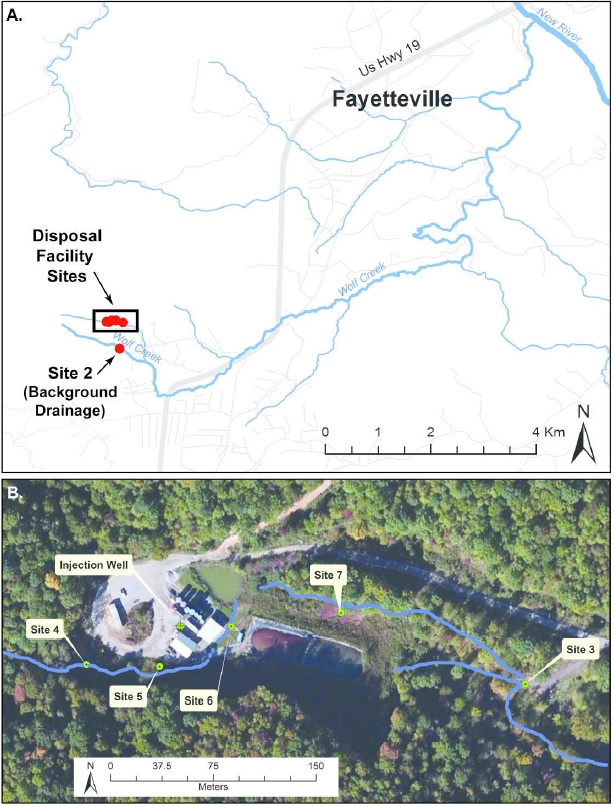
Map of sampling locations near Fayetteville, WV within the Wolf Creek watershed (A) and specific
sites (B) in a stream running adjacent to a class II disposal facility. Panel A shows that Site 2 was located in
a separate drainage from the disposal facility sites (outlined in black box), which are shown in panel B (Sites
4, 5, 6, 7 and 3). In panel B, the blue line highlights the stream and the yellow outline is the location of the
former impoundment ponds. Source: Esri. DigitalGlobe, GeoEy, i-cubed, Earthstar Geographies,
CNES/Airbus DS, USDA, USGS, AEX, Getmapping, Aerogrid, IGN, IGP, swisstopo, and the GIS User
Community.