
Great Salt Lake Satellite Images


Detailed Description
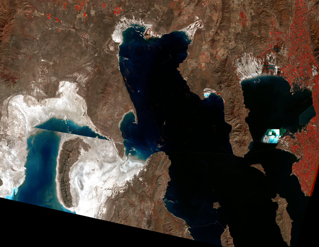
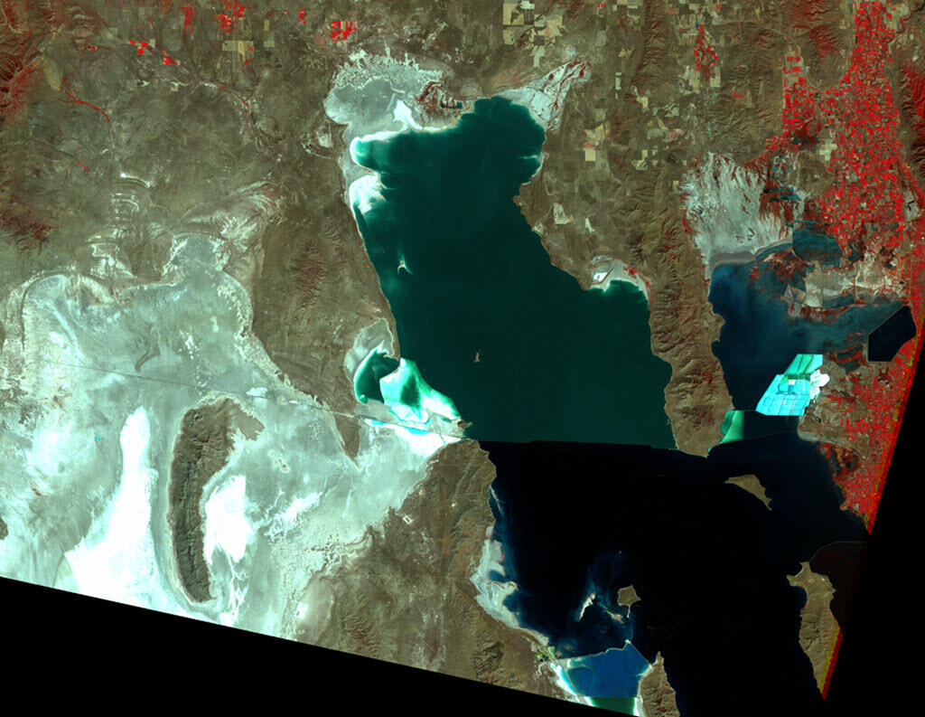
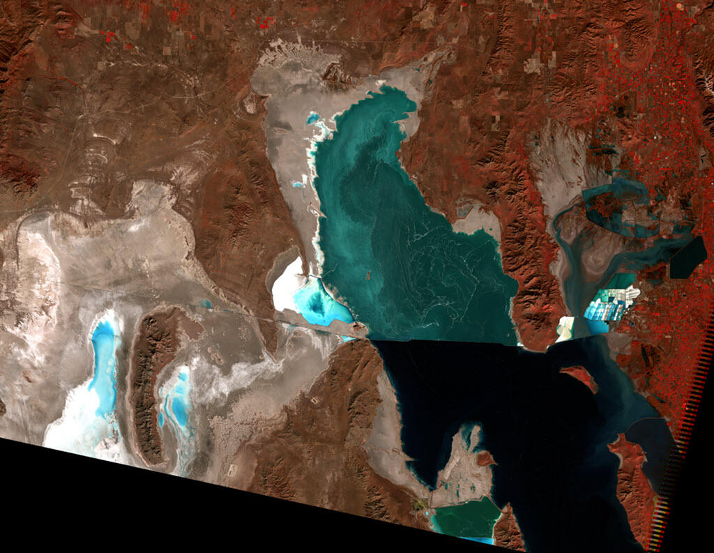
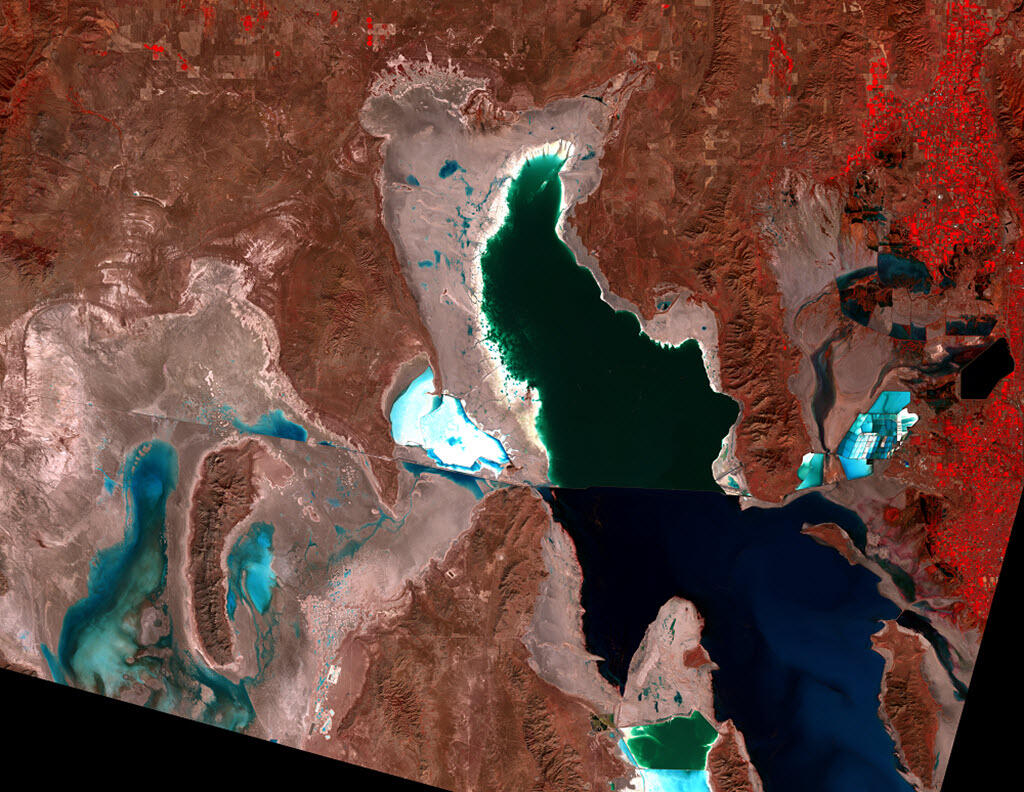
Satellite images show 50 years of change on the Great Salt Lake, 1972-2021.
Sources/Usage
Public Domain.
Related

Great Salt Lake - Fifty years of change through satellite images
The completion of the Railroad Causeway in 1959 divided the Great Salt Lake in half. Because all of the freshwater inflows enter the southern part of the lake, the north arm became much more saline than the south; well defined in the satellite images. Several years of greater than normal precipitation resulted in a large increase in the lake’s area during the early 1980's and the creation of a new...
Related
Great Salt Lake - Fifty years of change through satellite images
The completion of the Railroad Causeway in 1959 divided the Great Salt Lake in half. Because all of the freshwater inflows enter the southern part of the lake, the north arm became much more saline than the south; well defined in the satellite images. Several years of greater than normal precipitation resulted in a large increase in the lake’s area during the early 1980's and the creation of a new...