
Energy and Mineral Resources Data
Quality data are the foundation of well-informed decisions. The Geology, Energy and Mineral Mission Area delivers data and science about geologic resources that are used and trusted by decision-makers throughout the Nation.
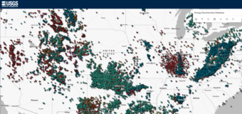
Featured Energy Resources Data
Featured Mineral Resources Data
National Geologic Map Database
Digital Registry of Scientific Collections (RESCICOLL)
We are the Nation’s primary source of detailed mapping and impartial scientific information on geologic resources and their supply chains, both domestically and globally.
We provide information about:
- The Nation’s geologic framework: we conduct geologic mapping and collect geochemical, geophysical, hyperspectral, geochronological and many other types of geologic data. We also preserve and promote the use of publicly-accessible geologic data, including both digital and physical materials.
- Energy and mineral resource occurrence: we assess the locations, quantities and quality of energy and mineral resources within or outside of the U.S.
- Mineral supply chains: we provide information about the supply, demand, trade, and supply chain risks for mineral commodities.
- Energy and mine wastes: we study both active and legacy energy and mineral development sites, including the locations, quantities and composition of waste products (including whether potential resources could be present), and how waste products interact with earth processes like weathering.
We deliver foundational data for the Nation.
With a long history of data collection and a wide network of scientists and partners, we are able to provide comprehensive datasets that span long time periods and large spatial areas.
These datasets – such as nation-wide and global inventories, assessments and geochemical databases - are essential for answering questions about the Nation’s diverse natural resources. They also accelerate scientific knowledge by unlocking opportunities for new research
Who uses our data?
Our data and information are used by federal decision-makers, States, Tribes, industry, universities and the public. Some examples include:
- The defense and national security community, policy-makers, and other Federal agencies rely on our information about mineral supply chains to shape policy and develop global trade strategies
- Land management agencies such as the Bureau of Land Management and State Geological Surveys use our geologic maps and resource assessments to understand the tradeoffs of developing mineral and energy resources on public lands
- State agencies use our inventories of abandoned mining infrastructure and legacy energy infrastructure to prioritize remediation and improve safety
- Some Tribes are using our mine waste science to identify, reclaim, or even explore the potential for recovering resources from mine wastes on Tribal lands
- Our assessments of domestic and global oil and gas resources move markets
- Our science and data help energy and mining companies determine where to invest in exploring for recoverable resources
- Engineering companies use our geologic maps to plan engineering and infrastructure projects
- Universities rely on our digital databases and thousands of physical samples to conduct cutting-edge research and to train the next generation of geoscientists.
- Our science is public and accessible, so anyone can discover if an orphaned well could be located near them, explore potential emerging resources, or just explore the geology of the ground beneath their house.