
1,000 Cameras and Counting
Growing network of webcams supports water science and safety
The USGS Hydrologic Imagery Visualization and Information System (HIVIS) now has more than 1,000 active webcams providing remote visibility of current water conditions. This real-time imagery supports water science and public safety nationwide.
Picture your favorite stream. What does a gage height of 3 feet look like? What about 12 feet?
The change in water level between these two numbers can mean the difference between safe conditions and a life-threatening flood, but for most people, abstract hydrologic data like gage height are difficult to visualize. To improve the delivery of important water safety information, the USGS has spent the last five years installing a nationwide network of webcams that visually capture water conditions in real time—and that network is still growing.
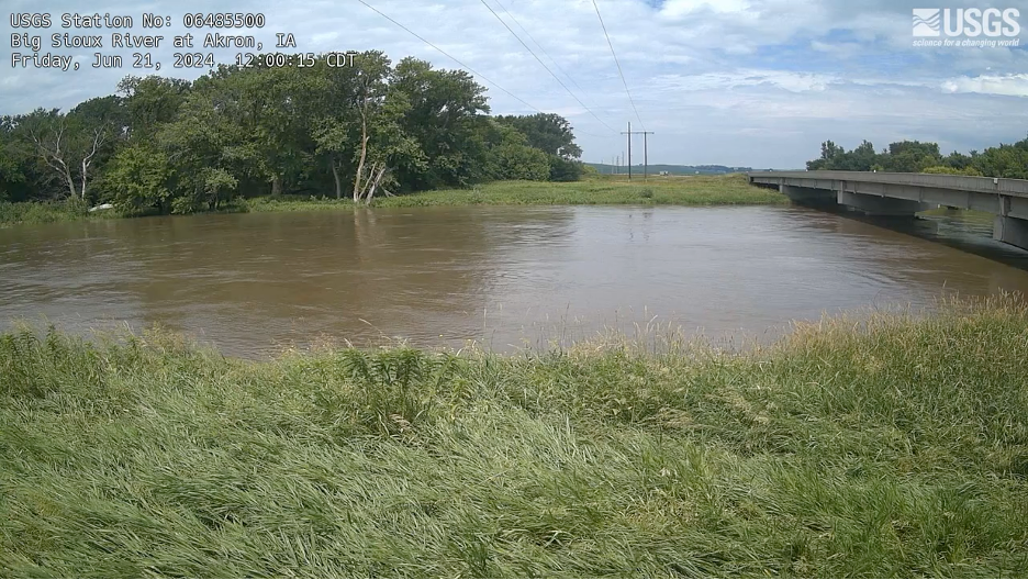
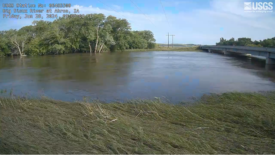
Link to HIVIS camera: HIVIS | Big Sioux River at Akron
These cameras enhance the value of traditional streamgage data by offering visual context, supporting a wide range of applications from public recreation to emergency management and scientific research.
-Frank Engel, Geographer, USGS Water Resources Mission Area
Expanding our HIVISibility
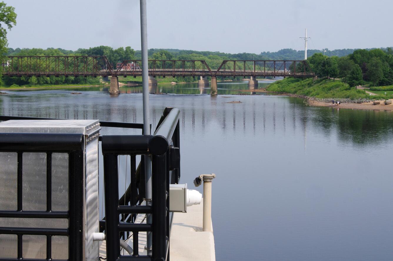
The USGS Hydrologic Imagery Visualization and Information System (HIVIS)—part of the larger National Imagery Management System (NIMS)—now serves more than 1,000 cameras nationwide. Installed at streamgages and other USGS hydrologic sites, HIVIS cameras capture still-frame images that show current water and environmental conditions. The images also help USGS scientists identify technical issues with equipment, verify remote water-monitoring measurements, and gather data for visual analyses.
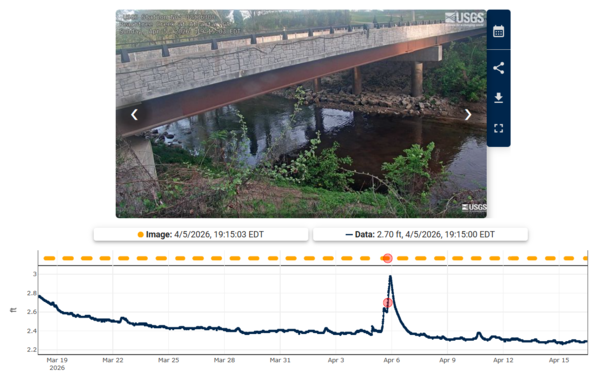
Visitors to the HIVIS Dashboard can use the interactive map to explore still-frame images and timelapse videos all the way from Isla Verde, Puerto Rico, to Point Barrow, Alaska. Many sites pair recent images with an interactive hydrograph, turning abstract hydrologic data into intuitive, visual information. This link allows the public and decision makers to better interpret water conditions, improving situational awareness, resource planning, and emergency response.
Advancing the delivery of actionable data
The milestone of reaching 1,000 cameras represents a significant advancement in the USGS’s ability to deliver actionable, real-time hydrologic information. The imagery supports local emergency managers, water resource planners, and the public by providing a “visual gage” that complements traditional data. It also enables innovative research, such as machine learning models for detecting river ice and estimating hydrologic variables. Recent events captured by HIVIS, like the Central Texas floods (July 2025) and Ruidoso floods in New Mexico (September 2025), demonstrate the system’s growing importance for public safety.
USGS cooperators and the public are increasingly recognizing the benefit of these cameras in capturing and understanding hydrologic events. In 2024 alone, roughly 136,000 users accessed the HIVIS Dashboard. Federal agencies like the U.S. Army Corps of Engineers use the imagery for dam operations and flood control. State transportation agencies rely on the cameras for road closures and bridge safety. Local governments use the images to inform evacuation efforts. In 2025, national news outlets covering the glacial lake outburst flooding in Juneau, Alaska, featured HIVIS imagery heavily in their stories, bringing USGS water science directly into people’s homes.
As the HIVIS network continues to grow, the USGS further improves the timely delivery of essential water monitoring information to communities nationwide.