
Happy Earth Day 2021!
USGS welcomes Earth Day 2021with a view of the entire planet, as presented by its Landsat satellite program.
Happy Earth Day! As we celebrate our wonderful planet and the fascinating things we learn about it every year, we wanted to share a unique view of the Earth, provided by the longest continuously running Earth-observing satellite program: Landsat.
The idea for Landsat began in 1966, three years before Apollo 11 landed on the Moon. At that time, the Department of the Interior and NASA announced plans for a civilian satellite that would focus specifically on Earth imagery. In 1972, the same year the famous Blue Marble image was taken by Apollo 17, NASA launched the first satellite of the Landsat program. Landsat, a joint effort of the USGS and NASA, has produced the longest, continuous record of Earth’s land surface as seen from space.

We’re now on Landsat 8 (with Landsat 7 still in orbit and continuing to acquire images), and NASA plans on launching Landsat 9 this September. As the technology deployed by Landsat advances, the uses for Landsat imagery also advance. On April 15, 2021, Google announced its Google Earth 3D Timelapse tool, which is based on imagery from Landsat, along with other imagery from NASA, the European Commission, and the European Space Agency. Timelapse allows users to access powerful 3D visuals to study our planet’s stories and consider actions regarding climate change, sustainable development and much more.
To celebrate Earth Day, we thought we would share some of the uses of Landsat imagery throughout the decades, and we also want to highlight Landsat’s beautiful imagery of the Earth.
Focus on the Forests
Graceful and majestic, forests have long held humanity’s imagination and been synonymous with the health of the environment. Through Landsat, the USGS has been studying the world’s forests and various factors that have affected them.
From the ground, the extent of forestland damage may simply be too large for field observers to quantify. But 438 miles above the Earth, Landsat satellites pass over every forest in the country dozens of times a year—every year—creating a historical archive of clear, composite images that tells the hidden stories of life and death in our nation’s forests. From pine beetles to the hemlock woolly adelgid, forest damage from invasive species is tracked by Landsat so forest managers can identify and quantify the impacts and develop effective mitigation strategies.
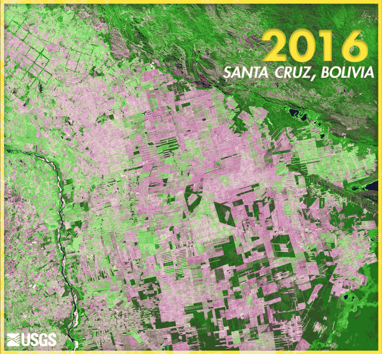
Unfortunately, it’s not just insects that are affecting our forests. Human-caused deforestation is a worldwide issue. In 2013, the first global image maps of tree growth and disappearance were published using data exclusively from the Landsat 7 satellite. The uniform data from more than 650,000 scenes, spanning the years 2000–2012, ensured a consistent global perspective across time, national boundaries, and regional ecosystems.
Our Dynamic Planet

It is not just forest landscapes that change over time. In the past 50 years, cities have grown, farmlands have expanded, wilderness has shrunk, and glaciers have retreated, all under Landsat’s watchful gaze. Through Landsat imagery, scientists and decisionmakers can see where land usage has changed and to what purpose it is currently being put.
Idaho, for example, has emerged as the second-leading state for irrigation usage behind California, and they needed a way to keep tabs on their water usage. After all, Idaho is not known for its high rainfall. Landsat’s eye in the sky has helped Idaho’s resource managers account for and track how much water they have and how much water they use each year for irrigation.
In another example of Landsat assisting with water usage, Canada and the United States share the St. Mary and Milk River system in Alberta and Montana. Apportioning water between the two countries, as well as the Blackfeet Nation, which also uses water from the rivers, can be a challenge, because irrigation and evapotranspiration are difficult to track using traditional methods. However, scientists from Canada and the United States were able to figure out how to use Landsat to get a much clearer idea of the amount of water actually being taken out of the rivers, either by human activities or other natural processes.
In the United States and around the world, cities are growing. The USGS seeks to illustrate and explain the spatial history of urban growth and corresponding land-use change. Scientists are studying urban environments from a regional perspective and a time scale of decades to measure the changes that have occurred in order to help understand the impact of anticipated changes in the future.
One example of how Landsat is aiding city planners lies in addressing areas of extreme heat that develop in cities during the summer. In New York City, planners and health officials were able to use Landsat to identify which neighborhoods had the worst hot spots and even track what effects their mitigation efforts had.

Watching over the World
The power of observation through Landsat is not just used to watch over environmental impacts and land-use change. The imagery is also brought to bear during natural hazard events. From hurricanes to wildfires to volcanoes, Landsat has helped responders during the events and has supported rebuilding efforts after the fact.
Landsat goes beyond the United States. The USGS Landsat program is part of the International Charter "Space and Major Disasters,” which serves as an important source of satellite imagery for responding to major natural and man-made disasters worldwide. The Charter comprises 17 member agencies from countries around the world and has been activated more than 700 times in the 20 years it has been in effect.

Work of Art
With all its uses, it’s no wonder that Landsat is treasured by both USGS scientists and its users outside the agency. Also, studies have shown it provides billions of dollars of value to people around the world. But one of the unanticipated benefits of Landsat is that the imagery allows us to see the Earth’s natural beauty from a perspective that only astronauts get. And on this Earth Day, we wanted to share the beauty of the images it produces. USGS scientists have been so captivated by the views of Landsat that they have created a regular series, called Earth As Art. So, as you enjoy Earth Day 2021, enjoy the Earth as seen by the world’s longest continually operating Earth observation program!