
Guiding Rovers for Safe Mars Exploration
Billions of dollars and a decade worth of research are on the line in the instant that a spacecraft touches down on Mars.
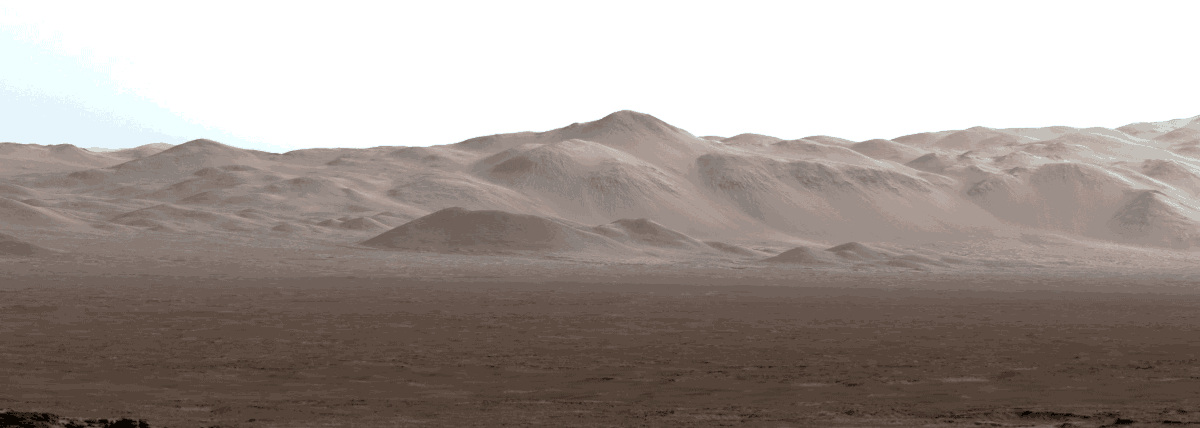
Billions of dollars and a decade worth of research are on the line in the instant that a spacecraft touches down on Mars. When deciding where to land on the planet’s rocky surface, it is essential to analyze potential landing sites and their surface characteristics.
“If it’s not safe to land, the mission could fail,” said Dr. Matthew Golombek, exploration program landing site scientist for the National Aeronautics and Space Administration’s (NASA) Jet Propulsion Laboratory. Golombek has been intimately involved in every landing site selection for Mars since the Mars Pathfinder, which touched down in 1996. Since that time, four spacecraft have landed successfully.
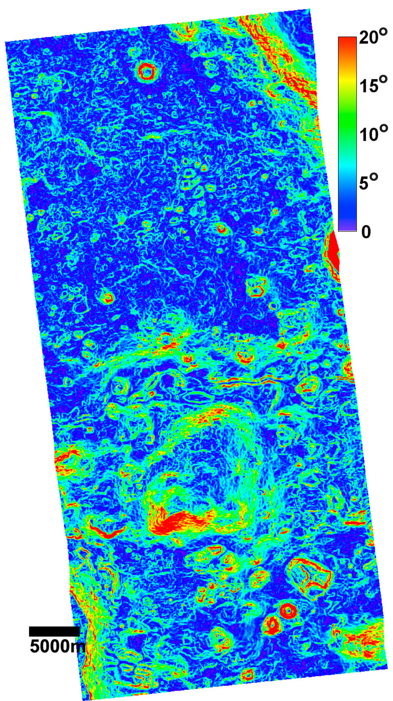
NASA—in collaboration with several agencies—leads space exploration for the United States. NASA depends on the U.S. Geological Survey (USGS) Astrogeology Science Center to provide a clear picture of the surface of Mars. The USGS has provided topographic and slope information for most landing sites since the Viking landers in 1979.
“The USGS is the planetary cartographer for NASA—they are the lead for creating planetary maps for our agency,” said Golombek. “In the planetary community, the USGS is without question the world’s expert. They are an irreplaceable community of people that provide critical data, which are absolutely fundamental to the Mars exploration program. We have worked together on virtually every site-selection effort we have done.”

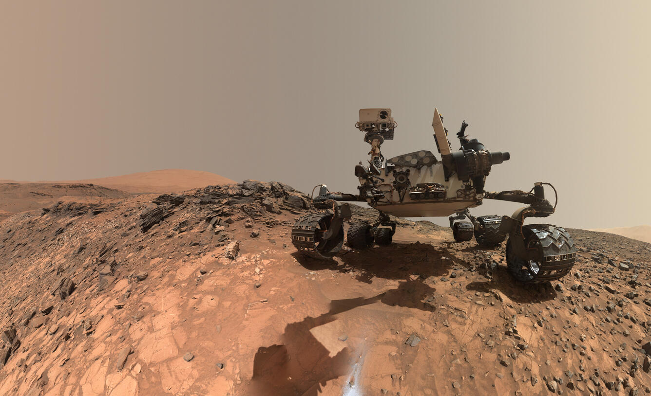

The Mars 2020 rover mission is estimated to cost \$2.1 billion. USGS scientists are not only busy analyzing the Martian surface for potential landing sites; they are helping improve safety and further the scientific quality of the mission.
Every rover that landed on Mars had a targeted ellipse, which is an area where the spacecraft is likely to land. For the Mars Pathfinder rover, the ellipse was an area about 185 miles across. Technology has advanced so much over the past 20 years that the Mars 2020 rover only has a 12-mile ellipse.
In the past, where the rover would land within the ellipse was uncontrollable. Scientists would worry about potentially hitting hazards, like sharp rocks or cliffs, and would likely select another site. Spacecraft travel so far from Earth that even “live” feeds are delayed by 10 to 20 minutes. The Mars 2020 rover will be equipped with a new technology: terrain relative navigation. This onboard programming allows the rover to reference hazard maps, developed in part from surface information provided by the USGS, to alter the vessel’s trajectory with thrusters if the landing site turns out to be dangerous.
“The Mars 2020 rover will be the first to carry hazard maps onboard, which will provide critical information needed for the rover to make last-minute landing changes to keep the spacecraft safe,” said Dr. Robin Fergason, a research geophysicist at the USGS Astrogeology Science Center. “This is very exciting, as it will allow the rover to explore scientifically interesting places that were previously inaccessible.”

Mars landing-site selection is a collaborative effort. The interested scientific community at large attends landing-site selection workshops. Currently, the community has narrowed the list to eight potential sites. USGS scientists are analyzing these sites to help determine their safety and navigability. Results will be presented to the community at a workshop in February 2017.
“The areas that we’re focusing on for 2020 are places where there is strong evidence that water was involved and those that may include elements needed to support life,” said Golombek. “We desperately would like to know whether life could have existed on Mars.”

The USGS Astrogeology Science Center has a rich history of participation in space exploration and planetary mapping. The center was established in 1963 to provide lunar geologic mapping for NASA and assist in training astronauts destined for the Moon. Throughout the years, the USGS has participated in processing and analyzing data from numerous missions to planetary bodies in our solar system.

For more information, contact Jennifer LaVista, USGS Public Affairs Specialist, at jlavista@usgs.gov.
Read more stories about USGS science in action.
