
Batten down the hatches, hurricane season is here. High winds, coastal erosion, storm surge and flooding can negatively impact communities, ecosystems and cost millions of dollars in repairs.
Batten down the hatches, hurricane season is here. High winds, coastal erosion, storm surge and flooding can negatively impact communities, ecosystems and cost millions of dollars in repairs. Hurricanes can generate hazardous waves and currents that have the power to move large amounts of sand, destroy homes, businesses, schools, roads, bridges and water and wastewater systems and reshape the Nation’s coastlines.
Scientists at the U.S. Geological Survey(USGS) are prepared, with improved tactics, continued research and new technology to face a hurricane head on. These strategies will provide emergency managers and decision-makers with the essential information needed to minimize flood risks and safeguard lives and properties for this season and for years to come.

According to the National Oceanic and Atmospheric Administration (NOAA), the 2015 Atlantic hurricane season will likely be below-normal. But even with a below-normal hurricane season, coastal communities are urged to take measures to ensure community and habitat safety. The first step is to learn how storms can move water, sand, debris and contaminants to destroy built infrastructure, sever communication lines and evacuation routes, rearrange local topography, disrupt water and power supplies and pollute the local environment for years to come. The second step is to put that information to use to improve our ability to predict and mitigate storm impacts on specific community and environmental resources. The USGS is doing both.
According to the National Oceanic and Atmospheric Administration (NOAA), the 2015 Atlantic hurricane season will likely be below-normal. But even with a below-normal hurricane season, coastal communities are urged to take measures to ensure community and habitat safety. The first step is to learn how storms can move water, sand, debris and contaminants to destroy built infrastructure, sever communication lines and evacuation routes, rearrange local topography, disrupt water and power supplies and pollute the local environment for years to come. The second step is to put that information to use to improve our ability to predict and mitigate storm impacts on specific community and environmental resources. The USGS is doing both.
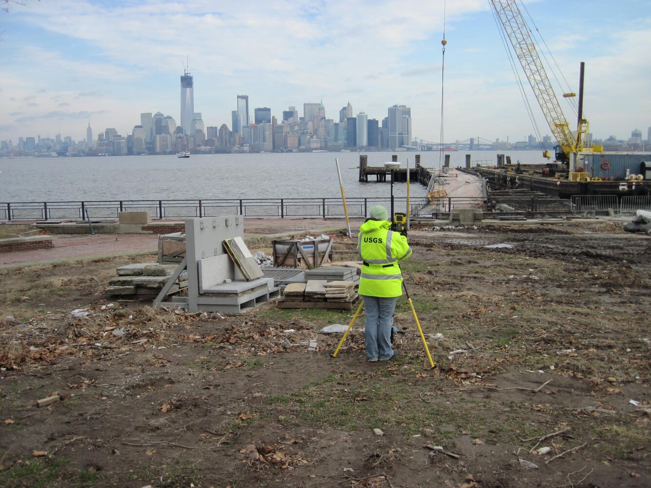
Storm-Tide Monitoring
Obtaining knowledge about a potential storm coming your way is vital in preparation for hurricane season. NOAA sea buoys, aircraft and satellites provide a lot of information when a storm is far out to sea. NOAA tide gages provide very accurate and timely data as the storm nears the coast, but they are few and far between. In response, the USGS developed a mobile storm-tide and wave-monitoring network to supplement the tide gage data and provide NOAA and emergency managers with useful information on the timing, extent and magnitude of overland storm tide and to report the height and frequency of waves driven overland by the storms. The network includes water-level and barometric-pressure monitoring devices, which are deployed just days or hours before a storm makes landfall.
The purpose of inland storm-tide monitoring is to study every moment of flooding in order to visualize how it interacts with bodies of water like bays, estuaries and streams and local topography like beaches and dunes.
SWaTH Network
The USGS established the Surge, Wave and Tide Hydrodynamic (SWaTH) Network in 2014 in the wake of Hurricane Sandy. SWaTH spans the Atlantic coast from North Carolina to Maine. The objective of the network is to provide accurate and timely storm-tide elevation and wave data at hundreds of locations identified and prioritized through discussions with local, state and federal emergency mangers and flood forecasters. The same data will also be used by scientists to improve predictive models and detect flood trends to help coastal communities prepare for future storms.

The USGS established the Surge, Wave and Tide Hydrodynamic (SWaTH) Network in 2014 in the wake of Hurricane Sandy. SWaTH spans the Atlantic coast from North Carolina to Maine. The objective of the network is to provide accurate and timely storm-tide elevation and wave data at hundreds of locations identified and prioritized through discussions with local, state and federal emergency mangers and flood forecasters. The same data will also be used by scientists to improve predictive models and detect flood trends to help coastal communities prepare for future storms.
SWaTH uses three different kinds of instruments to collect, record, and in many cases, transmit the data in real-time. All of the instruments record the precise time a storm tide arrives, depth of the water throughout the event, the height and frequency of waves caused by storms, the duration of the flood and the time for water to recede.
One type of SWaTH sensor is the tide-gage that provides long-term, real-time water-levels and local metrological data 24/7. Another type is the Rapid Deployment Gage (or RDG). RDGs provide short-term (storm based) real-time water-levels and local meteorology data in areas that are susceptible to the effects of storm-tide flooding at locations critical to emergency managers. The third sensor type simply records water-level data on-site, and is recovered and processed by hand after the storm. Some of these sensors are arranged in long transits (lines) perpendicular to the coast to help measure how local topography, natural features and land use can reduce or increase wave heights and the resulting flood damage.
Of course, collecting the data is only part of the job. Getting it to users is another. The USGS has developed a new web-based storm-tide map viewer to provide a public portal to these and other storm data. The public can see the data by visiting the USGS homepage and looking for the storm link.
The information obtained from these sensors helps scientists to develop more accurate storm-tide models. This is particularly helpful to improving predictions of flooding ahead of storms and better simulations of long-term, future flood patterns and trends. In turn, that information will be helpful to engineers when they design flood-hardened structures and assess the damage-reducing impacts of existing or engineered dunes and wetlands. Essentially, the information provided by the sensors and the USGS will help those building more resilient coastal communities.
Inland Flooding Threats

Over 8,000 gages nationwide comprise the USGS streamgage network to predict and track river flooding from heavy rainfall. Keeping the gages operational is critical for forecasters from the National Weather Service and local emergency responders to issue flood warnings to safeguard communities. Data from streamgages also provides important information to better understand current and future flood hazards.
Coastal Change Impacts
Elevated water levels and waves are the products of hurricanes and other intense tropical and non-tropical storms, which can lead to dramatic coastal change as beaches and dunes erode. Collision, overwash and inundation are the three systems of coastal change. When waves attack the base of dunes it causes dune-front erosion, also known as collision. If a higher surge or wave ensues, the waves can overtop the dunes leading to overwash that causes dune erosion, landward transport of beach and dune sand and in some serious circumstances buries roads and parts of buildings. When the elevation of storm surge and wave setup exceeds the elevation of the primary dune or beach, it is known as inundation. These conditions allow storm waves and water levels to directly impact buildings and roadways and to transport sand and debris inland where they may impact structures and habitats. Narrow islands may be breached, severing transportation corridors.
A storm-impact scale, developed by the USGS, predicts the likelihood of coastal change. Models of storm-induced water levels and accurate maps of coastal topography are combined to forecast the three coastal change systems. Each system describes how the physical form of the beach and the hurricane tend to interact, which results in modes of coastal change along beaches and dunes. This information will support management of coastal infrastructure, resources and safety.
Start with Science – After the Storm
After hurricanes and other intense coastal storms hit, the USGS works with partners to aid and assist communities, cities and states. Additionally, field crews work on federal lands to recover and reconstruct in a more resilient way. For example, USGS scientists have been working extensively with the National Park Service, U.S. Army Corps of Engineers and other partners in New York. Their goals are to look at the decimation of the protective sand dunes and discuss options for beach replenishment or possibly rebuilding portions of Fire Island National Seashore.
USGS goals include extending the predictive capability for determining storm-induced coastal erosion hazards, recognizing how different landforms mitigate storm surge, understanding the long-term consequences associated with the release of contaminants during natural hazards and better capturing the impacts to wildlife and ecosystems.
The USGS is very active in working to deliver high-resolution topographical surveys, evaluations of ecosystem resiliency, enhanced storm-tide monitoring, vulnerability assessments and data-display capabilities.
Links:
For more information please visit the following websites:
Ready.gov— What to do before, during and after an emergency
Ready.gov for kids— What to do before, during and after an emergency for kids
Coastal Change Hazards: Hurricanes and Extreme Storms
USGS Flood Information—Information about current and past flooding
USGS WaterAlert – Sends e-mail or text messages from the USGS streamgage of your choice
USGS WaterWatch— Provides current USGS water data for the nation
Start with Science to Address Vulnerable Coastal Communities
Sea Level Rise Hazards and Decision Support