
U.S. Geological Survey field crews are measuring record flooding on rivers and streams in 12 states across the country. USGS is making preparations for a prolonged field effort along the Ohio and Mississippi Rivers as major flooding will extend well into mid-to-late January, particularly along the lower Mississippi River.
Historic Flooding Across the Country
U.S. Geological Survey field crews are measuring record flooding on rivers and streams in 12 states across the country. USGS is making preparations for a prolonged field effort along the Ohio and Mississippi Rivers as major flooding will extend well into mid-to-late January, particularly along the lower Mississippi River.
Since late December, USGS has measured more than 50 preliminary record-high flood measurements along the Mississippi and Ohio Rivers and their tributaries.
Currently, Missouri, Arkansas and Illinois are experiencing the most extreme flooding. Flooding in Missouri has caused 22 fatalities, hundreds of road closures and more than 1,000 power outages across the southern portion of the state. USGS crews are out in Missouri, Illinois, Kentucky, and Arkansas making flood measurements of flooded streams, with extra concentration on those areas where levees have been overtopped and the collected data is so critical to public safety and preservation of property.
As the floodwaters move downstream, USGS is working to ensure field crews are deployed to areas necessary for the U.S. Army Corps of Engineers, the National Weather Service and other flood response agencies. The Mississippi River is expected to crest in Memphis, Tennessee sometime around January 8, and flood crest will be arriving in in Louisiana in the January 14 to 17 time frame. A similar flood situation in the Mississippi River Basis occurred in 2011 where USGS river data became crucial to ensure responsible decisions by emergency managers.
USGS Crews in the Field
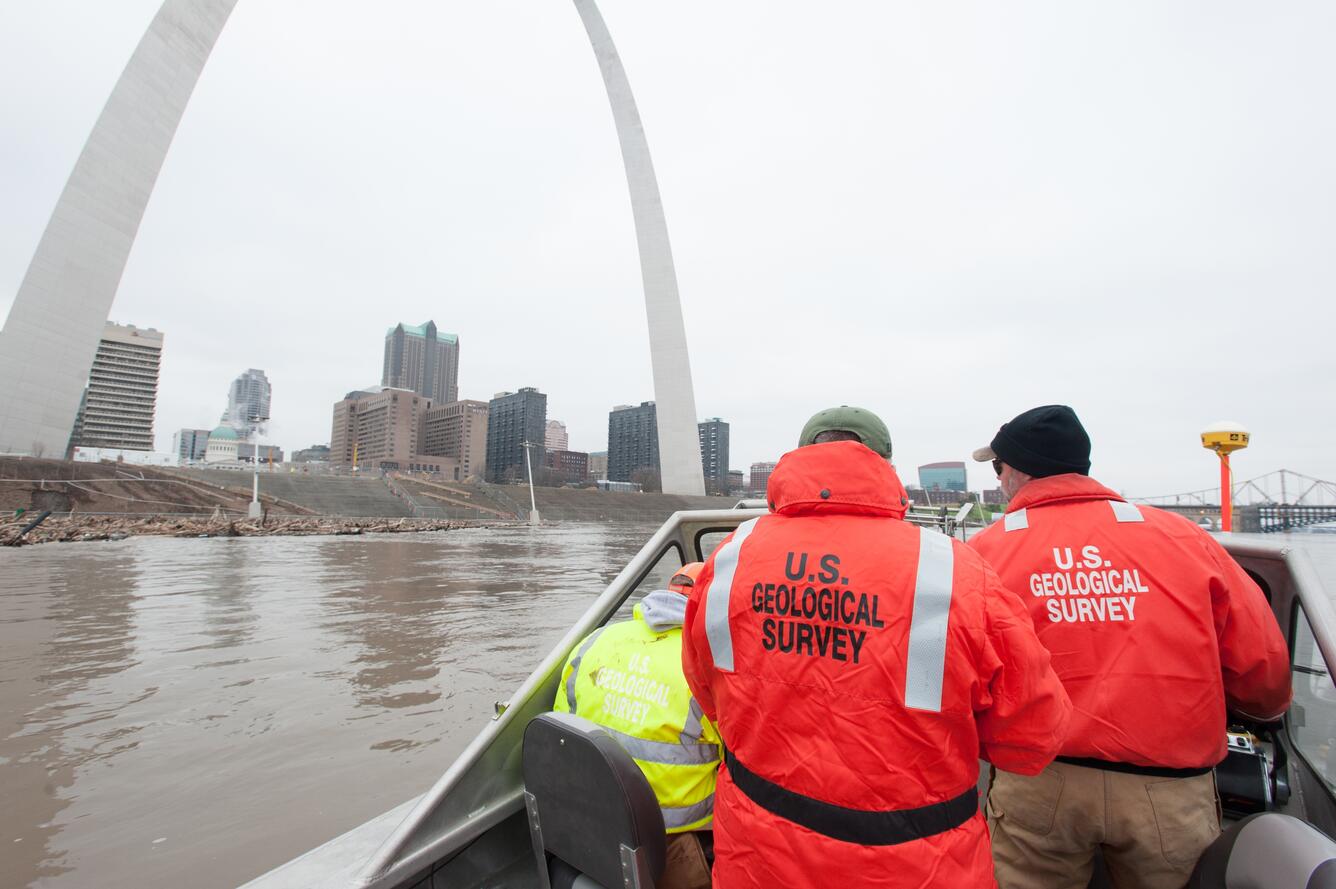
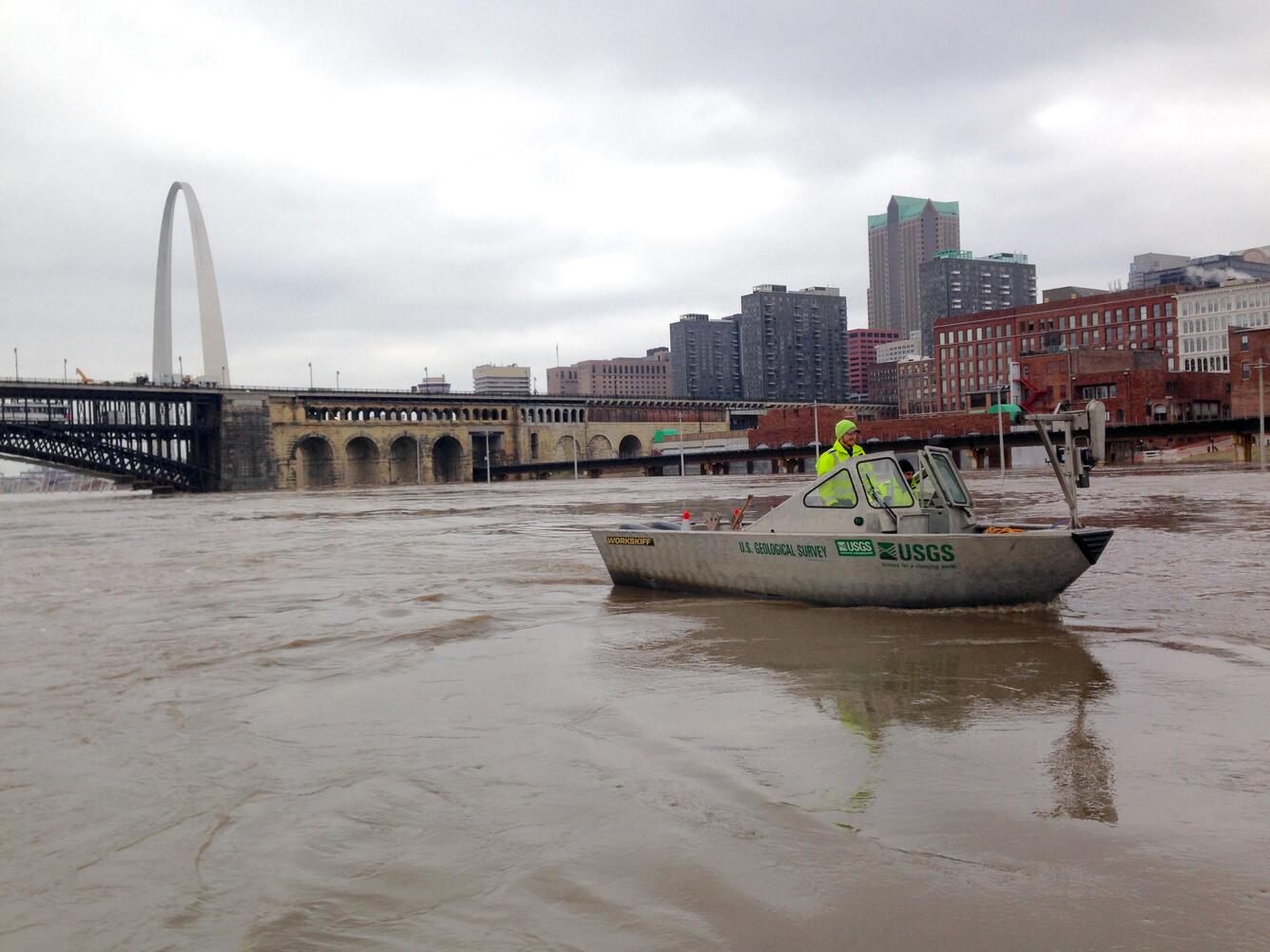
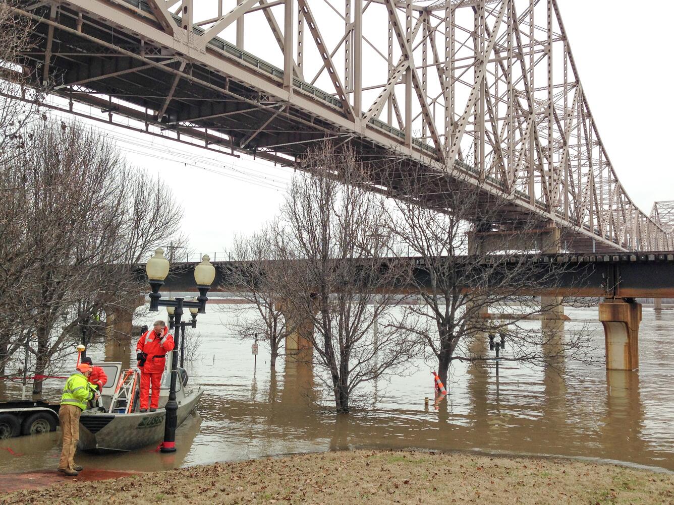
USGS hydrologists and field crews are out collecting flood information critical for emergency forecasting and response. They are taking flood measurements, collecting water samples, repairing damaged streamgages and flagging high water marks.
“USGS crews are working around the clock to make accurate flood measurements available to the Army Corps of Engineers, National Weather Service, and emergency managers for flood forecasting and flood-control operations,” said USGS National Flood Coordinator, Bob Holmes. “Our team is working closely with other agencies, like the U.S. Coast Guard, to assist with the logistics of gaining safe access to rivers for our USGS field crews. This was especially true as we prepared for the Mississippi River crest in St. Louis.”

Flood Information is Critical
The USGS is collecting critical streamflow data that are vital for protection of life, property and the environment. These data are used by the National Weather Service to develop flood forecasts, the U.S. Army Corps of Engineers to manage flood control and local agencies in their flood response activities.
There are more than 8,100 USGS-operated streamgages throughout the country that measure water levels, streamflow and rainfall. When flooding occurs, USGS crews make numerous streamflow measurements to verify the data USGS provides to federal, state and local agencies, as well as to the public.
For more than 125 years, the USGS has monitored flow in selected streams and rivers across the United States. The information is routinely used for water supply and management, monitoring floods and droughts, bridge and road design, determination of flood risk and for many recreational activities.
How Does Flooding Impact Water Quality?
Flooding impacts water quality in ways that can have short and long-term impacts on drinking water resources and aquatic ecosystems. In addition to the large quantities of water that occur during floods, increased amounts of sediment and chemicals are washed from the landscape into rivers and transported downstream.
Many sites experiencing flooding have USGS instrumentation for continuous water-quality monitoring, and the data are made available online. Continuous, real-time USGS water-quality monitoring stations provide scientists, water-resources managers and emergency responders with information to make informed decisions vital for the protection of life, property and the environment.

During this particular storm event, two sewage-treatment plants and a drinking-water plant in Missouri were inundated by water and failed, contributing untreated sewage to the floodwaters. The USGS has been collecting samples for water quality analysis at key locations in the Mississippi and Missouri River Basins since the onset of this storm event, and will continue sampling as the flood surge moves downstream in the lower Mississippi River basin states.
Samples are being analyzed for fecal bacteria, and chemicals such as nutrients, volatile and semi-volatile organic carbon compounds such as solvents and oil and fuel products, and organic wastewater chemicals such as pharmaceuticals and other products indicative of human waste. When possible, scientists are focusing on locations where data have been collected in the past to provide a baseline comparison for the effects of this event on water quality.
Learn more at the USGS Water Quality Information website.
Access Flood Information in Your Area

Access current flood and high flow conditions across the country by visiting the USGS WaterWatch website. Receive instant, customized updates about water conditions in your area via text message or email by signing up for USGS WaterAlert.
Media Advisories:
- 12/27/15: USGS Measures Flooding in Missouri
- 12/28/15: USGS Measures Flooding in Illinois
- 12/29: Media Advisory: Water Levels Surpass Records in Illinois River Basin: USGS Responds to Goliath in Oklahoma
- 12/30: USGS Measures Record Flooding in Missouri
- 12/31: USGS Records Historic Christmas Flooding in Arkansas
USGS Multimedia Gallery for December 2015 Flood Event
Other Agencies: