National Scenic Trails Added to Revised Michigan Maps
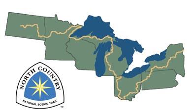
Newly released US Topo maps for Michigan now feature segments of the North Country National Scenic Trail. Several of the 1,290 new US Topo quadrangles for the state now display parts of the Trail along with other improved data layers.
Newly released US Topo maps for Michigan now feature segments of the North Country National Scenic Trail. Several of the 1,290 new US Topo quadrangles for the state now display parts of the Trail along with other improved data layers.
"USGS maps are excellent planning and navigation tools for hikers and other trail users” said Mark Weaver, Superintendent of the Trail. “The North Country Trail is a truly special recreational resource and we are quite thrilled to have the trail incorporated onto the maps.”
The North Country Trail is one of the 11 National Scenic Trails in the U.S. It is the longest national scenic trail, extending over seven states and 168 distinct land management units, from the vicinity of Crown Point State Park New York, to Lake Sakakawea State Park on the Missouri River in North Dakota, to the route of the Lewis and Clark National Historic Trail. Plans are underway to expand the trail to include the Arrowhead region of northern Minnesota, and extend the eastern terminus to the Appalachian Trail in Vermont, eventually bringing the trail to approximately 4,600 miles long.
"The North Country Trail tells the unique story of the people and the places in America's northern heartlands- the hardship of an unforgiving landscape, the joys of recreating in the Great North Woods and the challenges of making a living from the land without destroying it,” explained Bruce Matthews, Executive Director of the North Country Trail Association. “Being present on the USGS maps mean more people will become more deeply engaged with this story and with the North Country Trail.”
The USGS partnered with the National Park Service to incorporate the trail onto the Michigan US Topo maps. This NST joins the Ice Age National Scenic Trail, the Pacific Crest National Scenic Trail and the Pacific Northwest National Scenic Trail as being featured on the new Topo maps. The USGS hopes to eventually include all National Scenic Trails in The National Map products.
These new maps replace the first edition US Topo maps for Michigan and are available for free download from The National Mapand the USGS Map Locator & Downloader website.
Another important addition to the new Michigan US Topo maps in the inclusion of Public Land Survey System. PLSS is a way of subdividing and describing land in the US. All lands in the public domain are subject to subdivision by this rectangular system of surveys, which is regulated by the U.S. Department of the Interior.
“The inclusion of a layer for the PLSS with township, range, and section information on the new US Topo maps for Michigan is a valuable addition,” said Charley Hickman, Geospatial Liaison to Ohio and Michigan. “Many of the stakeholder groups in Michigan who use USGS topographic maps and data have noted the importance of PLSS as a key reference layer. Thanks to the Bureau of Land Management and the State of Michigan for making this data available.”
To compare change over time, scans of legacy USGS topo maps, some dating back to the late 1800s, can be downloaded from the USGS Historical Topographic Map Collection
To download US Topo maps: US Topo Quadrangles — Maps for America