
USGS releases assessment of undiscovered gas resources in Gulf Coast’s Haynesville Formation
47.9 trillion cubic feet of gas estimated in onshore Gulf and state waters
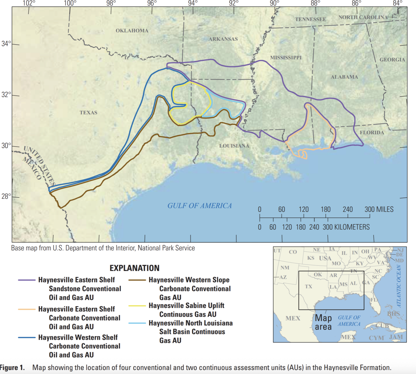
RESTON, Va. — The U.S. Geological Survey released its assessment of potential for undiscovered gas and oil in the Haynesville Formation underlying the onshore Gulf of America and adjoining state waters, assessing that there are technically recoverable resources of 47.9 trillion cubic feet of gas and 152 million barrels of oil.
Since the 1921 discovery of oil sands near Haynesville, La., the formation has produced 49.1 trillion cubic feet of natural gas, as much gas as the United States uses in 18 months at the current rate of consumption.
“The U.S. economy and our way of life depend on energy, and USGS oil and gas assessments point to resources that industry hasn’t discovered yet. In this case, we have assessed there are significant undiscovered resources in the Haynesville Formation of the Gulf Coast,” said Ned Mamula, director of the USGS.
The onshore Gulf Coast is a major energy production area thanks to a world-class petroleum system and extensive exploration and production infrastructure. This assessment is limited to the Haynesville Formation, which comprises a significant portion of the onshore Gulf Coast’s resources. More than 11,000 wells have targeted the formation, of which thousands were drilled since the last USGS assessment in 2017, requiring a new look at undiscovered resources. While the assessment area stretches from the Texas-Mexico border along the Gulf of America coast to the Florida panhandle, resources are concentrated on the Texas-Louisiana border. In May, the USGS released an assessment of undiscovered oil and gas in the Hosston and Travis Peak formations above the Haynesville.
Western Haynesville – an energy industry term for shale gas development on the western side of the East
Texas Basin -- is not included in this assessment and will be included in a forthcoming USGS assessment of undiscovered oil and gas resources in the Bossier Formation.
USGS oil and gas assessments began more than 50 years ago following an oil embargo against the U.S. that signaled a need to understand the occurrence, distribution and potential volumes of undiscovered resources. The embargo led to a mandate for the USGS to use geologic science and data to assess undiscovered oil and gas resources to help meet the nation’s needs. The work continues today – identifying new resources for domestic production as well as international resources that affect market conditions -- an important part of the USGS mission to provide actionable insight to U.S. leaders, other Federal agencies, industry and the public.
USGS energy resource assessments provide information to policy makers on resource potential in areas of the U.S. and the world. For land-management agencies such as the Bureau of Land Management, the results of an energy resources assessment feed into land-use and resource management plans. For the private sector, USGS assessments of undiscovered energy resources provide context for planning detailed exploration.
The range of assessments produced has changed with the technology available to produce oil. In 1995, the USGS began conducting assessments of unconventional, technically recoverable resources. “The shift to horizontal drilling with fracking has revolutionized oil and gas production, and we’ve changed with it,” said Christopher Schenk, USGS geologist.
The USGS Energy Resources Program assesses the potential for undiscovered oil and gas resources in priority geologic provinces in the United States and around the world. Two methodologies are used by the USGS: one for assessing conventional oil and gas resources and one for assessing unconventional (continuous) oil and gas resources (such as shale gas and coalbed gas).