An official website of the United States government
Here's how you know
Official websites use .gov
A .gov website belongs to an official government organization in the United States.
Secure .gov websites use HTTPS
A lock () or https:// means you’ve safely connected to the .gov website. Share sensitive information only on official, secure websites.
Scattered breakouts persist northeast of Pu‘u ‘Ō‘ō, with much of the active lava moving along the northern flow field boundary, burning vegetation and creating smoke plumes. This view looks southwest, and Pu‘u ‘Ō‘ō is near the top of the photograph.
A closer view of Pu‘u ‘Ō‘ō, looking northwest. The vent for the June 27th lava flow is at the right edge of the photograph, near the source of white fume. Mauna Loa (upper left) and Mauna Kea (upper right) are visible in the distance.
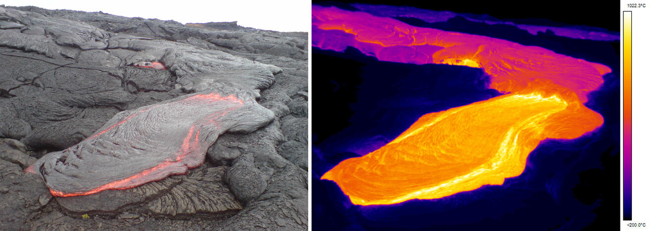
A narrow stream of lava pours from the top of a tumulus (roughly 3 meters, or 10 feet above the surroundings), attesting to the fluid pressure in the interior of the flow. This view looks north, towards the area that lava is burning forest. Mauna Kea is faintly visible in the distance.
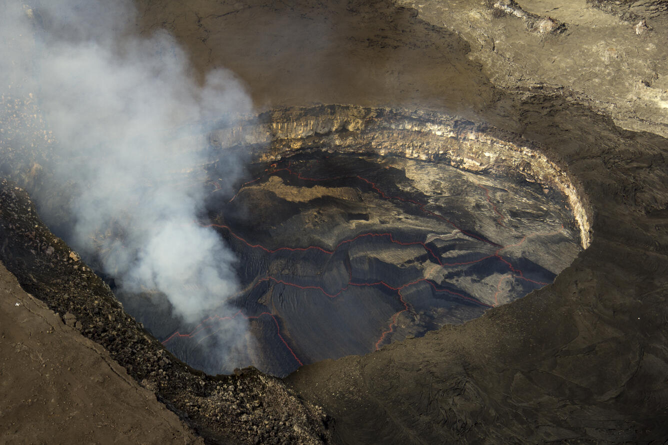
The summit lava lake level has continued to rise over the past week with inflation, and was about 30 meters (roughly 100 feet) below the Overlook crater rim.