An official website of the United States government
Here's how you know
Official websites use .gov
A .gov website belongs to an official government organization in the United States.
Secure .gov websites use HTTPS
A lock () or https:// means you’ve safely connected to the .gov website. Share sensitive information only on official, secure websites.
Lava continues to enter the ocean at Kamokuna, where a lava delta about 19 acres in size has been built. The gravel emergency access road is visible on both sides of the surface flow that cut it. The view is to the southwest.
Lava is transported to the Kamokuna ocean entry, its plume is visible in the distance, via a lava tube. The trace of an active lava tube is often identifiable by a line of fume, as seen here for the episode 61g lava tube above the Pūlama pali.
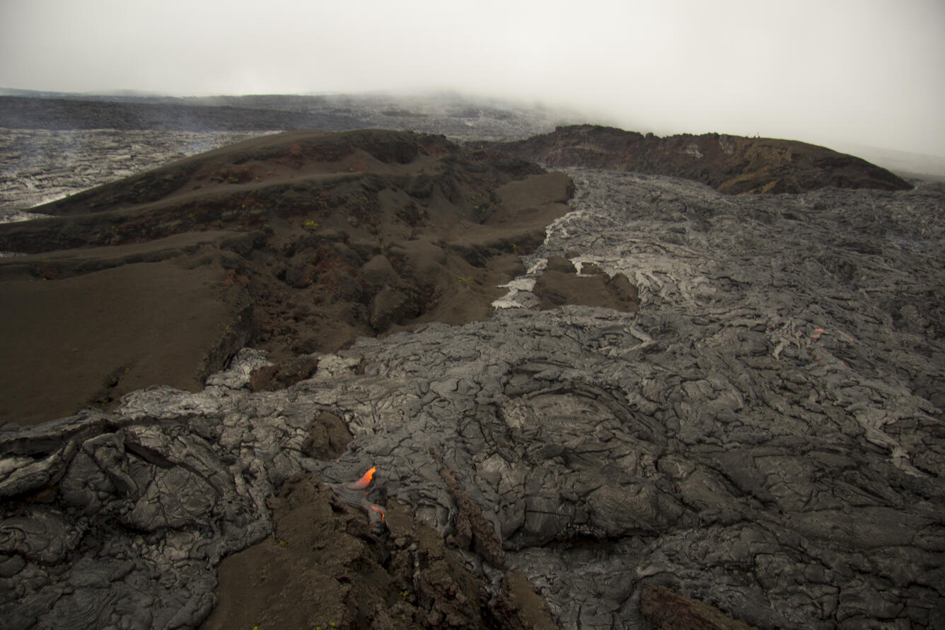
A breakout from the episode 61g vent at the head of the lava tube on November 21 sent lava streaming downslope. That breakout was still active when observed on November 29 and had traveled about 1.3 km (0.8 miles), partly surrounding Pu‘u Halulu, a tephra cone formed in 1983 at the start of the Pu‘u ‘Ō‘ō eruption. The PEcam webcam looks upslope from Pu‘u Halulu toward Pu‘u ‘Ō‘ō, which is shrouded by clouds (top background).
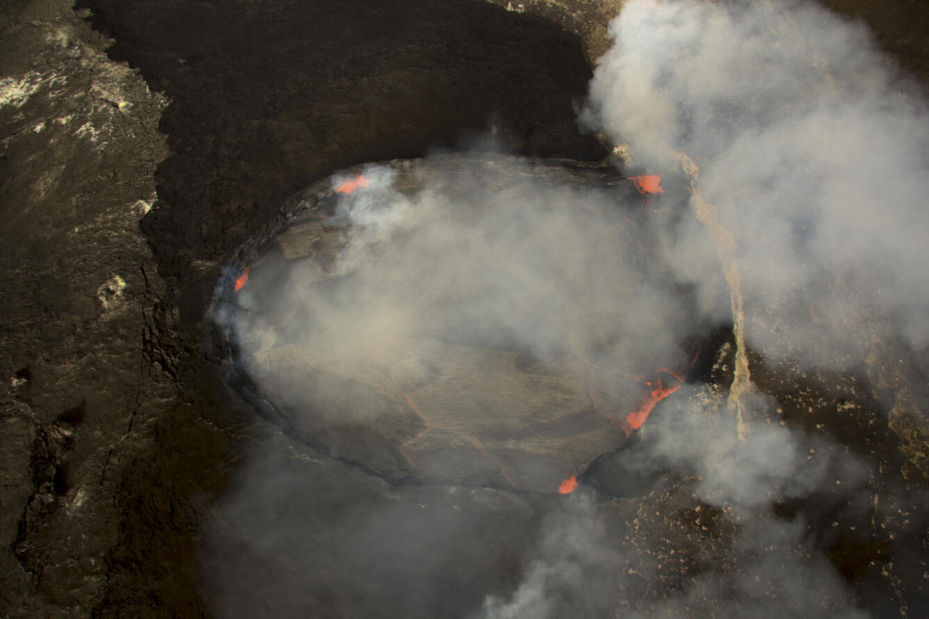
Kīlauea's summit lava lake in Halema‘uma‘u is about 255 m (~840 ft) long (left to right in the image) and 195 m (~640 ft) wide. From this perspective, magma rises into the lake near its north edge (upper left) and circulates to the south, where it sinks all along the south margin of the lake. The rim of Halema‘uma‘u is at the right edge of the photo, and the closed visitor overlook is hidden beneath the fume at upper right.
The U.S. Geological Survey Hawaiian Volcano Observatory and the National Park Service Jaggar Museum are perched together near the summit of Kīlauea, about 1.7 km (~1.1 mi) from the lava lake in Halema‘uma‘u, producing a plume in the background.