An official website of the United States government
Here's how you know
Official websites use .gov
A .gov website belongs to an official government organization in the United States.
Secure .gov websites use HTTPS
A lock () or https:// means you’ve safely connected to the .gov website. Share sensitive information only on official, secure websites.
The June 27th lava flow remains active above Pāhoa. The tip of the flow remains stalled about 155 meters (170 yards) from Pāhoa Village Road, which crosses the middle of the photo. Smoke plumes are visible above town, caused by burning vegetation at the site of lava breakouts. Highway 130 is at the bottom of this photo, which was taken from a helicopter.
Another helicopter view of the active June 27th lava flow above Pāhoa. Smoke plumes are caused by burning vegetation at the site of lava breakouts along the margins of the flow. AP‘A‘ā Street / Cemetery Road, partially covered by lava, is in the foreground.
A timelapse camera that USGS HVO scientists were using to monitor a lava tube skylight was caught in an overflow this morning. In this view, recent lava has surrounded the tripod and melted the power cable.
This view from the helicopter shows the light gray, recent pāhoehoe lava that emerged from the tube skylight and nearly destroyed two timelapse cameras. The summit of Pu‘u ‘Ō‘ō is out of view at upper right.
An aerial view into a skylight revealed flowing lava in the main tube feeding the June 27th lava flow. The large opening is about 7 meters (7.5 yards) across.
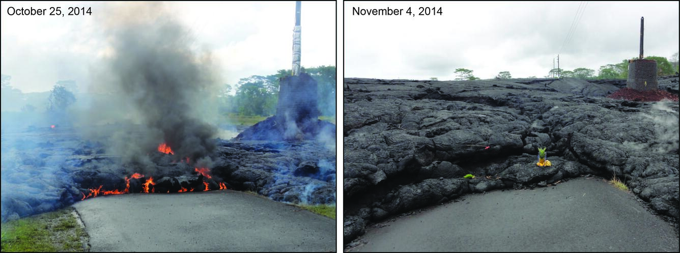
The main mode of growth of the June 27th lava flow over the past several days has been inflation (thickening) of the flow. The photos above were taken where lava crossed AP‘A‘ā Street / Cemetery Road. On October 25 (left), just a few hours after the flow crossed the road, the lava was only about 3 feet thick. Ten days later, on November 4 (right), the flow was about 12 feet thick. The cinder pile surrounding the power pole provides a sense of scale for the inflation.