An official website of the United States government
Here's how you know
Official websites use .gov
A .gov website belongs to an official government organization in the United States.
Secure .gov websites use HTTPS
A lock () or https:// means you’ve safely connected to the .gov website. Share sensitive information only on official, secure websites.
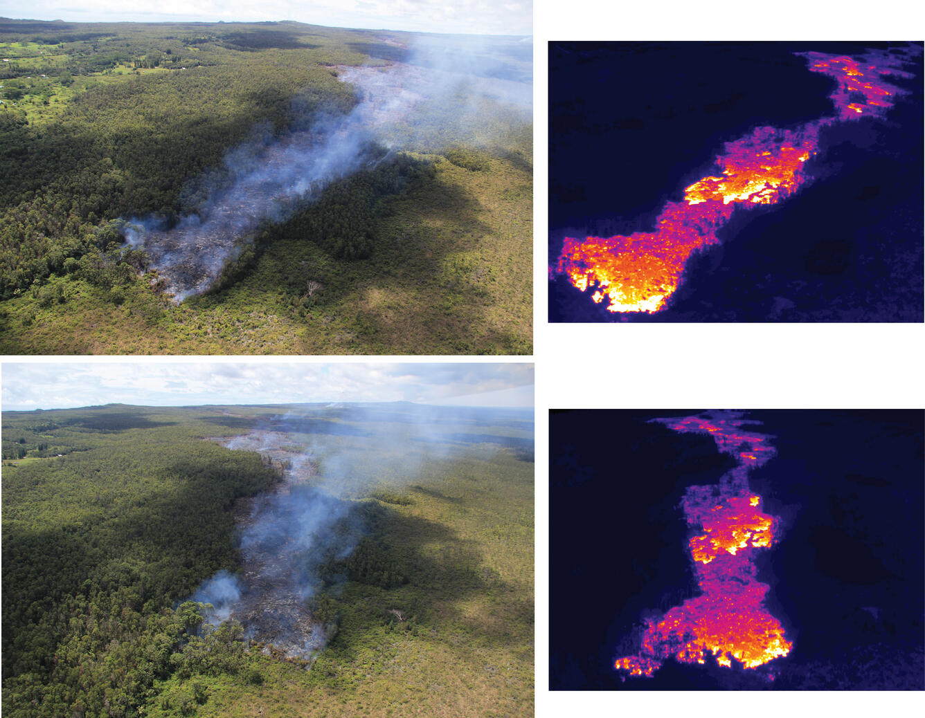
The June 27th flow remains active and heading northeast, moving through Kaohe Homesteads. For several weeks the flow has been moving through thick forest, and today the flow front reached the forest boundary and more open ground. Nevertheless, active portions of the flow remain in the forest and fires continue. The flow front today was 2.4 km (1.5 miles) upslope of Apa‘a St.
Views of the flow front from two different angles, with equivalent thermal images for comparison. The thermal images show that surface breakouts were focused on three areas near the flow front: 1) the flow front itself, 2) an area 300 meters (yards) behind the flow front and 3) a larger area about 1 km (0.6 miles) behind the flow front.
A close-up view of the surface of the June 27th lava flow, near the flow front. The pāhoehoe flow is too thin and slow to topple trees as it passes, but instead the lava surrounds the trees and burns through the base. When the trees fall over, the flow surface may have cooled enough that the trunks remain intact. If the surface is hot enough to burn through the fallen trunks, all that remains is a line of ashen residue (see right side of image).