Photo Opportunity: Scientists Prepare for Seismic Study in East Bay
MEDIA ADVISORY: Faculty and students from California State University, East Bay, U.S. Geological Survey scientists, and community volunteers are conducting an experiment to visualize the subsurface in and around the Hayward Fault and measure how the ground in different neighborhoods responds to earthquake shaking.
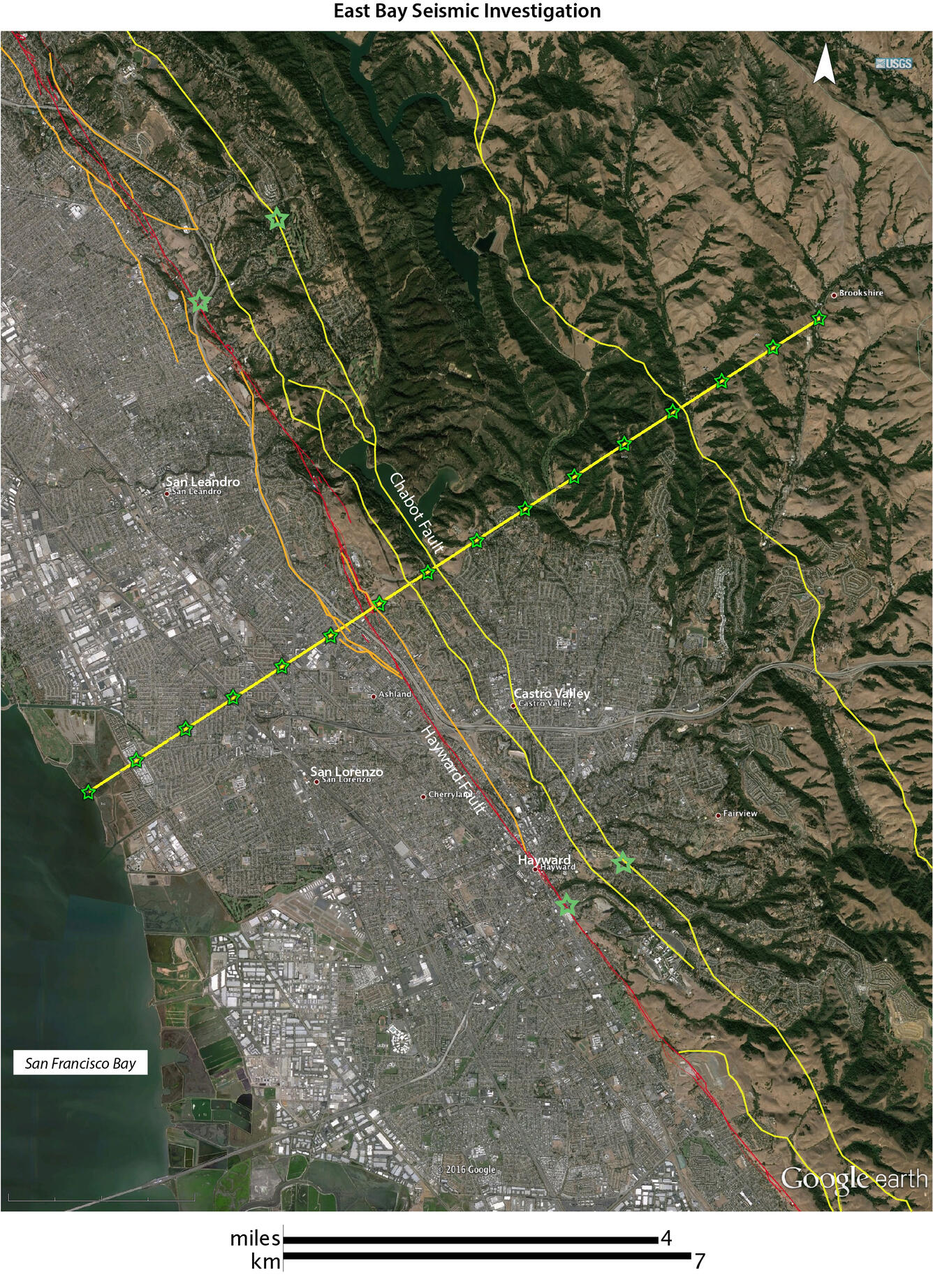
Hundreds of small portable seismographs will be temporarily set out along lines that cross the Hayward Fault through the cities of San Leandro and Castro Valley, and very small explosive “bangs” will be set off at the bottom of 20-30-foot-deep drill holes in September.
The small explosive “bangs” at the bottom of the drill holes will send seismic energy traveling through subsurface geological layers, and will be recorded on the temporary seismographs. These explosions are so small, they can only be felt if one is standing within a few feet of the drill hole. This experiment will allow researchers to gather information about the geologic setting that can’t easily be learned any other way. The data gathered will help characterize the underground geology around the Hayward Fault in three dimensions in the San Leandro and Castro Valley areas, will yield information that helps characterize localized shaking effects during an earthquake, and can be used to help the community prepare for future earthquakes.
Please RSVP to Susan Garcia or Leslie Gordon, so we know how many to expect.
Who:
Rufus Catchings, USGS geophysicist and co-project chief.
Luther Strayer, CSUEB professor of geology and co-project chief.
Coyn Criley, USGS science technician.
Joanne Chan, USGS geophysicist.
Mark Goldman, USGS geophysicist.
Adrian McEvilly, CSUEB graduate student.
Jennifer Bahramian, CSUEB graduate student.
What:
Watch USGS and CSUEB scientists and technicians drill a hole, 20 – 30 feet deep, in preparation for an East Bay seismic survey. See what the temporary seismographs look like, and learn how they work. Learn from scientists about the upcoming experiment, and what they hope to learn from it.
When:
Friday, September 9, 2016, 11:00 a.m. PDT
Where:
Lake Chabot Regional Park, Castro Valley. Enter the park at its southern end at 17900 Lake Chabot Road, in Castro Valley. The sign at this entrance says “District Offices.” It is not the park’s main entrance, or the marina. After pulling in the driveway, drive about ¾ mile uphill toward the district offices; the Nike Classroom will be on the left, and the Regional Parks District Police offices will be on your right. Park in the lot for the Nike Classroom. After parking, continue walking on the main road you just came in, and turn right down the path just past the park offices. The pavement will end just after your turn. Follow the dirt road around as it curves, walking about 100 yards along the trail until you come to a hairpin curve.
A better understanding of the ground’s response to seismic energy can contribute to improved building codes and other mitigation options for a more resilient community. Hundreds of residents and property owners in selected locations in and around San Leandro and Castro Valley are helping with this effort to better characterize how shaking will occur during a future earthquake on the Hayward Fault. Throughout September, USGS scientists and volunteers will be in San Leandro and Castro Valley-area neighborhoods, surveying locations to place the seismic instruments that will record the tiny explosions.