
Research Spotlight: New Habitat Maps Inform Endangered Least Bell’s Vireo Recovery in California
A new report from USGS ecologists analyzes the suitability of California habitat for the federally endangered Least Bell’s Vireo (Vireo bellii pusillus) across its current and historic range. The resulting maps identify the 6% of the state’s riparian habitat most likely to be used by the Least Bell’s Vireo and help meet federal recovery objectives for this species.

The Least Bell’s Vireo was listed as endangered in 1980 by the state of California and in 1986 by the federal government due to habitat loss and introduced brown-headed cowbirds (Molothrus ater). Protection efforts have resulted in a rebounding of the population, but efforts continue to sustain and grow the population of Least Bell’s Vireos and identify sites where it may be vulnerable to future losses. Understanding the features of suitable vireo habitat and where suitable habitat is located can help managers focus their conservation strategy.
In response to this need, the USGS researchers built a model that uses Least Bell’s Vireo observation records and habitat data to determine the landscape features associated with the sites where these birds are found. Given the current rarity of Least Bell’s Vireos, the researchers selected a modeling approach that considers that there might be places that are suitable but where there are no recent records. For example, Least Bell’s Vireos only live in southern California today, but they once thrived in northern and central California as well, where the climate, topography, and vegetation can differ considerably. The model identified several important features common to Least Bell’s Vireo habitat, such as having >60% riparian vegetation, little to no slope, and being within 130 m of water.
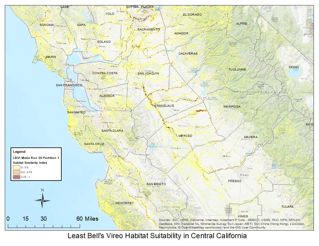
The researchers then used the model to create maps of suitable vireo habitat in California. Only 6% of the riparian habitat in California was identified as suitable for the Least Bell’s Vireo.
Though this area of land is small, pinpointing suitable habitat and its features will help the U.S. Fish and Wildlife Service meet several recovery objectives for the Least Bell’s Vireo. These objectives include distinguishing specific areas to survey for new vireo occurrences, characterizing important vireo-habitat relationships at the landscape-scale, and identifying and prioritizing areas for habitat management. As new data become available from future surveys and habitat mapping, the model and associated maps can be updated, further improving their predictive ability. The results of the study can also help managers identify areas where habitat can be restored to expand vireo populations to manage for threats such as brown-headed cowbird parasitism and the emerging Fusarium Dieback complex involving an exotic beetle that damages or kills riparian trees.
Management Implications:
- Features of suitable Least Bell’s Vireo habitat include >60% riparian vegetation, flat land at the 150-meter scale, little to no slope, and being within 130 m of water.
- New maps identify suitable Least Bell’s Vireo habitat across its current and historic range in California.
- Future surveys for Least Bell’s Vireo should prioritize areas of high-habitat suitability where vireos have been observed previously, such as the San Joaquin Valley and central coast regions, or near source populations.
- By collecting habitat data during field surveys in both suitable and unsuitable habitats, researchers and managers can help improve habitat suitability maps for future use.
This research spotlight refers to:
Preston, K.L., Kus, B.E., and Perkins, E., 2021, Modeling Least Bell’s Vireo habitat suitability in current and historic ranges in California: U.S. Geological Survey Open-File Report 2020–1151, 44 p., https://doi.org/ 10.3133/ ofr20201151.
Associated data for this publication:
Preston, K.L., Kus, B.E., and Perkins, E.E., 2019, Least Bell’s Vireo habitat suitability model for California (2019): U.S. Geological Survey data release, https://doi.org/ 10.5066/ P90T9WT2.
Click here to download a PDF version of this research spotlight.