
EarthView–Landsat Chronicles Deforestation in Colombia
USGS EarthView of the Week
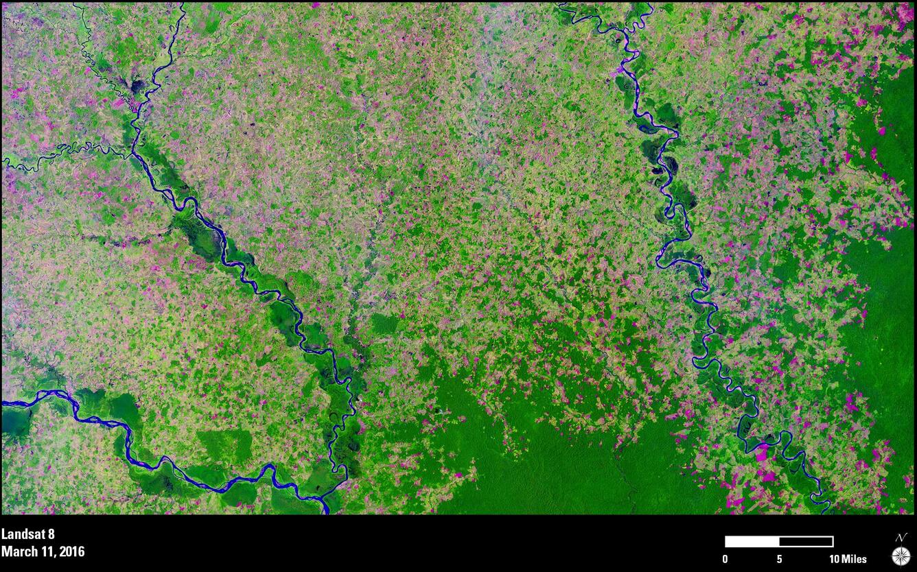
This EarthView from Landsat shows deforestation in Colombia between 1989 and 2016.
EarthViews is a continuing series in which we share a USGS Image of the Week featuring the USGS/NASA Landsat program. From the artistry of Earth imagery to natural and human-caused land change over time, check back every Friday to finish your week with a visual flourish!
The EarthView: Landsat Chronicles Deforestation in Colombia
Description:
Deforestation has long been a fact of life in the Amazon, Andean, and Caribbean regions of Colombia, South America, something that Landsat satellite data have thoroughly chronicled through the years.
Landsat images used by Colombia.s Institute of Hydrology, Meteorology and Environmental Studies (IDEAM) determined that total forest land cover in the country has dropped from 56.8 percent in 1990 to 52.6 percent by 2012, or almost 5 million hectares.

Driven by logging, mining, and conversion to agricultural uses, Colombia lost 140,356 hectares of forest cover in 2014 alone, according to IDEAM, and 120,934 hectares in 2013. These scenes from Landsat 4 in 1989 and Landsat 8 in 2016 reveal the dramatic change over time. Dark green depicts rain forest in both images. The pink, yellow, and lighter green indicate the removal of healthy forest.
Colombia has committed to zero net deforestation in the Amazon by 2020, to allow no overall loss of forest area or forest quality while allowing some flexibility to meet local needs. Satellite images, including those from Landsat, will continue to be an important component in monitoring this goal.
Hungry for some science, but you don’t have time for a full-course research plate? Then check out USGS Science Snippets, our snack-sized science series that focuses on the fun, weird, and fascinating stories of USGS science.