
EarthView–Saudi Wheat Experiment Relied on Fossil Water
USGS EarthView of the Week
This EarthView shows how fossil water is used for agriculture in Saudi Arabia.
EarthViews is a continuing series in which we share a USGS Image of the Week featuring the USGS/NASA Landsat program. From the artistry of Earth imagery to natural and human-caused land change over time, check back every Friday to finish your week with a visual flourish!

The EarthView: Saudi Wheat Experiment Relied on Fossil Water
Description:
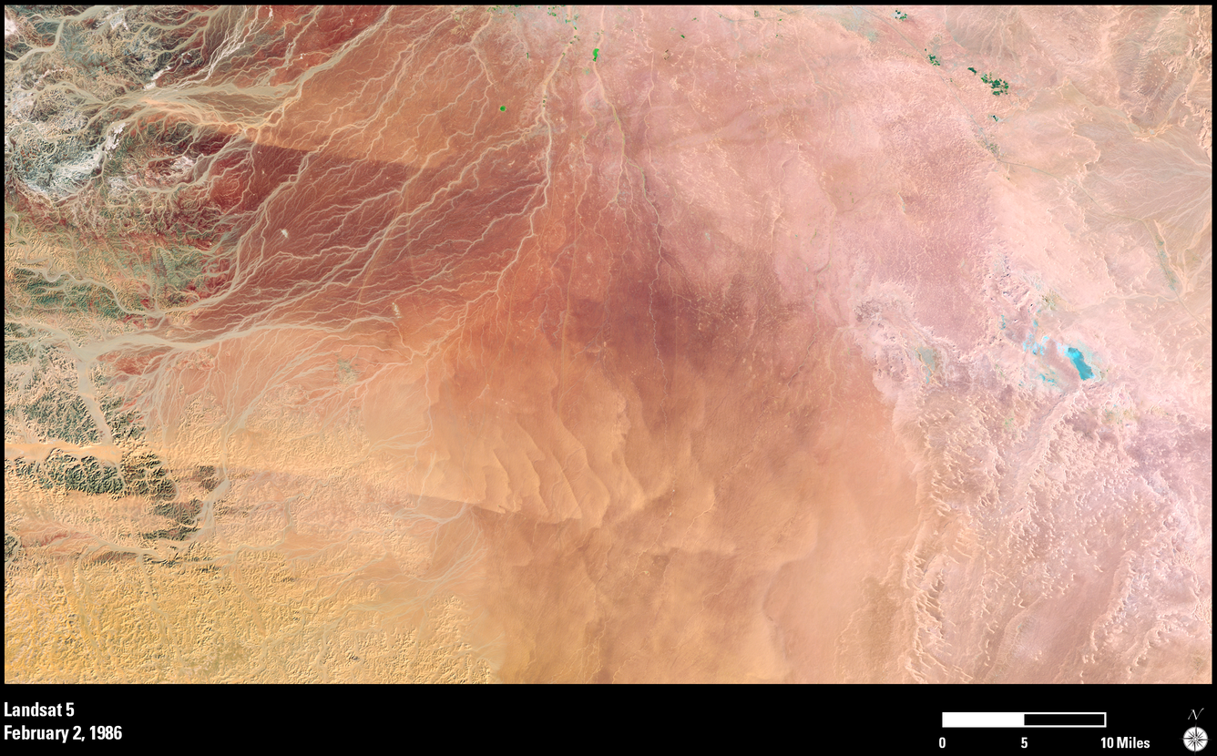
In the mid-1980s, Saudi Arabia embarked on an ambitious agricultural plan to grow crops in its desert areas using ancient fossil water deep beneath the sand, and installed center-pivot irrigation systems in the barren Wadi As-Sirhan basin in the northwest part of the country. The water, which was once used to grow fruit, vegetables and wheat, was buried deep underground for thousands of years.
These Landsat images show the remarkable transformation of desert sand in 1986 into green, circular fields—some as large as 1 kilometer across—by 2016.
The drawback with center-pivot irrigation lies in the fact that water in these aquifers is not recharged. Rainfall here only averages 100 to 200 millimeters per year, making groundwater in the area a nonrenewable resource. Hydrologists predict it will only be feasible to pump the groundwater for another 50 years, so domestic wheat production will be phased out. Local farmers are being encouraged to engage in alternative sustainable agricultural activities, such as greenhouse farming using advance drip irrigation techniques, to produce fruits and vegetables.
Future Landsat data acquisitions will be useful in monitoring and seeing how the changes in farming techniques affect the landscape.
Hungry for some science, but you don’t have time for a full-course research plate? Then check out USGS Science Snippets, our snack-sized science series that focuses on the fun, weird, and fascinating stories of USGS science.