
EarthView–Wildfires Scorch Pampas Region of Argentina
USGS EarthView of the Week
This week's EarthView shows the effects of 2 dozen wildfires in Argentina.
EarthViews is a continuing series in which we share a USGS Image of the Week featuring the USGS/NASA Landsat program. From the artistry of Earth imagery to natural and human-caused land change over time, check back every Friday to finish your week with a visual flourish!

The EarthView: Wildfires Scorch Pampas Region of Argentina
Description:
Since mid-December 2016, roughly two dozen wildfires in the Pampas region of Argentina have consumed almost 2.5 million acres while unleashing giant plumes of dense smoke above the rural landscapes.
Likely caused by thunderstorms that followed a stretch of severe drought in the winter and spring of 2016, the first fires started southwest of the city of Bahía Blanca. A scene from Landsat 8’s Operational Land Imager (OLI) on December 22, 2016, shows smaller red burn scars from those initial blazes—an area of approximately 100,000 acres.
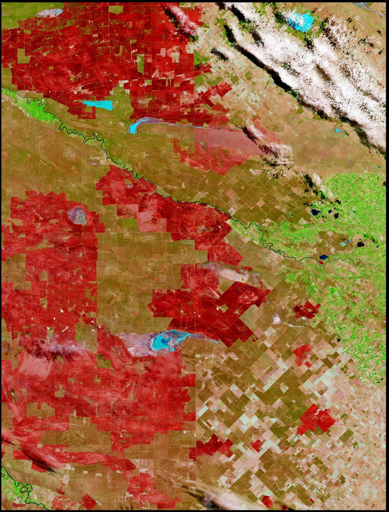
Despite rain in the final days of December, a handful of hot spots persisted, and the fires spread. When it passed overhead on January 7, 2017, OLI captured dramatic imagery of large red burn scars across the landscape of Argentina’s central province of La Pampa, and its southern province of Rio Negro.
On January 5, 2017, the International Charter “Space and Major Disasters,” of which USGS is a member, granted Argentina’s request for Charter members’ available satellite data to help in rapidly assessing the extent of damage and determining a disaster response.
Hungry for some science, but you don’t have time for a full-course research plate? Then check out USGS Science Snippets, our snack-sized science series that focuses on the fun, weird, and fascinating stories of USGS science.