
Flights Above the Mississippi Alluvial Plain to Continue Aquifer Mapping
New Phase of USGS Low-level Surveys Begins in November
A low-flying airplane will soon be visible to residents in the multi-state area comprising the Mississippi Alluvial Plain (MAP), marking the beginning of the next stage of the U.S. Geological Survey’s high-resolution airborne survey project to map aquifers.
Coordinated by USGS scientists to map the properties of aquifers throughout parts of the MAP, the low-level flights are intended to provide critical data needed by state and local decisionmakers to evaluate and manage groundwater resources in the region.
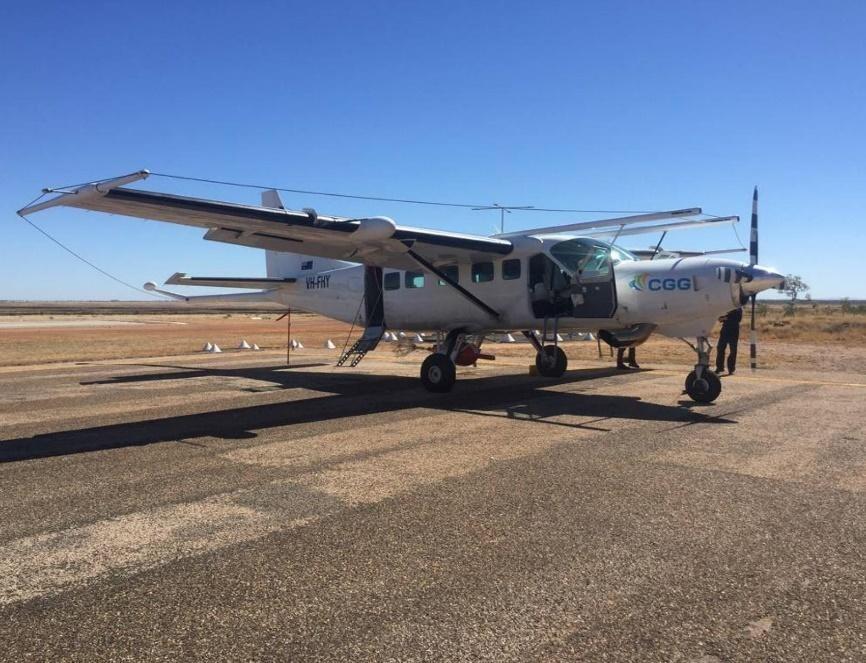
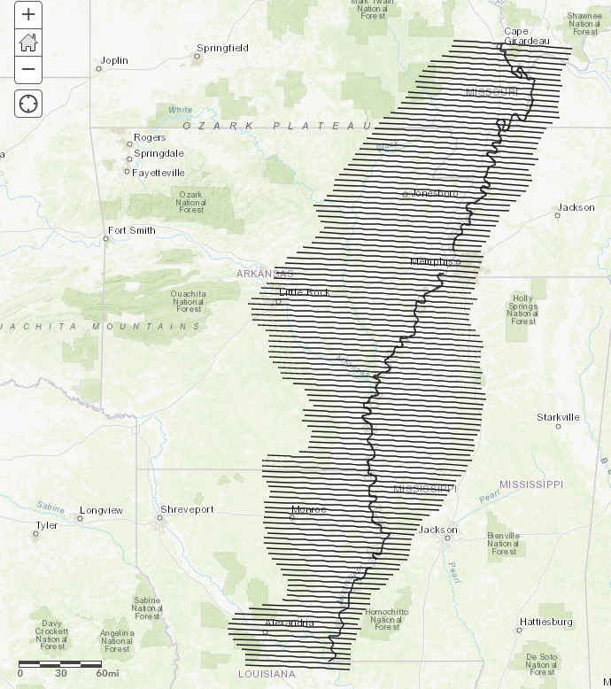
Beginning in early November and lasting for 2-3 months, an airplane contracted by the USGS and operated by CGG Airborne of Ontario, Canada, will make low-level flights over more than 20 million acres and seven states within the MAP. Experienced pilots specially trained and approved for low-level flying will operate the aircraft. All flights are coordinated with the Federal Aviation Administration to ensure accordance with U.S. law. The flights will be based out of Greenwood-Leflore Airport in Mississippi for the first three weeks. Follow the planned flight lines here.
The first segment of regional survey flights completed in early 2019 have provided unique and previously impossible views of the MAP’s shallow aquifer system. In this second phase, the survey will acquire data from the subsurface up to 1,000 feet below ground, or 2-3 times deeper than previous flights.
Instruments on the airplane will collect information about the geology in shallow aquifers of the region. When the data analysis is complete, resulting state-of-the-art maps will help USGS researchers understand the aquifer system that supports groundwater resources at depths up to about 1,000 feet underground.
This survey will be flown mainly east-west at an altitude of 400 feet along lines spaced approximately 4 miles apart. The airplane will have an attached electromagnetic instrument housed in a small receiver that is towed 300 feet behind and about 150 feet beneath the aircraft. All survey flights will occur during daylight hours.
Residents and visitors should not be alarmed to witness a low-flying aircraft with a small towed sensor behind it. The airplane will also carry scientific instruments including a magnetometer and a gamma-ray spectrometer. None of the instruments pose a health risk to people or animals, and flights will not occur directly over populated areas.
The survey is being conducted by the USGS Water Availability and Use Program as part of the MAP Regional Water Availability Study. More information about the MAP project can be found online.
Additional resources:
Surveys from Above Give Scientists a New Perspective on Water