Media Advisory: Remobilized 100-Year-Old Volcanic Ash: Is It a Health Hazard?

ANCHORAGE, Alaska — Two community events about monitoring old volcanic ash resuspended by high winds are scheduled next week in the City of Kodiak and in Larsen Bay, Alaska.
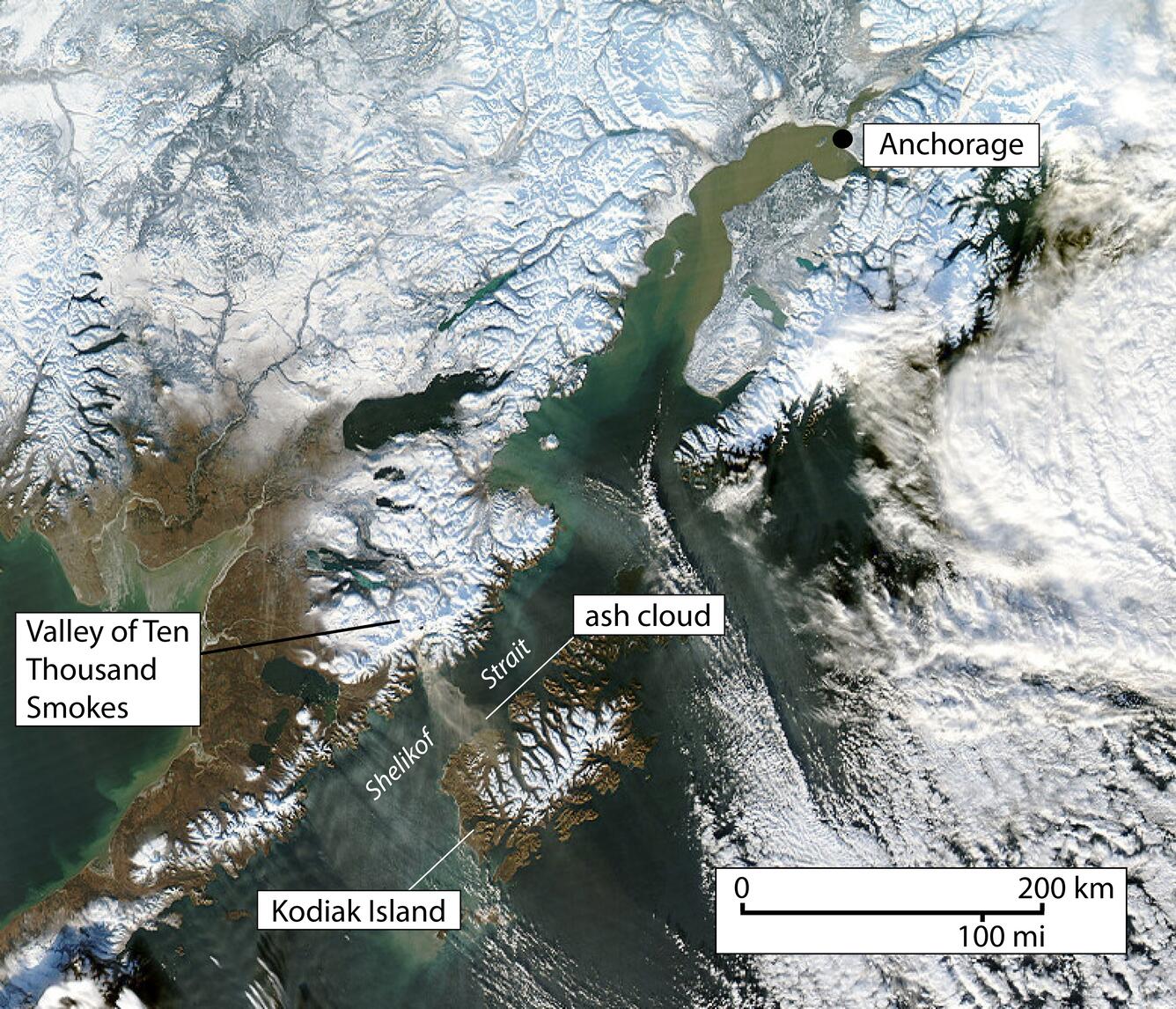
U.S. Geological Survey scientists with the Alaska Volcano Observatory are deploying instruments in two locations on Kodiak Island to monitor air quality during strong northwesterly winds, when old loose volcanic ash erupted over 100 years ago can be picked up and reworked into dust clouds from the Valley of Ten Thousand Smokes and carried over Shelikof Strait, Kodiak Island and the Gulf of Alaska. These clouds contain volcanic ash shards that are a known hazard to aviation. Scientists are studying other effects of the remobilized ash fallout on the ground and whether there is a public health hazard.
This phenomenon is not the result of volcanic activity and occurs seasonally in the spring and fall during times of high winds and dry snow-free conditions in the Katmai area and other young volcanic areas of Alaska. USGS works closely with the National Weather Service who has the responsibility to issue forecasts and statements of resuspended volcanic ash.
The Alaska Volcano Observatory is a cooperative program of the USGS, the University of Alaska Fairbanks Geophysical Institute and the Alaska Division of Geological and Geophysical Surveys.
What:
(Event #1)Public presentation: "Resuspended Volcanic Dust from the Katmai Region to Kodiak Island"
When:Tuesday, Sept. 8, 2015, 7:00 p.m. AKDT
Who:Kristi Wallace, USGS/AVO geologist
Where:USFWS Kodiak Refuge Visitor Center, 402 Center Ave, Kodiak, Alaska
What:
(Event #2)
Scientific equipment viewing and Q & A session: Photo opportunity and discussion about instruments to monitor air quality during wind-blown resuspension events in Larsen Bay and Kodiak.
When:Wednesday, Sept. 9, 2015, 1:00 p.m. AKDT
Who:Kristi Wallace, USGS/AVO geologist
David Harmes, Mayor of Larsen Bay
Where:Larsen Bay Mayor David Harmes' home (please call for address)
Larsen Bay, Alaska
Background Information:
- Visit the volcanic ash and human health website for more information.
- Official warnings about ash resuspension events are issued by the National Weather Service.
- Forecasts of airborne ash hazard to aircraft.
- Volcanic Ash Advisories.
- Forecasts of ash fall.
- Air quality hazards and guidance from Alaska Department of Environmental Conservation, Division of Air Quality.