Announcing Landsat Data Product Improvements
USGS sets earth observation precedent with Landsat Collection 2 Dataset.
Landsat Collection 2 marks the second major reprocessing campaign on the USGS Landsat archive since 2016, resulting in several data product improvements that harness recent advancements in data processing, algorithm development, and data access and distribution capabilities. The USGS switched to a collections-based Landsat archive management strategy four years ago in recognition of the need for consistent Landsat 1-8 sensor data and in anticipation of future periodic reprocessing of the archive to reflect new sensor calibration knowledge. The USGS plans to release Landsat Collection 2 on December 1, 2020.
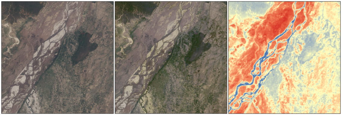
The USGS announced earlier this year that a commercial cloud environment would be used to produce Collection 2 and to distribute more than 49 years of Landsat data. Landsat Collection 2 includes Level-1 calibrated data for all sensors since 1972. Additionally, for the first time in the program’s history, the production of Level-2 geophysical surface reflectance and surface temperature imaged products from 1982 to present are available. Furthermore, Landsat Collection 2 improves geometric interoperability with Europe’s Sentinel-2 missions, which will support a wide variety of applications that require high temporal repeat and finer spatial resolution optical data.
Several significant geometric and radiometric improvements are being made with Landsat Collection 2 that include user access to consistent Quality Assessment information in Level-1 and Level-2 data products, as well as consistent metadata files to support rapid querying of the Landsat collection inventory. Landsat Collection 2 will be distributed using a USGS-managed commercial cloud environment where all image data products will be available in a Cloud-Optimized Geospatial Tagged Image File Format (GeoTIFF) (COG). COGs are an extension of the current GeoTIFFs that improve access to geospatial Earth datasets in a cloud-based environment, allowing users to search, discover, and request only the data they need.
The USGS was pleased to have its Collection 2 surface reflectance and surface temperature products certified by the international Committee on Earth Observation Satellites (CEOS) for compliance with its CEOS Analysis-Ready Data for Land (CARD4L) specifications. This internationally recognized certification ensures that Landsat Collection 2 products will be more interoperable with data from other Earth-observing platforms, such as Europe’s Sentinel-2 satellites, as the European Space Agency also works toward CARD4L-compliant products.
A summary of the enhancements and improvements between Landsat Collection 1 and Landsat Collection 2 is provided in this quick reference guide. Landsat Collection 2 data products will be available for download at no charge from the USGS’s EarthExplorer data portal. No-cost, open access to USGS Landsat data began in 2008.
Visit the Landsat Collection 2 web page for additional information and documentation.