USGS Online Mapper Provides a Decadal Look at Groundwater Quality
A first of its kind, national assessment of an unseen, valuable resource used by millions of people.
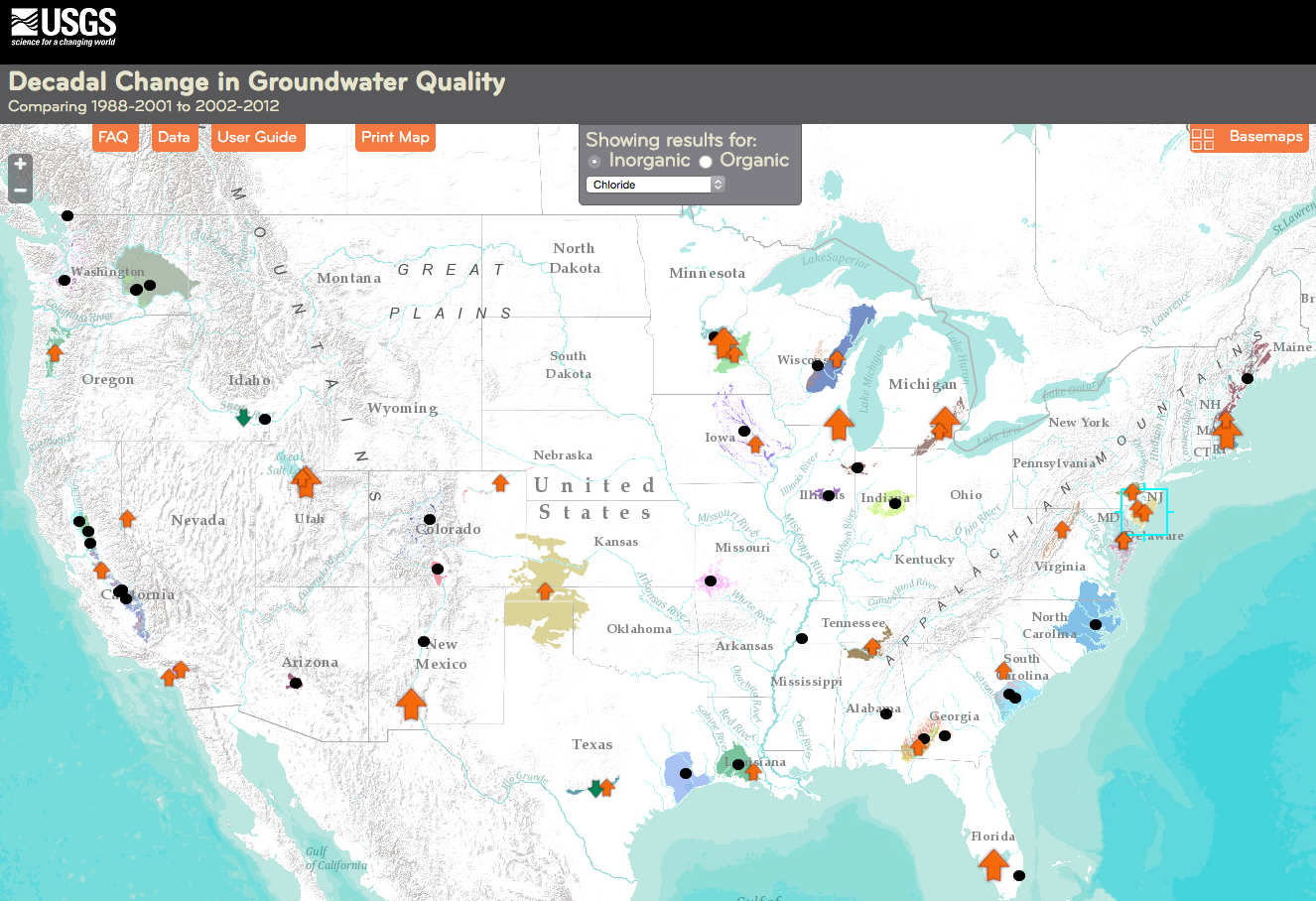
A new online interactive mapping tool provides summaries of decadal-scale changes in groundwater quality across the Nation.
About 140 million people—almost one-half of the Nation’s population—rely on groundwater for drinking water. Tracking changes in groundwater quality and investigating the reasons for these changes is crucial for informing management decisions to protect and sustain our valuable groundwater resources
The mapper shows how concentrations of 24 contaminants, such as nutrients, pesticides, metals, and volatile organic compounds, are changing over decadal periods in 67 groundwater networks across the Nation. Each network consists of about 20 to 30 wells selected to represent water-quality conditions in a given geographical area, aquifer, and in some cases, a specific land use.
Decadal Groundwater-Quality Change Summary:
• Increases in concentrations of chloride (31*), dissolved solids (25), deethylatrazine (17), nitrate (14), and uranium (8).
• Decreases in concentrations of fluoride (10), arsenic (8) and prometon (6).
*Note: (31) is the number of groundwater networks where an increase or decrease was observed. The first set of samples was obtained from 1988-2000, and the second set was obtained from the same wells from 2001-2012.
Groundwater quality data were collected in about 5,000 wells between 1988 and 2001 by the USGS National Water-Quality Assessment Project. About 1,500 of these wells were sampled again between 2002 and 2012 to evaluate decadal changes in groundwater quality.
ACCESS THE MAPPER: http://nawqatrends.wim.usgs.gov/decadal/
The mapping tool is one component of the National Water-Quality Assessment Project’s ongoing efforts to assess, understand, and forecast the quality of the Nation’s groundwater.