
US Topo Cartographic Specifications - Transportation
US Topo cartographic specifications for Transportation including Airport, Rail, Route, and Trail.
Feature Types
AIRPORT
Heliport
FType: Complex
FCode: 20001
Feature Description: An area of land, water, or a structure used or intended to be used for the landing and takeoff of helicopters, and includes its building and facilities, if any.
Cartographic Representation
| Point Graphic Depiction | Linear Graphic Depiction | Polygon Graphic Depiction |
|---|---|---|
Media

Sources/Usage: Public Domain. View Media Details
| Not Applicable | Not Applicable |
Point Symbology Specifications
| SpecName | Size (Pt) | Color R/G/B | Transparency (%) |
|---|---|---|---|
| Layer 1 (Top) | 6.00 | 0/0/0 | 0 |
| Layer 2 | 19.00 | 0/0/0 | 0 |
| Layer 3 | 14.00 | 230/152/0 | 0 |
| Layer 4 | 16.00 | 230/152/0 | 0 |
| Layer 5 | 14.00 | 230/152/0 | 0 |
| Layer 6 | 16.00 | 230/152/0 | 0 |
| Layer 7 (Base) | 14.00 | 255/255/255 | 0 |
Runway
FType: Runway
FCode: 20100
Feature Description: A defined rectangular area on a land airport prepared for the landing and takeoff run of aircraft along its length.
Cartographic Representation
| Point Graphic Depiction | Linear Graphic Depiction | Polygon Graphic Depiction |
|---|---|---|
| Not Applicable | Not Applicable |
Media

Sources/Usage: Public Domain. View Media Details
|
Polygon Symbology Specifications
| SpecName | Size (Pt) | Color R/G/B | Transparency (%) |
|---|---|---|---|
| Layer 1 (Outline) | 0.40 | 0/0/0 | 0 |
Annotation
| Font Style | Font Size (Pt) | Font Color R/G/B | Halo Size (Pt) | Halo Color R/G/B | Placement Properties | Anno Graphic Depiction |
|---|---|---|---|---|---|---|
| Segoe UI | 8.00 | 0/ 0/ 0 | 0.70 | 240/ 240/ 240 | Horizontal and offset from polygon. |
Media

Sources/Usage: Public Domain. View Media Details
|
Seaplane Anchorage / Base
FType: Complex
FCode: 20002
Feature Description: A designated area of water used or intended to be used for the landing and takeoff of seaplanes and shoreside access.
Cartographic Representation
| Point Graphic Depiction | Linear Graphic Depiction | Polygon Graphic Depiction |
|---|---|---|
Media

Sources/Usage: Public Domain. View Media Details
| Not Applicable | Not Applicable |
Point Symbology Specifications
| SpecName | Size (Pt) | Color R/G/B | Transparency (%) |
|---|---|---|---|
| Layer 1 (Top) | 16.00 | 24/74/225 | 0 |
| Layer 2 | 16.00 | 24/74/225 | 0 |
| Layer 3 | 18.00 | 14/74/225 | 0 |
| Layer 4 | 2.00 | 24/74/225 | 0 |
| Layer 5 | 2.00 | 24/74/225 | 0 |
| Layer 6 | 2.00 | 24/74/225 | 0 |
| Layer 7 | 2.00 | 24/74/225 | 0 |
| Layer 8 (Base) | 14.00 | 255/255/255 | 0 |
RAIL
Rail
FType: No FType for this feature
FCode: 20200
Feature Description: A primary railway that provides service between destinations.
Rail: Siding / Spur
FType: No FType for this feature
FCode: 20201
Feature Description: A stretch of railway track connected to a main railway and used for temporary storage, passing, loading, and/or unloading. The siding / spur can be part of a rail yard.
Cartographic Representation
| Point Graphic Depiction | Linear Graphic Depiction | Polygon Graphic Depiction |
|---|---|---|
| Not Applicable |
Media

Sources/Usage: Public Domain. View Media Details
| Not Applicable |
Line Symbology Specifications
| SpecName | Size (Pt) | Color R/G/B | Transparency (%) |
|---|---|---|---|
| Layer 1 (Hash Line) | 2.88 | 0/0/0 | 0 |
| Layer 2 (Solid Line) | 0.36 | 0/0/0 | 0 |
ROUTE
4WD
FType: No FType for this feature
FCode: No FCode for this feature
Feature Description: An unpaved dirt trail where a four-wheel drive vehicle is required.
Cartographic Representation
| Point Graphic Depiction | Linear Graphic Depiction | Polygon Graphic Depiction |
|---|---|---|
| Not Applicable |
Media

Sources/Usage: Public Domain. View Media Details
| Not Applicable |
Line Symbology Specifications
| SpecName | Size (Pt) | Color R/G/B | Transparency (%) |
|---|---|---|---|
| Layer 1 (Top) | 0.55 | 130/130/130 | 0 |
| Layer 2 | 0.55 | 130/130/130 | 0 |
| Layer 3 (Base) | 1.80 | 235/235/235 | 0 |
Closed Road
FType: No FType for this feature
FCode: No FCode for this feature
Feature Description: Roads that are closed to vehicular traffic but still exist on the transportation system for potential future use.
Cartographic Representation
| Point Graphic Depiction | Linear Graphic Depiction | Polygon Graphic Depiction |
|---|---|---|
| Not Applicable |
Media

Sources/Usage: Public Domain. View Media Details
| Not Applicable |
Line Symbology Specifications
| SpecName | Size (Pt) | Color R/G/B | Transparency (%) |
|---|---|---|---|
| Layer 1 (Top) | 0.70 | 130/130/130 | 0 |
| Layer 2 (Base) | 0.90 | 235/235/235 | 0 |
Controlled-access Highway
FType: No FType for this feature
FCode: No FCode for this feature
Feature Description: Interstates and limited access highways.
Cartographic Representation
| Point Graphic Depiction | Linear Graphic Depiction | Polygon Graphic Depiction |
|---|---|---|
| Not Applicable |
Media

Sources/Usage: Public Domain. View Media Details
| Not Applicable |
Line Symbology Specifications
| SpecName | Size (Pt) | Color R/G/B | Transparency (%) |
|---|---|---|---|
| Layer 1 (Top) | 1.25 | 175/75/76 | 0 |
| Layer 2 (Base) | 2.50 | 130/41/41 | 0 |
Ferry Route
FType: No FType for this feature
FCode: No FCode for this feature
Feature Description: A route that connects and maintains transportation flow over a body of water. Conveys vehicles, people, and cargo over a waterbody in a boat. Excludes commuter ferry (ferry taxis) routes and routes used by sightseeing watercraft. Spatial representation is generalized and may not accurately depict the real world location of the feature.
Cartographic Representation
| Point Graphic Depiction | Linear Graphic Depiction | Polygon Graphic Depiction |
|---|---|---|
| Not Applicable |
Media

Sources/Usage: Public Domain. View Media Details
| Not Applicable |
Line Symbology Specifications
| SpecName | Size (Pt) | Color R/G/B | Transparency (%) |
|---|---|---|---|
| Layer 1 (Line) | 1.00 | 155/155/155 | 0 |
Annotation
| Font Style | Font Size (Pt) | Font Color R/G/B | Halo Size (Pt) | Halo Color R/G/B | Placement Properties | Anno Graphic Depiction |
|---|---|---|---|---|---|---|
| Segoe UI, Italic | 6.00 | 0/ 0/ 0 | 1.00 | 240/ 240/ 240 | Curved and offset from the line. |
Media

Sources/Usage: Public Domain. View Media Details
|
Interstate Route
FType: No FType for this feature
FCode: No FCode for this feature
Feature Description: Fast, wide roads that traverse states and connect important cities. Part of the Interstate Highway System.
Cartographic Representation
| Point Graphic Depiction | Linear Graphic Depiction | Polygon Graphic Depiction |
|---|---|---|
Media

Sources/Usage: Public Domain. View Media Details
| Not Applicable | Not Applicable |
Point Symbology Specifications
| SpecName | Size (Pt) | Color R/G/B | Transparency (%) |
|---|---|---|---|
| Layer 1 (Road Shield - Top) | 24.00 | 0/0/0 | 0 |
| Layer 2 (Road Shield) | 24.00 | 0/0/255 | 0 |
| Layer 3 (Road Shield - Base) | 24.00 | 255/0/0 | 0 |
Annotation
| Font Style | Font Size (Pt) | Font Color R/G/B | Halo Size (Pt) | Halo Color R/G/B | Placement Properties | Anno Graphic Depiction |
|---|---|---|---|---|---|---|
| Segoe UI | 7.00 | 255/ 255/ 255 | Not Applicable | Not Applicable | Regular placement, horizontal and centered on line. |
Media

Sources/Usage: Public Domain. View Media Details
|
Local Connecting Road
FType: No FType for this feature
FCode: No FCode for this feature
Feature Description: Roads that collect traffic from local roads and connect smaller towns, subdivisions, and neighborhoods.
Cartographic Representation
| Point Graphic Depiction | Linear Graphic Depiction | Polygon Graphic Depiction |
|---|---|---|
| Not Applicable |
Media

Sources/Usage: Public Domain. View Media Details
| Not Applicable |
Line Symbology Specifications
| SpecName | Size (Pt) | Color R/G/B | Transparency (%) |
|---|---|---|---|
| Layer 1 (Line) | 1.50 | 110/111/110 | 0 |
| Layer 2 (Line - Base) | 2.50 | 255/255/255 | 0 |
Annotation
| Font Style | Font Size (Pt) | Font Color R/G/B | Halo Size (Pt) | Halo Color R/G/B | Placement Properties | Anno Graphic Depiction |
|---|---|---|---|---|---|---|
| Segoe UI | 7.00 | 0/ 0/ 0 | 1.00 | 240/ 240/ 240 | Curved and offset from line. |
Media

Sources/Usage: Public Domain. View Media Details
|
Local Road
FType: No FType for this feature
FCode: No FCode for this feature
Feature Description: Generally a paved street, road, or byway that usually has a single lane of traffic in each direction.
Cartographic Representation
| Point Graphic Depiction | Linear Graphic Depiction | Polygon Graphic Depiction |
|---|---|---|
| Not Applicable |
Media

Sources/Usage: Public Domain. View Media Details
| Not Applicable |
Line Symbology Specifications
| SpecName | Size (Pt) | Color R/G/B | Transparency (%) |
|---|---|---|---|
| Layer 1 (Line) | 1.00 | 155/155/155 | 0 |
Annotation
| Font Style | Font Size (Pt) | Font Color R/G/B | Halo Size (Pt) | Halo Color R/G/B | Placement Properties | Anno Graphic Depiction |
|---|---|---|---|---|---|---|
| Segoe UI, Italic | 6.00 | 0/ 0/ 0 | 1.00 | 240/ 240/ 240 | Curved and offset from the line. |
Media

Sources/Usage: Public Domain. View Media Details
|
Ramp
FType: No FType for this feature
FCode: No FCode for this feature
Feature Description: A road, sometimes called a "slip road", that typically allows controlled access from adjacent, not at-grade roads onto a limited access highway, often in the form of a cloverleaf interchange.
Cartographic Representation
| Point Graphic Depiction | Linear Graphic Depiction | Polygon Graphic Depiction |
|---|---|---|
| Not Applicable |
Media

Sources/Usage: Public Domain. View Media Details
| Not Applicable |
Line Symbology Specifications
| SpecName | Size (Pt) | Color R/G/B | Transparency (%) |
|---|---|---|---|
| Layer 1 (Line) | 1.75 | 201/103/103 | 0 |
Secondary Highway or Major Connecting Road
FType: No FType for this feature
FCode: No FCode for this feature
Feature Description: Main arteries and highways that are not limited access, usually in the U.S. Highway or State Highway systems.
Cartographic Representation
| Point Graphic Depiction | Linear Graphic Depiction | Polygon Graphic Depiction |
|---|---|---|
| Not Applicable |
Media

Sources/Usage: Public Domain. View Media Details
| Not Applicable |
Line Symbology Specifications
| SpecName | Size (Pt) | Color R/G/B | Transparency (%) |
|---|---|---|---|
| Layer 1 (Line) | 1.75 | 201/103/103 | 0 |
Annotation
| Font Style | Font Size (Pt) | Font Color R/G/B | Halo Size (Pt) | Halo Color R/G/B | Placement Properties | Anno Graphic Depiction |
|---|---|---|---|---|---|---|
| Segoe UI | 7.00 | 0/ 0/ 0 | 1.00 | 240/ 240/ 240 | Curved and offset from line. |
Media
Sources/Usage: Public Domain. View Media Details
|
State Route
FType: No FType for this feature
FCode: No FCode for this feature
Feature Description: Numbered routes designated and maintained by local state governments.
Cartographic Representation
| Point Graphic Depiction | Linear Graphic Depiction | Polygon Graphic Depiction |
|---|---|---|
Media

Sources/Usage: Public Domain. View Media Details
| Not Applicable | Not Applicable |
Point Symbology Specifications
| SpecName | Size (Pt) | Color R/G/B | Transparency (%) |
|---|---|---|---|
| Layer 1 (Road Shield - Top) | 22.00 | 0/0/0 | 0 |
| Layer 2 (Road Shield - Base) | 22.00 | 255/255/255 | 0 |
Annotation
| Font Style | Font Size (Pt) | Font Color R/G/B | Halo Size (Pt) | Halo Color R/G/B | Placement Properties | Anno Graphic Depiction |
|---|---|---|---|---|---|---|
| Segoe UI | 7.00 | 0/ 0/ 0 | Not Applicable | Not Applicable | Regular placement, horizontal and centered on line. |
Media

Sources/Usage: Public Domain. View Media Details
|
Tunnel
FType: No FType for this feature
FCode: No FCode for this feature
Feature Description: An underground passage that is open at both ends and contains a road. Connects and maintains transportation flow underneath physical or human-built obstructions, such as a mountains or rivers. Spatial representation is generalized and may not accurately depict the real world location of the feature.
Cartographic Representation
| Point Graphic Depiction | Linear Graphic Depiction | Polygon Graphic Depiction |
|---|---|---|
| Not Applicable |
Media

Sources/Usage: Public Domain. View Media Details
| Not Applicable |
Line Symbology Specifications
| SpecName | Size (Pt) | Color R/G/B | Transparency (%) |
|---|---|---|---|
| Layer 1 (Line) | 0.216 | 156/156/156 | 0 |
| Layer 2 (Line) | 0.216 | 156/156/156 | 0 |
| Layer 3 (Line - End Caps) | 0.216 | 155/155/155 | 0 |
Forest Service High Clearance Route
FType: No FType for this feature
FCode: No FCode for this feature
Feature Description: Routes under the jurisdiction of the Forest Service that require a vehicle with high ground clearance to navigate safely.
Cartographic Representation
| Point Graphic Depiction | Linear Graphic Depiction | Polygon Graphic Depiction |
|---|---|---|
Media

Sources/Usage: Public Domain. View Media Details
| Not Applicable | Not Applicable |
Point Symbology Specifications
| SpecName | Size (Pt) | Color R/G/B | Transparency (%) |
|---|---|---|---|
| Layer 1 (Road Shield - Outline) | 0.25 | 0/0/0 | 0 |
| Layer 2 (Road Shield - Fill) | Not Applicable | 255/255/255 | 0 |
Annotation
| Font Style | Font Size (Pt) | Font Color R/G/B | Halo Size (Pt) | Halo Color R/G/B | Placement Properties | Anno Graphic Depiction |
|---|---|---|---|---|---|---|
| Segoe UI | 5.25 | 0/ 0/ 0 | Not Applicable | Not Applicable | Centered on point. |
Media

Sources/Usage: Public Domain. View Media Details
|
Forest Service Primary Route
FType: No FType for this feature
FCode: No FCode for this feature
Feature Description: Routes under the jurisdiction of the Forest Service that provide public access to popular recreation areas and connect populated areas.
Cartographic Representation
| Point Graphic Depiction | Linear Graphic Depiction | Polygon Graphic Depiction |
|---|---|---|
Media

Sources/Usage: Public Domain. View Media Details
| Not Applicable | Not Applicable |
Point Symbology Specifications
| SpecName | Size (Pt) | Color R/G/B | Transparency (%) |
|---|---|---|---|
| Layer 1 (Road Shield - Top) | 22.00 | 0/0/0 | 0 |
| Layer 2 (Road Shield - Base) | 22.00 | 255/255/255 | 0 |
Annotation
| Font Style | Font Size (Pt) | Font Color R/G/B | Halo Size (Pt) | Halo Color R/G/B | Placement Properties | Anno Graphic Depiction |
|---|---|---|---|---|---|---|
| Segoe UI | 5.00 | 0/ 0/ 0 | Not Applicable | Not Applicable | Centered on point. |
Media

Sources/Usage: Public Domain. View Media Details
|
Forest Service Secondary Route
FType: No FType for this feature
FCode: No FCode for this feature
Feature Description: Routes under the jurisdiction of the US Forest Service that are not as highly trafficked as primary routes but have higher traffic than local roads.
Cartographic Representation
| Point Graphic Depiction | Linear Graphic Depiction | Polygon Graphic Depiction |
|---|---|---|
Media

Sources/Usage: Public Domain. View Media Details
| Not Applicable | Not Applicable |
Point Symbology Specifications
| SpecName | Size (Pt) | Color R/G/B | Transparency (%) |
|---|---|---|---|
| Layer 1 (Road Shield -Outline) | 0.25 | 0/0/0 | 0 |
| Layer 2 (Road Shield -Fill) | Not Applicable | 255/255/255 | 0 |
Annotation
| Font Style | Font Size (Pt) | Font Color R/G/B | Halo Size (Pt) | Halo Color R/G/B | Placement Properties | Anno Graphic Depiction |
|---|---|---|---|---|---|---|
| Segoe UI | 5.25 | 0/ 0/ 0 | Not Applicable | Not Applicable | Centered on point. |
Media

Sources/Usage: Public Domain. View Media Details
|
US Route
FType: No FType for this feature
FCode: No FCode for this feature
Feature Description: Also known as “US Highways,” these are numbered highways that connect populated places across the country and can sometimes be limited-access via onramps and offramps.
Cartographic Representation
| Point Graphic Depiction | Linear Graphic Depiction | Polygon Graphic Depiction |
|---|---|---|
Media

Sources/Usage: Public Domain. View Media Details
| Not Applicable | Not Applicable |
Point Symbology Specifications
| SpecName | Size (Pt) | Color R/G/B | Transparency (%) |
|---|---|---|---|
| Layer 1 (Road Shield - Top) | 22.00 | 0/0/0 | 0 |
| Layer 2 (Road Shield - Base) | 22.00 | 255/255/255 | 0 |
Annotation
| Font Style | Font Size (Pt) | Font Color R/G/B | Halo Size (Pt) | Halo Color R/G/B | Placement Properties | Anno Graphic Depiction |
|---|---|---|---|---|---|---|
| Segoe UI | 7.00 | 0/ 0/ 0 | Not Applicable | Not Applicable | Regular placement, horizontal and centered on line. |
Media

Sources/Usage: Public Domain. View Media Details
|
TRAIL
Snow Trail
FType: No FType for this feature
FCode: No FCode for this feature
Feature Description: A trail that has a surface consisting predominantly of snow or ice and that is designed and managed to accommodate use on that surface.
Cartographic Representation
| Point Graphic Depiction | Linear Graphic Depiction | Polygon Graphic Depiction |
|---|---|---|
| Not Applicable |
Media

Sources/Usage: Public Domain. View Media Details
| Not Applicable |
Line Symbology Specifications
| SpecName | Size (Pt) | Color R/G/B | Transparency (%) |
|---|---|---|---|
| Layer 1 (Dashed Line - Top) | 0.90 | 124/81/173 | 0 |
| Layer 2 (Solid Transparent Line - Base) | 1.70 | 225/225/225 | 50 |
Annotation
| Font Style | Font Size (Pt) | Font Color R/G/B | Halo Size (Pt) | Halo Color R/G/B | Placement Properties | Anno Graphic Depiction |
|---|---|---|---|---|---|---|
| Segoe UI | 7.00 | 124/ 81/ 173 | 0.80 | 240/ 240/ 240 | Regular placement, curved and offset from line. |
Media

Sources/Usage: Public Domain. View Media Details
|
Standard/Terra Trail
FType: No FType for this feature
FCode: No FCode for this feature
Feature Description: A trail that has a surface consisting predominantly of the ground and that is designed and managed to accommodate use on that surface.
Cartographic Representation
| Point Graphic Depiction | Linear Graphic Depiction | Polygon Graphic Depiction |
|---|---|---|
| Not Applicable |
Media

Sources/Usage: Public Domain. View Media Details
| Not Applicable |
Line Symbology Specifications
| SpecName | Size (Pt) | Color R/G/B | Transparency (%) |
|---|---|---|---|
| Layer 1 (Dashed Line - Top) | 0.90 | 230/76/0 | 0 |
| Layer 2 (Solid Transparent Line - Base) | 1.70 | 225/225/225 | 50 |
Annotation
| Font Style | Font Size (Pt) | Font Color R/G/B | Halo Size (Pt) | Halo Color R/G/B | Placement Properties | Anno Graphic Depiction |
|---|---|---|---|---|---|---|
| Segoe UI | 7.00 | 176/ 82/ 33 | 0.80 | 240/ 240/ 240 | Regular placement, curved and offset from line. |
Media

Sources/Usage: Public Domain. View Media Details
|
Water Trail
FType: No FType for this feature
FCode: No FCode for this feature
Feature Description: A trail that has a surface consisting predominantly of water (but may include land-based portages) and that is designed and managed to accommodate use on that surface.
Cartographic Representation
| Point Graphic Depiction | Linear Graphic Depiction | Polygon Graphic Depiction |
|---|---|---|
| Not Applicable |
Media

Sources/Usage: Public Domain. View Media Details
| Not Applicable |
Line Symbology Specifications
| SpecName | Size (Pt) | Color R/G/B | Transparency (%) |
|---|---|---|---|
| Layer 1 (Dashed Line - Top) | 0.90 | 156/156/156 | 0 |
| Layer 2 (Solid Transparent Line - Base) | 1.70 | 130/130/130 | 80 |
Annotation
| Font Style | Font Size (Pt) | Font Color R/G/B | Halo Size (Pt) | Halo Color R/G/B | Placement Properties | Anno Graphic Depiction |
|---|---|---|---|---|---|---|
| Segoe UI | 7.00 | 156/ 156/ 156 | 0.80 | 240/ 240/ 240 | Regular placement, curved and offset from line. |
Media

Sources/Usage: Public Domain. View Media Details
|
Related Information
-
US Topo Cartographic Specifications US Topo Cartographic Specifications
This page and associated links define the U.S. Geological Survey (USGS) digital topographic map (US Topo) cartographic specifications including feature symbology and annotation. The specifications are organized by data sets and themes listed below.
US Topo Cartographic Specifications - Version History US Topo Cartographic Specifications - Version History
This page highlights version history and details the refinements made to the published US Topo Cartographic Specifications.
US Topo Cartographic Specifications - Elevation US Topo Cartographic Specifications - Elevation
US Topo cartographic specifications for elevation generated contours.
US Topo Cartographic Specifications - Geographic Names US Topo Cartographic Specifications - Geographic Names
US Topo cartographic specifications for Geographic Names Landforms.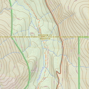
US Topo Cartographic Specifications - Government Units US Topo Cartographic Specifications - Government Units
US Topo cartographic specifications for governmental units including Bureau of Land Management, Counties, International, Military, Native American Areas, Public Land Survey System, States, Forest Service, and Wildlife boundaries.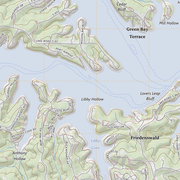
US Topo Cartographic Specifications - Hydrography US Topo Cartographic Specifications - Hydrography
US Topo cartographic specifications for Hydrography including NHDArea, NHDFlowline, NHDLine, NHDPoint, NHDWaterbody, and National Wetland Inventory (NWI).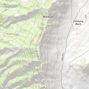
US Topo Cartographic Specifications - Land Cover US Topo Cartographic Specifications - Land Cover
US Topo cartographic specifications for Land Cover including Woodland.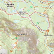
US Topo Cartographic Specifications - Structures US Topo Cartographic Specifications - Structures
US Topo cartographic specifications for Structures including Emergency Services, Medical Services, Pipelines, Public Services, and Recreation.
US Topo Cartographic Specifications - Transportation US Topo Cartographic Specifications - Transportation
US Topo cartographic specifications for Transportation including Airport, Rail, Route, and Trail.