
Elevation-Derived Hydrography Data Acquisition Specifications: Collection Area Requirements
Elevation-Derived Hydrography Data Acquisition Specifications
Collection Area Requirements
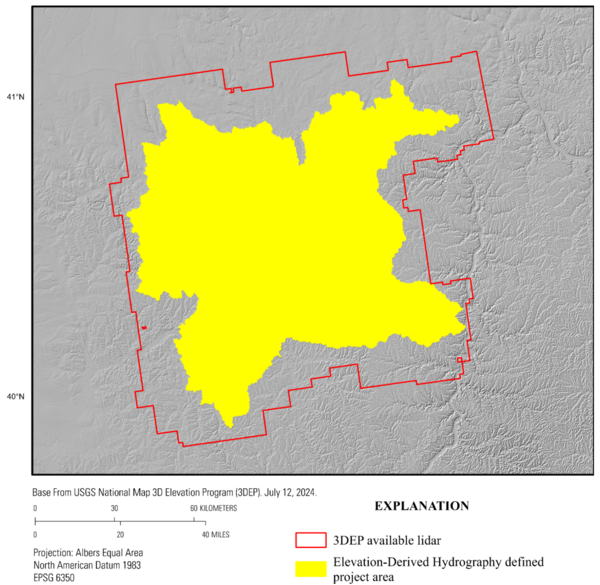
The collection area (or defined project area [DPA]) refers to the geographic extent where the elevation source exists and from which hydrography will be derived. Hydrographic features shall be derived from existing 3DEP elevation data (see “Source Raster Data Requirements”).
Hydrographic features shall be collected within watersheds, as defined by the Watershed Boundary Dataset (WBD). A 10-digit hydrologic unit is the minimum unit size recommended for collection. A 12-digit hydrologic unit may be considered if collection restrictions exist due to political boundaries or elevation data availability.
- Hydrographic features shall be collected within the hydrologic unit area. A buffered area around each hydrologic unit shall be used to review and delineate the hydrographic features.
- Features in the DPA need to snap to elevation-derived hydrography source 3DHP data in x, y, and z coordinates.
- If less accurate hydrographic features are the only data that exist outside of a hydrologic unit, features shall not be snapped or adjusted to match those adjacent features.
Final Deliverable Project Area
The Final Deliverable Project Area (FDPA) is the boundary of the DPA (Figure 2) plus any additional areas of hydrography that were not accounted for by the original DPA (Figure 3 and Table 15).
