
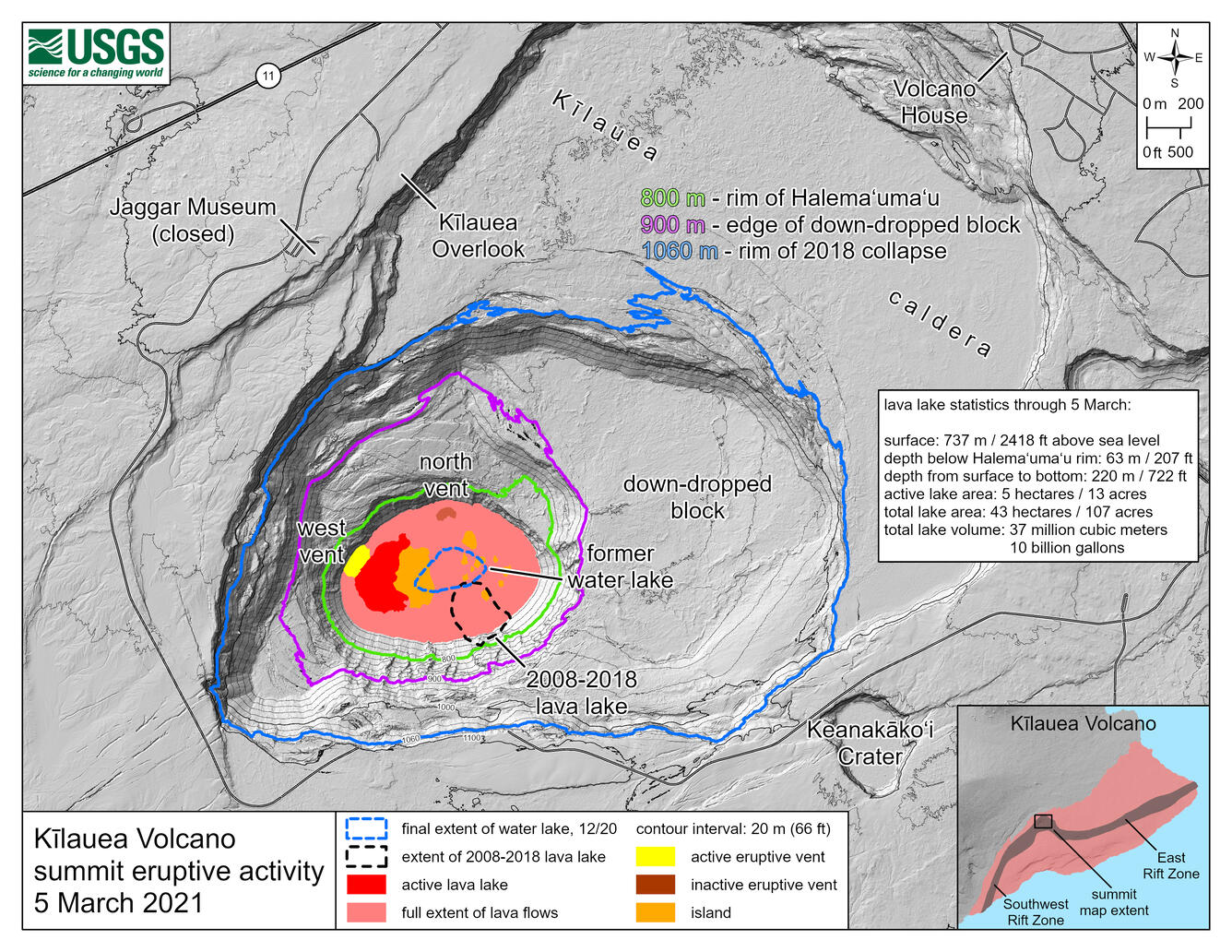
March 5, 2021—Kīlauea summit eruption contour map
March 5, 2021
Media
Sources/Usage: Public Domain. View Media Details