



Peering beneath the surface of Long Valley Caldera with geodetic surveys
Long Valley Caldera has been volcanically quiet in recent years, but that doesn’t mean scientists have stopped watching...
The California Volcano Monitor is a weekly column written by scientists and collaborators of the California Volcano Observatory. This week's contribution is from Joshua Crozier, geophysicist with the U.S. Geological Survey.
In posts earlier this year, we talked about what we've observed while monitoring earthquakes and deformation at Long Valley caldera over the last few years. While Long Valley has been pretty quiet seismically, the ground within the caldera has switched from uplift to subsidence. Even if it seems to point away from volcanic activity, such a significant change is important to document in detail. For that reason, the California Volcano Observatory recently carried out the most extensive geodetic survey of the caldera since the late 1990s.
"Geodesy" is the study of the position and gravitational force of locations on the Earth's surface. During geodetic surveys, USGS scientists used a variety of instruments to take extremely precise measurements at many different locations across the caldera. One type of measurement is ground displacement, which is recorded with temporary GPS stations. Similarly to the GPS in a cell phone, these stations used orbiting satellites to calculate their location. However, the instruments scientists use are much more precise, capable of measuring a location down to the centimeter or fraction of an inch (as opposed to phones, which are accurate on the scale of meters or feet). Data from these temporary GPS deployments complement data from permanent GPS stations and satellite radar (InSAR) measurements, and are combined into detailed maps of deformation over time.
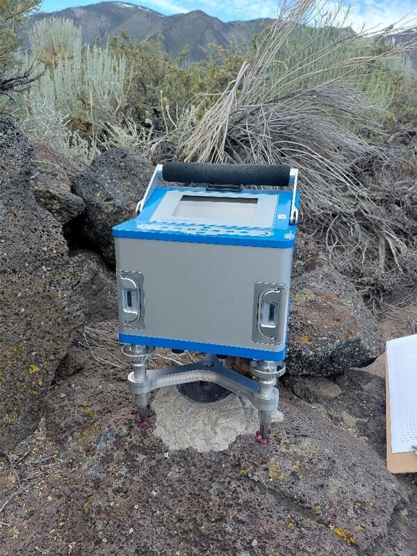
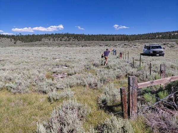
A second type of geodetic measurement is the strength of the Earth’s gravity. Gravity is often taught as a constant value in school physics, but it actually exhibits small variations across Earth’s surface. These variations depend on elevation (or the distance from the Earth's core), the density of underlying rock, and the presence of water, magma, or gas in the ground below the sensor. Precise values for gravity are measured with gravimeters at various locations across the caldera, which are then compared with past surveys to see how they have changed over time. Because gravimeters can be affected by groundwater, it's also important to measure the elevation of the local water table. This is recorded by dropping weights or conductive wires down wells that have been drilled for various purposes (like providing water for livestock). Knowing how the water table is changing is also useful for monitoring water resources in general.
Together, what will all of these measurements tell us? By using computer simulations to analyze the data, we can understand what fluid movement is causing the current deflation. This will in turn shed insights into the cause of past episodes of ground inflation, and better prepare us for assessing any future changes at Long Valley.