U.S. flag

An official website of the United States government

June 27, 2025

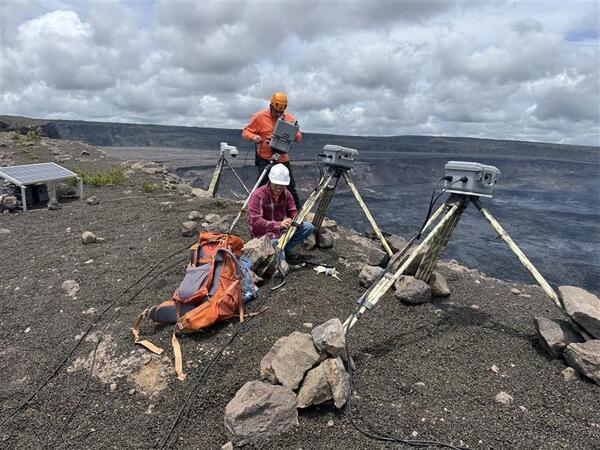
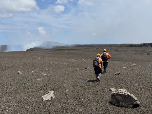
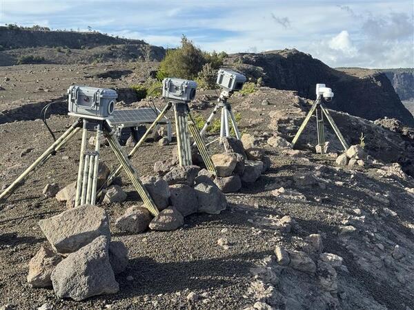
The F1cam, KWcam, and continuous laser rangefinder went offline on March 26 of this year, as tephra fallout from lava fountaining during episode 15 of the ongoing Kīlauea summit eruption damaged the monitoring infrastructure. The instruments were recently reinstalled with permission from Hawaiʻi Volcanoes National Park at a location on the rim farther away from the active vents.

Media
Color photograph of scientist near volcano monitoring equipment
The KWcam, F1cam, and laser rangefinder have been co-located with the V1cam on the western rim of Kaluapele, Kīlauea summit caldera. These instruments will provide additional monitoring for the ongoing episodic Kīlauea summit eruption.  USGS photo by M. Warren. 

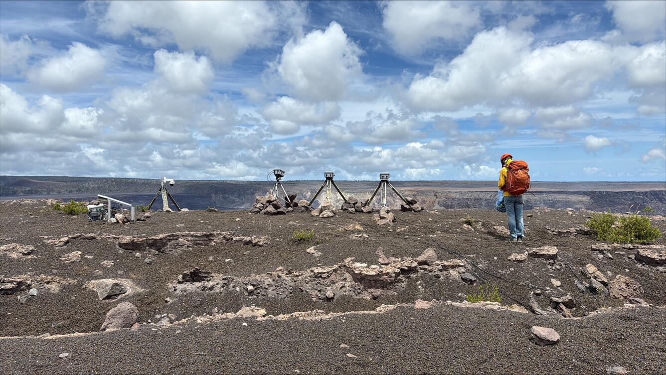
The KWcam, F1cam, and continuous laser rangefinder are now located on the western rim of Halemaʻumaʻu, near the livestream V1cam location. The view of the KW and F1 cameras is generally to the southeast. 

Links to webpages for these webcameras are provided below. Static images are also available on the Kīlauea summit webpage page: Summit Webcams | U.S. Geological Survey

Laser rangefinder data monitoring the crater floor elevation is available on the webpages below: 


Media
Color photograph of scientist installing webcameras on rim of volcano
On June 24, USGS Hawaiian Volcano Observatory staff reinstalled the KWcam, F1cam, and laser rangefinder on the rim of Kaluapele, Kīlauea summit caldera. These instruments had been removed from the field in March 2025 as they were within an area impacted by tephra fallout from the ongoing eruption in Halemaʻumaʻu at the summit of Kīlauea. Their new location, where they were installed with permission from Hawaiʻi Volcanoes National Park, is farther from the active vents.  USGS photo by M. Patrick. 
Media
Color photograph of two scientists walking on volcanic landscape
USGS Hawaiian Volcano Observatory physical science technicians leave the field after installing two webcams and a continuous laser at the summit of Kīlauea, to help monitor the ongoing lava fountains. The landscape here is now covered by a thick carpet of tephra from the recent lava fountaining episodes, changing much of the appearance of the western caldera rim. In the distance to their left, the vent produces an outgassing plume that hugs the ground and is carried downwind. USGS photo by M. Patrick.
Media
Color photograph of webcamera equipment perched on the edge of a crater
The V1cam (far right), KWcam, F1cam, and continuous laser rangefinder are perched on the northwest rim of Halemaʻumaʻu crater. This monitoring equipment are powered by a series of solar panels and battery banks (visible in the background of the photo), all of which are installed with permission from Hawaiʻi Volcanoes National Park. USGS photo by M. Patrick. 
Was this page helpful?