
Photo and Video Chronology – Hawaiian Volcano Observatory – January 6, 2023
By Hawaiian Volcano Observatory
January 7, 2023
HVO scientists collect detailed data to assess hazards and understand how the eruption is evolving at Kīlauea's summit, all of which are shared with the National Park Service and emergency managers. Access to this hazardous area is by permission from, and in coordination with, Hawai‘i Volcanoes National Park.
January 6, 2023 — Kīlauea Summit Eruption
An eruption within Halema‘uma‘u, at Kīlauea's summit, began at approximately 4:30 p.m. on January 5, 2023. Scientists observed it overnight and in the morning of January 6.
Media
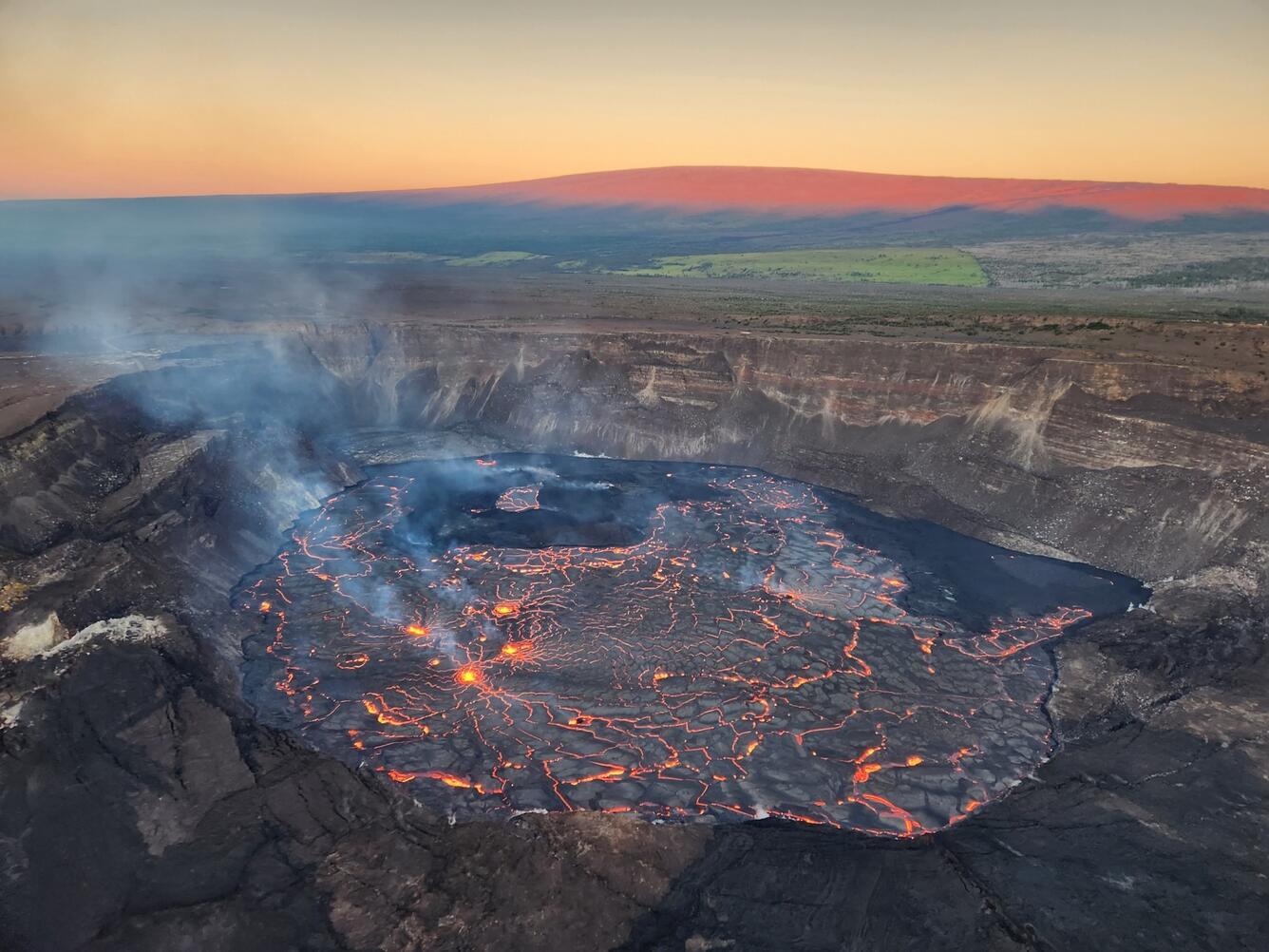
Sources/Usage: Public Domain. View Media Details
Media

During an overnight field shift on January 6, 2023, a USGS geologist takes rangefinder measurements to gather information about lava lake levels and fountain dimensions within the newly erupting Halema‘uma‘u Crater, at the summit of Kīlauea. USGS photo by J.M. Chang.
Sources/Usage: Public Domain. View Media Details
Media

Webcam sentinels stand watch over the new eruption within Halema‘uma‘u Crater, at the summit of Kīlauea, in the early morning hours of January 6, 2023. USGS photo taken from the south rim by J.M. Chang.
Sources/Usage: Public Domain. View Media Details
Media

View of eastern half of lava lake within Halema‘uma‘u, Kīlauea summit, in the early morning of January 6, 2023. In this view looking north, four active lava fountains are visible, three in the center of the photo and one in the middle right (smaller). The dark area in the left center of the photo is the main island, formed during the December 2020 eruption; lava did not cover the northern (top) part of the island and so it appears dark. USGS photo by N. Deligne.
Sources/Usage: Public Domain. View Media Details
Media

This image, taken early on January 6th, shows a lava fountain on the eastern portion of Halema‘uma‘u. Numerous areas of upwelling, like the one pictured here, are actively feeding the lava lake and re-surfacing material that was emplaced from activity in 2022. This fountain measured 16-33 feet in height (5-10 meters).
Sources/Usage: Public Domain. View Media Details
Media

Sources/Usage: Public Domain. View Media Details
Media

Sources/Usage: Public Domain. View Media Details
January 5, 2023 — Kīlauea Summit Eruption
An eruption within Halema‘uma‘u, at Kīlauea's summit, began at approximately 4:30 p.m. on January 5, 2023.
Media

Sources/Usage: Public Domain. View Media Details
Media

Sources/Usage: Public Domain. View Media Details
January 4, 2023 — Kīlauea Summit Webcam Maintenance
HVO scientists upgraded the Kīlauea Summit Webcam on January 4, 2023. This view is currently streaming live at https://www.youtube.com/usgs/live.
Media

The KWcam webcam, on the west rim of Kīlauea caldera, was upgraded on January 4, 2023, to a more advanced model, which provides a slightly wider view and higher image quality. This should provide an improved view of any future activity in Halema‘uma‘u. In this photo, an HVO scientist begins the process of the webcam swap. USGS photo by M. Patrick.
Sources/Usage: Public Domain. View Media Details