
Photo and Video Chronology – Hawaiian Volcano Observatory – January 8, 2023
By Hawaiian Volcano Observatory
January 9, 2023
HVO scientists collect detailed data to assess hazards and understand how the eruption is evolving at Kīlauea's summit, all of which are shared with the National Park Service and emergency managers. Access to this hazardous area is by permission from, and in coordination with, Hawai‘i Volcanoes National Park.
Media
Sources/Usage: Public Domain. View Media Details
Media

Telephoto view of the most active lava fountain during a helicopter overflight of the current eruption within Halema‘uma‘u, Kīlauea, taken on January 8, 2023. This fountain is within the eastern half of Halema‘uma‘u. The red cracks that emanate from the fountain, giving the appearance of a spider's web, indicate that lava is moving radially away from the fountain in all directions. USGS photo by N. Deligne.
Sources/Usage: Public Domain. View Media Details
Media

Telephoto low angle view of the most active lava fountain of the current eruption within Halema‘uma‘u, Kīlauea, taken during a helicopter overflight on January 8, 2023. This fountain is within the eastern half of Halema‘uma‘u. USGS photo by N. Deligne.
Sources/Usage: Public Domain. View Media Details
Media

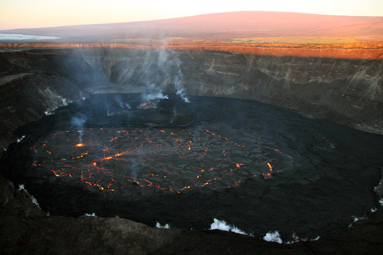
Photo of Halema‘uma‘u crater, at the summit of Kīlauea, taken from the southeast corner of the crater during an early morning helicopter overflight on Sunday, January 8, 2023. The eruption within Halema‘uma‘u that began on January 5, 2023, continues, with activity concentrated primarily in the eastern part of the crater. Here, an active fountain can be seen in the middle of the photo. USGS photo by J.M. Chang.
Sources/Usage: Public Domain. View Media Details
Media

Photo of Halema‘uma‘u crater, at the summit of Kīlauea, taken during a 7:00 am HST helicopter overflight on Sunday, January 8, 2023. Multiple overlapping photos like this, taken as the helicopter flies around the crater, are used to create Structure-for-Motion (SfM) 3-D models. The 3-D models allow geologists to determine the surface area of and depth to the lava lake, from which eruption volume and rate can be estimated. USGS photo by J.M. Chang.
Sources/Usage: Public Domain. View Media Details
Media

A helicopter overflight on January 8, 2023, allowed for aerial visual and thermal imagery to be collected of Halema‘uma‘u crater at the summit of Kīlauea. The active vents are located in the eastern portion of the crater, though lava has also filled the areas previously active in the western portion of the crater. The scale of the thermal map ranges from blue to red, with blue colors indicative of cooler temperatures and red colors indicative of warmer temperatures.
Sources/Usage: Public Domain. View Media Details