
Photo and Video Chronology — January 10, 2025 — Kīlauea summit overflight
By Hawaiian Volcano Observatory
January 10, 2025
On the morning of January 10, 2025, USGS Hawaiian Volcano Observatory staff conducted a monitoring overflight of Kīlauea summit. Although the eruption has remained paused since the evening of January 3, 2025, glow has since persisted from the inactive vents and lava was observed within them during the overflight.
Media
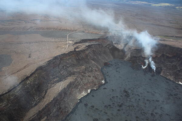
An aerial image of the western portion of Halema‘uma‘u crater within Kaluapele (Kīlauea's summit caldera). The eruption remained paused during the morning overflight on January 10, with a plume of volcanic gas rising from the vents on the western crater wall and blowing southwest with typical trade winds. The old Crater Rim Drive (left) was heavily damaged during the summit collapse events in 2018, which included portions of the road slumping into the crater. USGS photo taken by L. DeSmither.
Sources/Usage: Public Domain. View Media Details
Media
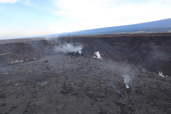
This aerial view shows the two eruptive cones from the December 2024 to January 2025 paused eruption at Kīlauea's summit. The eruption paused on Jan 3, 2025, but geologists observed active lava within the vents during the monitoring overflight. This photo is looking southwest with the southwest flank of Mauna Loa in the background. USGS photo by H. Winslow.
Sources/Usage: Public Domain. View Media Details
Media
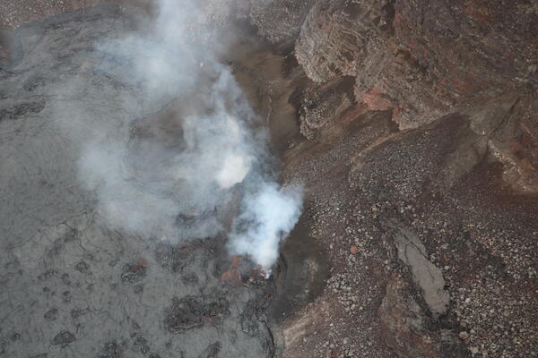
An aerial view of both eruptive vents from the December 2024 to January 2025 eruption in Kīlauea's summit. This photo is looking down with the south vent on the left and the north vent on the right. The south vent has been the most active during the eruption and produced fountains up to 90 meters (about 300 feet) during its opening phase. While the eruption is paused as of Januar 3, 2025, today (1/10/25) geologists observed a small lava flow coming out of the south vent and lava glow within the north vent. USGS photo by H. Winslow.
Sources/Usage: Public Domain. View Media Details
Media

Telephoto view of eruptive cones from the December 2024 to January 2025 eruption in Kīlauea's summit. This photo was taken looking down onto the caldera floor during a USGS Hawaiian Volcano Observatory monitoring overflight the morning of January 10, 2025. The north cone that was active during the recent eruption is in the center of the image, and lava glowing from within the vent is visible. The south vent is out of the frame, but a small lava flow is coming out of that vent and visible in the top left portion of the photo. USGS photo by H. Winslow.
Sources/Usage: Public Domain. View Media Details
Media
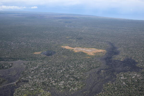
This aerial photo, looking southeast from Kīlauea summit down Chain of Craters Road within Hawai‘i Volcanoes National Park, shows a lava flow from 1974 (bottom left and right) along with Puhimau Crater (center left). The Puhimau thermal area near the center of the image, is a distinctive tan color where vegetation has been dying for decades due to the heating of the ground from stored magma below. Maunaulu is also visible near the upper left corner of the photo. USGS photo taken on January 10, 2025, by L. DeSmither.
Sources/Usage: Public Domain. View Media Details
Media
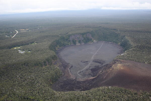
An aerial view of Kīlauea Iki and Pu‘u Pua‘i taken during an overflight of Kīlauea summit on January 10, 2025. Pu‘u Pua‘i, the large cinder cone in the lower right of the image, was formed by lava fountains that reached 580 meters (1,900 ft) during the 1959 Kīlauea IKI eruption. The popular Kīlauea Iki hiking trail is visible across the crater floor. USGS photo taken by L. DeSmither.
Sources/Usage: Public Domain. View Media Details
Media
Sources/Usage: Public Domain. View Media Details