
Photo & Video Chronology — November 13, 2025 — Kīlauea summit eruption episodes 34-36
By Hawaiian Volcano Observatory
November 13, 2025
The summit eruption of Kīlauea continues, with 36 episodes of lava fountaining since the eruption began on December 23, 2024. Within the past month and a half, fountaining episodes 34, 35, and 36 occurred at the summit of Kīlauea.
Media
Sources/Usage: Public Domain. View Media Details
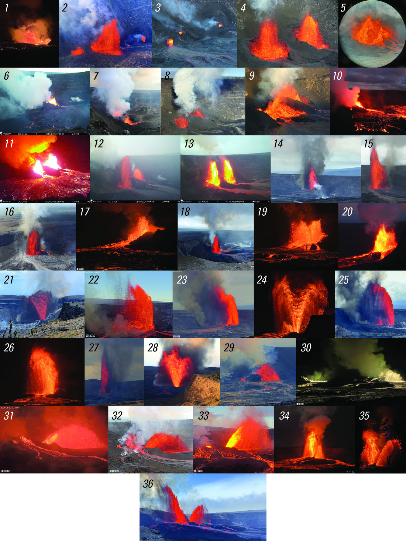
Episode 34: October 1, 2025
Media
Sources/Usage: Public Domain. View Media Details
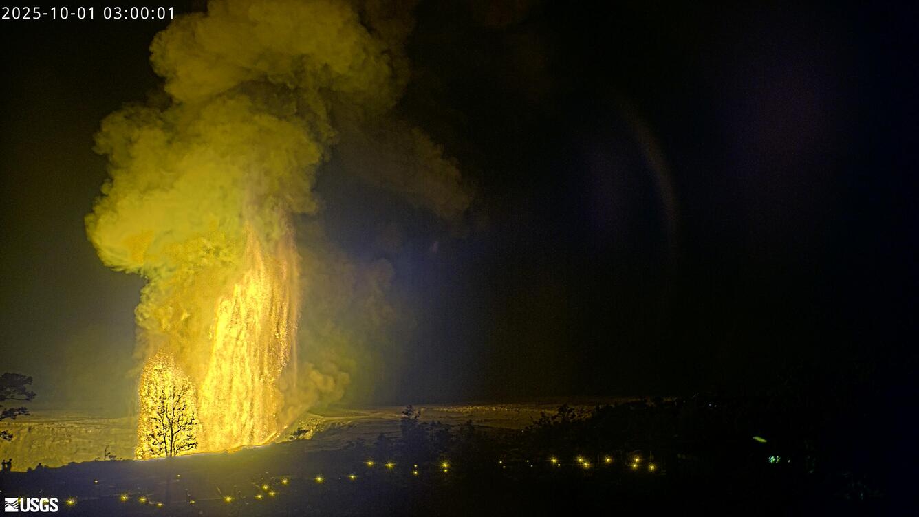
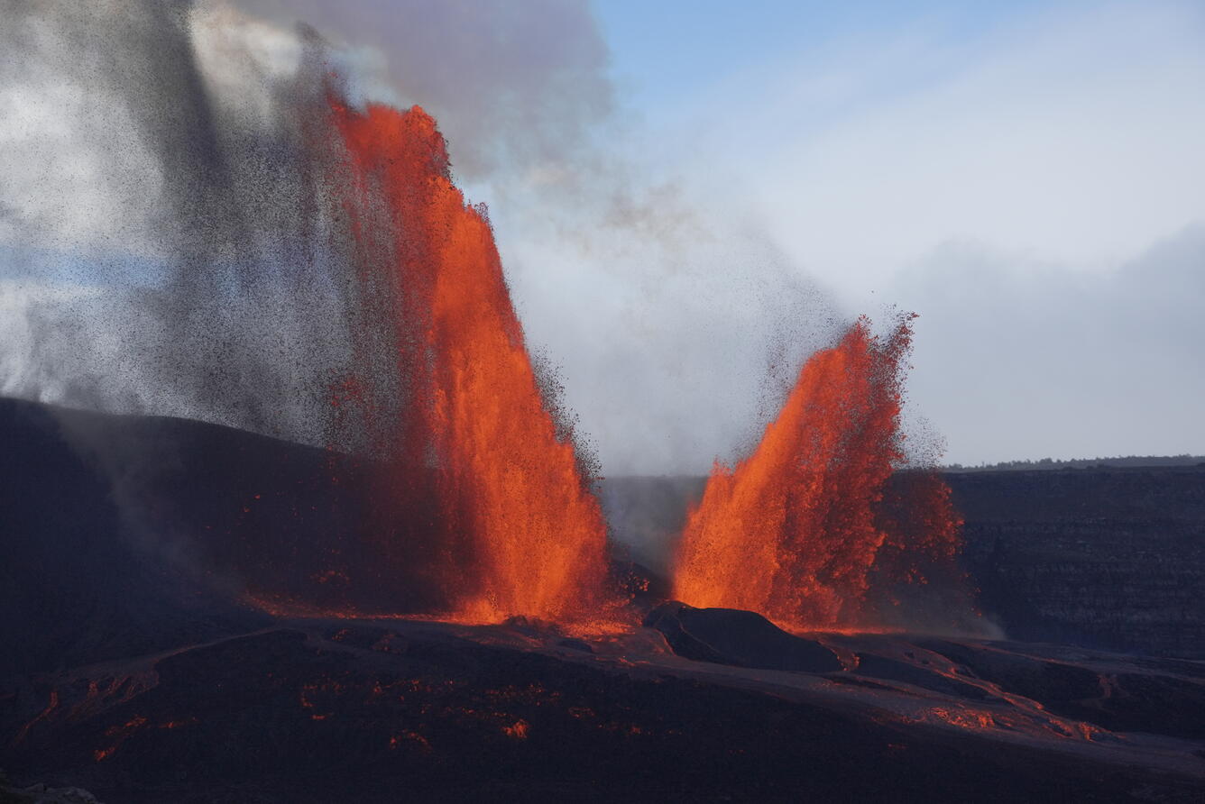
Episode 35: October 17-18, 2025
Media
Sources/Usage: Public Domain. View Media Details
Media
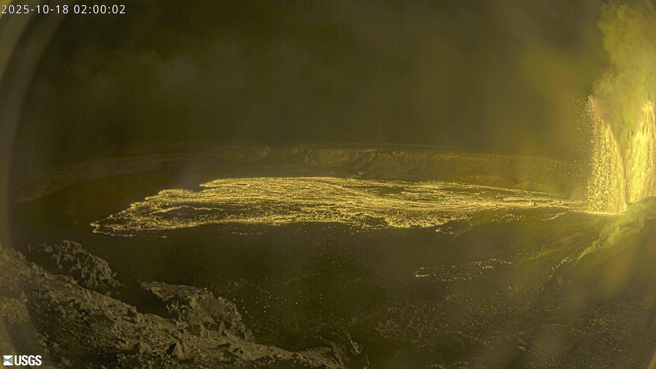
A USGS Hawaiian Volcano Observatory field engineer conducts repairs on a gas sensor downwind of the eruptive vents at Kīlauea summit, after digging out tephra that partially buried the instrument during episode 35 lava fountaining. Photo taken October 21, 2025, by M. Patrick.
Sources/Usage: Public Domain. View Media Details
Media
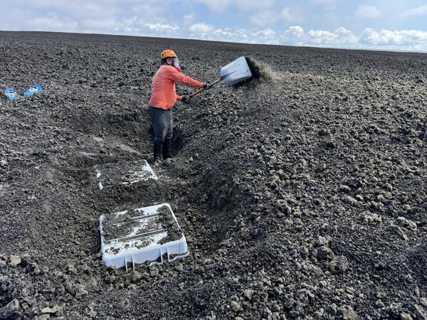
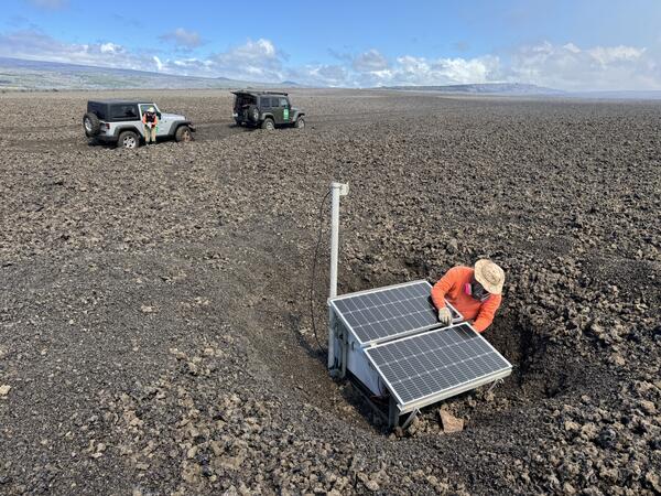
On October 21, a USGS Hawaiian Volcano Observatory field engineer dug out monitoring equipment buried by tephra fallout from the episode 35 lava fountaining. USGS photo by M. Patrick.
Sources/Usage: Public Domain. View Media Details
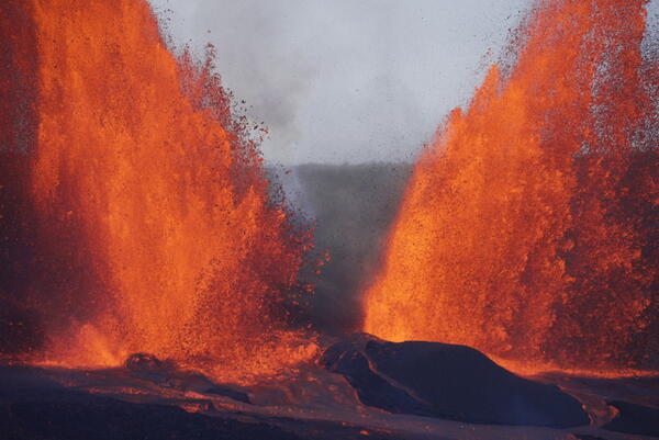
Episode 36: November 9, 2025
Media
Sources/Usage: Public Domain. View Media Details
Media
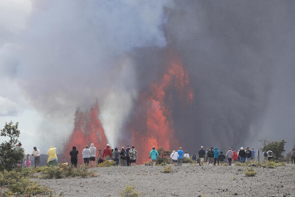
Hawai‘i Volcanoes National Park visitors watch the lava fountains from Uēkahuna overlook on Sunday, November 9. USGS photo by M. Patrick.
Sources/Usage: Public Domain. View Media Details
Media
A telephoto view of the vent region within Halema‘uma‘u crater during episode 36 of lava fountaining at the summit of Kīlauea, on Sunday, November 9. USGS photo by M. Patrick.
Sources/Usage: Public Domain. View Media Details
Media
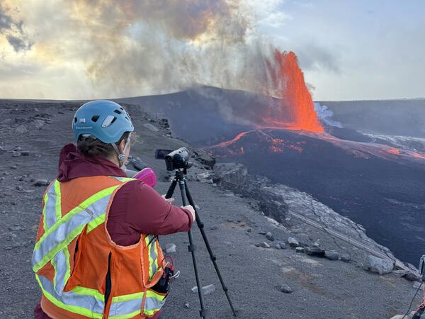
A USGS Hawaiian Volcano Observatory geologist collects video of episode 36 lava fountaining from the south rim of the caldera at Kīlauea summit, on Sunday, November 9. Video data helps document activity and is used for later research on lava fountaining dynamics. USGS photo by M. Patrick.
Sources/Usage: Public Domain. View Media Details
Media
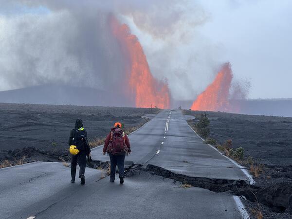
USGS Hawaiian Volcano Observatory geologists approach the south rim of Halema‘uma‘u crater to make observations of episode 36 at the summit of Kīlauea. This section of Crater Rim Drive within Hawai‘i Volcanoes National Park was damaged in the 2018 summit collapse, and remains closed to the public. USGS photo by M. Patrick on November 9.
Sources/Usage: Public Domain. View Media Details
Media
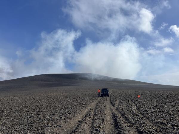
The day after episode 36 of the ongoing Kīlauea eruption, USGS geologists inspected the tephra deposit west of Halema‘uma‘u, in the closed area of Hawai‘i Volcanoes National Park. This photo looks south, with Halema‘uma‘u out of view to the left. Tephra from the lava fountains continues to accumulate and since December 2024 has built up a hill that is more than 140 ft (42 m) high, covering Crater Rim Drive. During episode 36, which lasted only five hours, the hill grew by an estimated 30 ft (9 m). USGS photo by N. Deligne.
Sources/Usage: Public Domain. View Media Details
Media
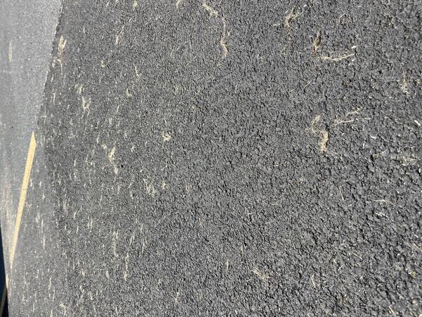
Episode 36 lava fountaining from Kīlauea's ongoing summit eruption formed tephra, including Pele's hair (strands of fine volcanic glass). Winds blowing from the north resulted in Pele's hair being deposited in Pāhala, a town about 20 miles (32 km) to the southwest of the eruptive vents in Halema‘uma‘u. Communities closer to the eruption did not receive any Pele's hair due to the wind conditions. This photo shows light-colored strands of Pele hair on a parking lot in Pāhala. USGS photo by N. Deligne.
Sources/Usage: Public Domain. View Media Details