
Photo & Video Chronology — November 17, 2025 — Surveying the hazardous closed area of Kīlauea summit
By Hawaiian Volcano Observatory
November 18, 2025
On November 17, 2025, U.S. Geological Survey Hawaiian Volcano Observatory staff conducted fieldwork in the closed area of Hawaiʻi Volcanoes National Park, noting evidence of several hazards associated with the recent lava fountaining episode.
Media
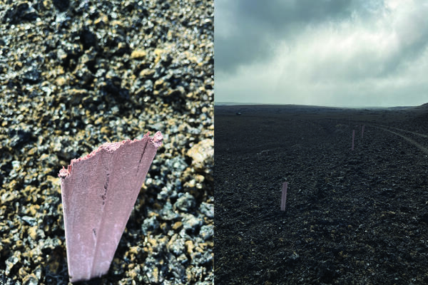
This plastic road marker shown on the left side of this photo was found on the side of Crater Rim Drive within the hazardous closed area of Hawai‘i Volcanoes National Park, downwind of the episodically erupting vents within Halema‘uma‘u crater. The post appears to have had its top sheared off by tephra ejected during episode 36 lava fountaining of the ongoing Kīlauea eruption, suggesting a powerful direct impact. The damaged road marker is the closest one in the right part of the photo, which looks southeast along Crater Rim Drive. Hawai‘i Volcanoes National Park has closed this section of Crater Rim Drive to the public since 2007 due to the frequent volcanic hazards caused by eruptive vents upwind. USGS photo by N. Deligne.
Sources/Usage: Public Domain. View Media Details
Media
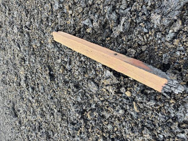
This wooden post used to mark the side of Crater Rim Drive within a hazardous closed area of Hawai‘i Volcanoes National Park. The post has been slowly buried by tephra from lava fountains that have been episodically active during the ongoing eruption of Kīlauea at Halema‘uma‘u that started on December 23, 2025. During episode 36 lava fountaining on November 9, hot or possibly molten tephra falling from the lava fountains fell on or near the wooden pole, causing it to smolder and fall over, highlighting the hazardous nature of this closed section of Crater Rim Drive. USGS photo by N. Deligne.
Sources/Usage: Public Domain. View Media Details
Media

Sources/Usage: Public Domain. View Media Details
Media
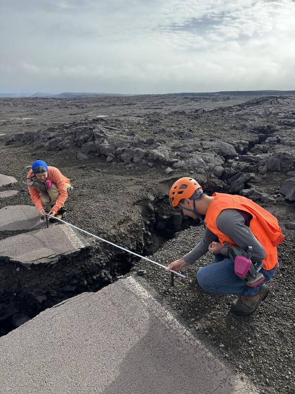
The west portion of Crater Rim Drive in Hawaiʻi Volcanoes National Park was damaged during the Kīlauea summit collapse of 2018. This area has remained closed to the public, being impacted by tephrafall and volcanic gas during recent eruptions. U.S. Geological Survey Hawaiian Volcano Observatory scientists measure one of many cracks in the road, which sometimes show movement associated with earthquakes or new fissure vent openings. These changes underscore the many hazards that can occur within the closed area of Hawaiʻi Volcanoes National Park. USGS photo by N. Kohagura.
Sources/Usage: Public Domain. View Media Details
Media
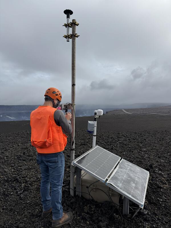
A U.S. Geological Survey Hawaiian Volcano Observatory geologists checks the status of one of the Kīlauea monitoring stations downwind of the active vents in Halemaʻumaʻu. This station has been buried incrementally by tephra as a result of lava fountaining, and solar panels were damaged by tephra impact. USGS photo by N. Kohagura.
Sources/Usage: Public Domain. View Media Details