U.S. flag

An official website of the United States government

September 30, 2025

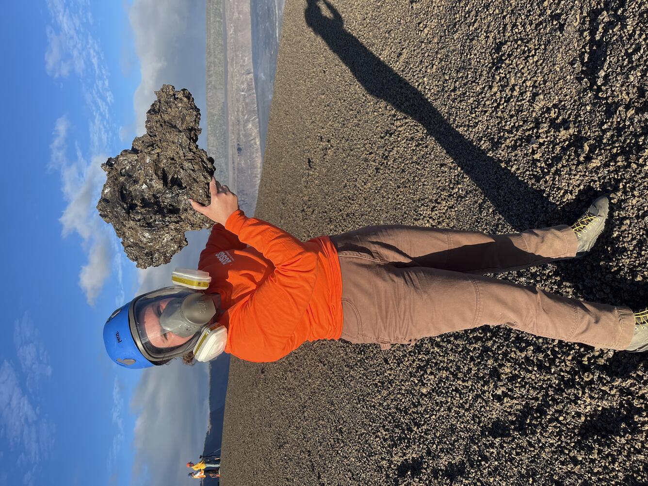
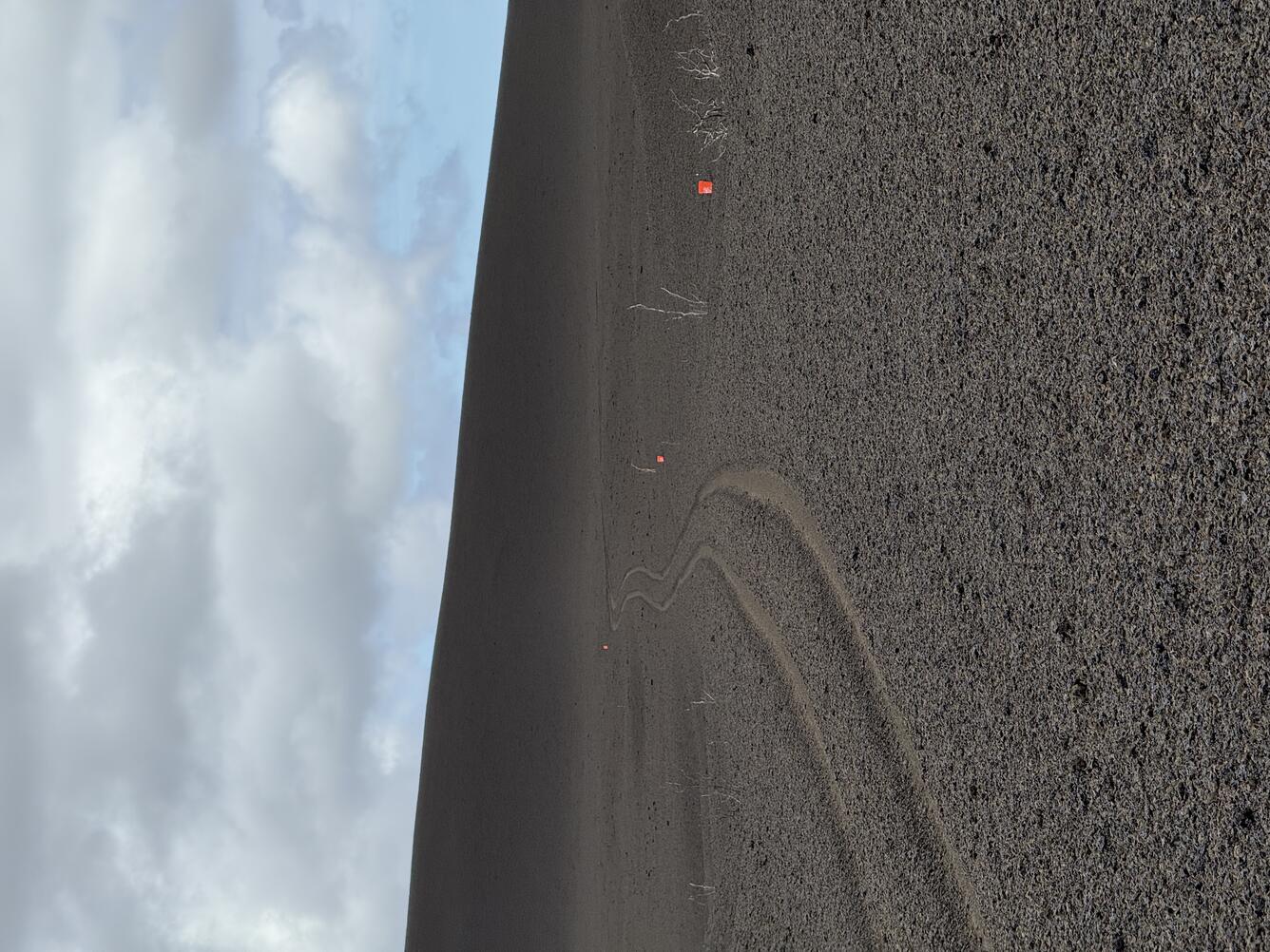
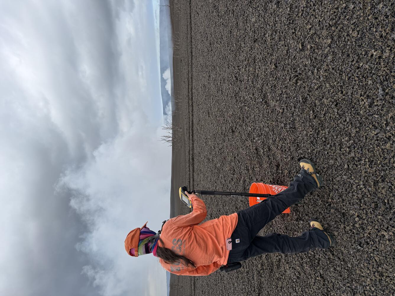
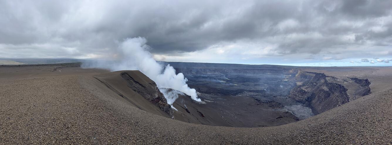
On September 25, USGS Hawaiian Volcano Observatory geologists surveyed the elevation along a transect across the new tephra cone formed by the recent lava fountaining episodes at the summit of Kīlauea. 

Media
Color photograph of scientist holding recently erupted volcanic rock
During the lava fountains of episode 33 on September 19, tephra particles traveled through the air and fell downwind west of Halema‘uma‘u. This clast was about 16 inches (40 centimeters) long, very lightweight due to being very bubble-rich, and delicate. USGS photo by N. Deligne.
Media
Color photograph of volcanic landscape with tire tracks
A USGS Hawaiian Volcano Observatory geologist surveys the elevation along a transect across the new tephra cone formed by the recent lava fountaining episodes at the summit of Kīlauea. Repeat measurements across the same set of points have been done after every episode starting with episode 23, to track the growth and changes of the tephra hill. USGS photo by M. Decker. 
Media
Color photograph of scientist taking measurement on volcanic landscape
The tire tracks in this photo trace the path of Crater Rim Drive (closed to the public) in Hawai‘i Volcanoes National Park. This part of the road is covered by tephra erupted from Kīlauea volcano since December 23, 2024. Where the photo is taken the tephra is over 5 feet thick, increasing to over 60 feet thick at the mound of tephra on the skyline. Visible along the tire tracks are three orange sample collection buckets. There are also ʻōhiʻa lehua trees that have suffered a lot of damage during high lava fountaining episodes when tephra falls on them, defoliating them, striping their bark in places, and breaking branches. USGS photo by M. Decker. 
Media
Color photograph of steaming volcanic crater
This panoramic image shows Halema‘uma‘u crater a few days after the end of episode 33 of the ongoing eruption of Kīlauea volcano. This photo, looking eastward (north is left, south is right), was taken from near the top of the mound of tephra that has accumulated west of Halema‘uma‘u since the start of the eruption in December 2024. The south vent is vigorously degassing, and the north vent is just out of view. Wind conditions at the time were blowing the combined north and south vent volcanic plume to north towards Uēkahuna; most of the time tradewinds blow the plume over where the photographer is standing. USGS photo by N. Deligne.
Was this page helpful?