
Photo & Video Chronology – September 3, 2025 – Kīlauea summit fieldwork after episode 32 lava fountaining
By Hawaiian Volcano Observatory
September 4, 2025
USGS Hawaiian Volcano Observatory geologists visited the caldera rim at Kīlauea summit to assess the aftermath of episode 32 lava fountaining.
Media

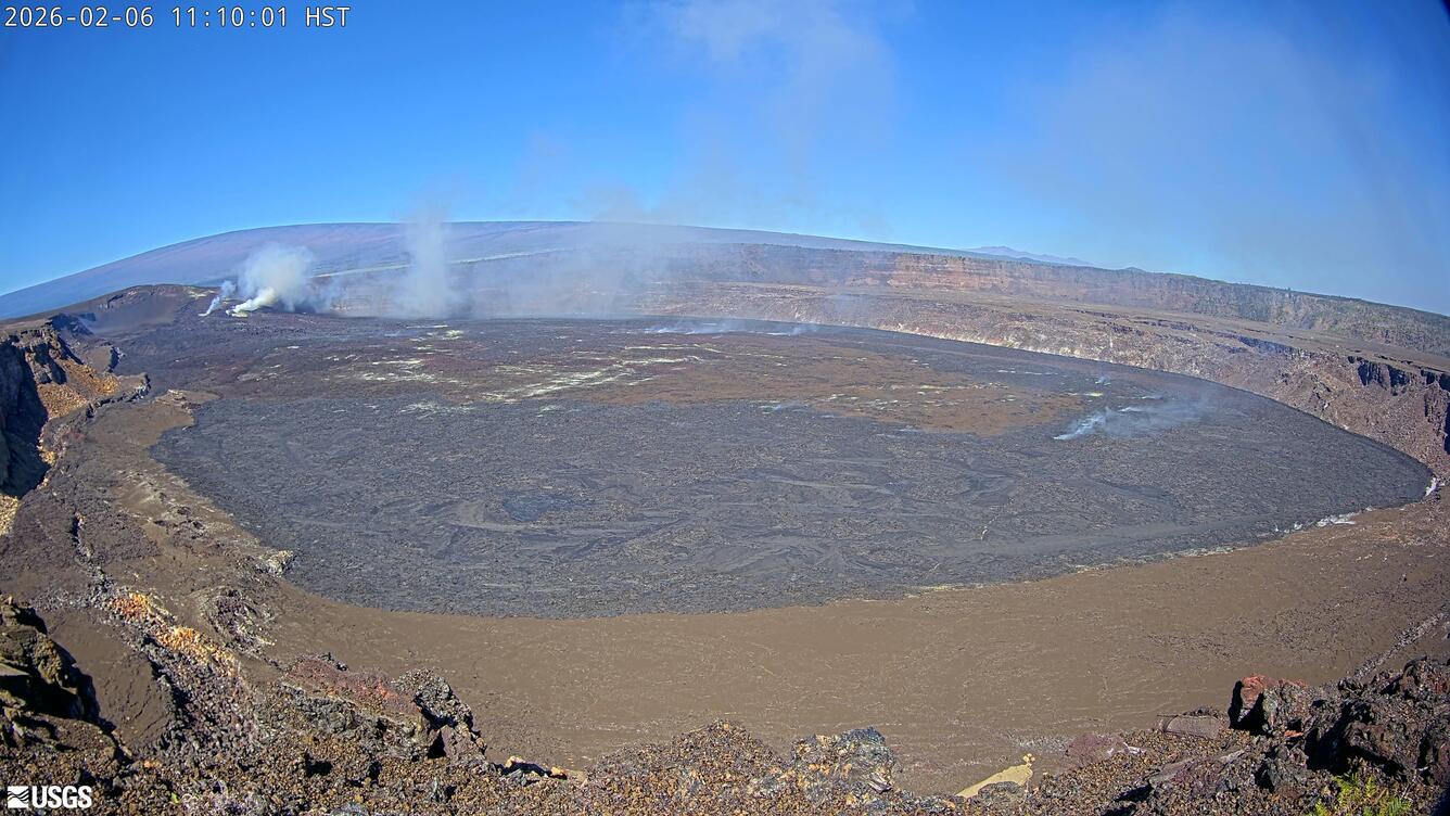
USGS Hawaiian Volcano Observatory geologists visited the caldera rim at Kīlauea summit to assess the aftermath of episode 32 lava fountaining. The vent was quiet, with no audible sounds, and a thick outgassing plume rose from the vents. The broad lava channel that was fed from episode 32 lava fountaining can be seen here extending to the left side of the image. USGS photo by M. Patrick.
Sources/Usage: Public Domain. View Media Details
Media

Tephra is the material erupted that travels through the air before falling on the ground. During the ongoing eruption of Kīlauea, tephra from each episode of lava fountaining tells us about the magma storage conditions leading to the eruption. Sometimes collecting tephra is difficult, as the collection buckets may not be ideally situated, or they may get damaged by large, hot bombs. In this case, the collection bucket worked perfectly, and provided a nearly full sample. This bucket is situated just west of the north vent, near the caldera rim. USGS photo by M. Patrick.
Sources/Usage: Public Domain. View Media Details
Media

The tire tracks in this photo trace the path of Crater Rim Drive (closed to the public) in Hawai‘i Volcanoes National Park. This part of the road is covered by more than a meter (yard) of tephra erupted since December 23, 2024. Just south of this photo, a large mound of tephra accumulated during the ongoing eruption has buried the road over 20 meters (yards) deep. USGS photo by M. Patrick.
Sources/Usage: Public Domain. View Media Details
Media

This view is from the south rim of the summit caldera on Kīlauea and shows the vent complex formed during the ongoing eruption. The vent area consists of overlapping lobes of spatter-fed flows, layers of tephra, and thin fluid lava flows. Much of the rubbly material in the central portion of the photo originates from "spatter-fed" flows, which forms as hot spatter from the lava fountains piles up around the vents, and then coalesces to form a very viscous type of secondary lava flow. USGS photo by M. Patrick.
Sources/Usage: Public Domain. View Media Details
Media

South of the active vents at Kīlauea summit, sections of Crater Rim Drive (closed to the public) in Hawai‘i Volcanoes National Park are covered in thinner deposits of tephra. The main axis of deposition of tephra was to the west of the vents, where the tephra has formed a mound over 20 meters (yards) deep over the road. USGS photo by M. Patrick.
Sources/Usage: Public Domain. View Media Details
Media

This view is taken from the flank of the new tephra mound at Kīlauea summit, over Crater Rim Drive (closed to the public) in Hawai‘i Volcanoes National Park. The tire tracks of the vehicle mark the path of Crater Rim Drive. An expansive area west of the vents is a now a continuous plain of tephra deposited during episodic lava fountains that have been occurring since December 23, 2024. USGS photo by M. Patrick.
Sources/Usage: Public Domain. View Media Details
Media

A USGS Hawaiian Volcano Observatory geologist descends from the new tephra mound at Kīlauea summit that has been deposited over part of Crater Rim Drive (closed to the public) in Hawai‘i Volcanoes National Park. The short wooden post in the bottom left is the top of a sign post for the road. A tephra collection bucket is situated here for tephra sampling. USGS photo by M. Patrick.
Sources/Usage: Public Domain. View Media Details
Filling of Kaluapele (Kīlauea's summit caldera) as a result of episodic lava fountaining since December 23, 2024

Sources/Usage: Public Domain. View Media Details