
Volcano Watch - Geology of the past, how long will the eruption last?
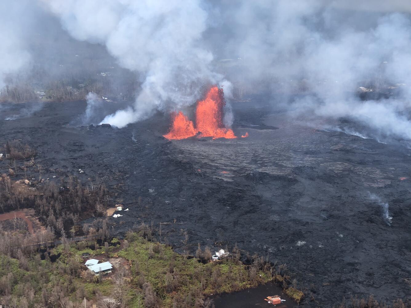
The 2018 lower East Rift Zone (LERZ) eruption of Kīlauea brought an end to the 35+ year eruption at Pu‘u ‘Ō‘ō. With the draining of the summit and the collapse of Pu‘u ‘Ō‘ō, Puna residents were concerned that the eruption in the LERZ could be long-lived.
How could we evaluate, at that time, how long the eruption would last? Geologic investigations work under the premise that the key to the future is found in the past. By investigating past eruptions, we learn the way a volcano is likely to behave in the future.
We looked at the geology of Kīlauea to see what we could learn about past eruptive behavior. Along the east rift zone are features, such as lava shields, that are indicative of long-lived eruptions. These include Maunaulu, Kānenuiohamo, Pu‘u ‘Ō‘ō, Kupaianaha and Heiheiahulu (above the Black Sands subdivision). These all occur in the upper and middle parts of the East Rift Zone. Where are the lava shields in the LERZ? There are none.
Large cones reveal past eruptions along the LERZ, but most of the eruptive vents are small and are hidden by the lush vegetation. All the cones and fissure vents erupted flows of only limited extent and are small when compared to the flow fields created by the shields.
The limited extent of the flows infers that the eruptions lasted for a relatively short period of time—but how short? Adopting a broad perspective, we analyzed how past eruptions could guide us to estimate how long the 2018 eruption could last.
Using historical information from LERZ eruptions in 1840, 1955, 1960 and 1961, we were able to calculate the average eruption rate (or flux) from the volume and duration. The flux values for 1840, 1955, 1960 and 1961, respectively, are 91, 12, 36 and 8 cubic meters per second. How does this information help us assess prehistoric eruption characteristics?
For prehistoric eruptions where we lacked information on eruption rate and duration, we compiled lava flow areas. To estimate the volume of erupted material, we compiled the mappable area, estimated how much more area may have been covered by later flows, and finally multiplied the “corrected” area by an average thickness of 7 m (23 ft; based on drill hole data).
For flow area correction, we assumed that flows 200-400 years old had 25% of the original flow buried by younger flows and that flows 400-750 years old had half (50%) of their original surface covered.
Why do we need the corrected volume of the prehistoric flows? We can use the volume of the prehistoric flows to provide constraints on eruption duration. To do this, we divided the correct prehistoric flow volume by a range of historic fluxes to arrive at the duration—the number of days—the prehistoric eruptions could have lasted.
In our analyses, we threw out the high and low flux values and used the intermediate values to calculate the eruption duration. Why discard the highest and lowest effusion rates? By the time we conducted this assessment, the 2018 eruption had already been going on for almost one month and the shortest eruption (1961) lasted only one day and the highest rate resulted in duration of about 20 days! Using the flux information from the 1955 and 1960 eruptions, we calculated an eruption duration range of 51 to 155 days. The 2018 eruption lasted 124 days.
Although we could not discount that the eruption may last for years, this geologic look at prior LERZ eruptions along with the absence of shields, the modest flow fields, and the smaller eruptive volumes of prior events all point to activity of limited duration. By using prehistoric geologic information garnered from geologic mapping, the key to the future was to look at the past; our analysis provided a valuable guide on how long the 2018 eruption would last.
Volcano Activity Update
Kīlauea is not erupting. Rates of seismicity, deformation, and gas release have not changed significantly over the past week.
There were 2 events with 3 or more felt reports in the Hawaiian Islands during the past week. On February 04, 2019 at 07:40 p.m. HST, a magnitude-2.6 earthquake occurred 11 km (7 mi) northwest of Volcano Village at a depth of 9 km (5.8 mi) below sea level. On February 07, 2019, at 09:07 a.m. HST, a magnitude-4.6 earthquake occurred offshore 85 km (53 mi) southwest of Hawaiian Ocean View at a depth of 27 km (16.7 mi) below sea level.
Deformation signals are consistent with refilling of the middle ERZ. Sulfur dioxide emission rates have been below detection limits in the lower ERZ since early September, though minor amounts of volcanic gas are still present.
Hazardous conditions still exist at both the lower ERZ and summit. Residents in the lower Puna District and Kīlauea summit areas on the Island of Hawai‘i should stay informed and heed Hawai‘i County Civil Defense closures, warnings, and messages (http://www.hawaiicounty.gov/active-alerts).
The USGS Volcano Alert level for Mauna Loa remains at NORMAL.