10k Years of Climate Data Retrieved from Minnesota Lake
USGS scientist Dr. Jessica Rodysill was interviewed in a Northern News Now story highlighting how sediment layers collected from Minnesota’s Lake LaSalle reveal what climate conditions looked like thousands of years ago.
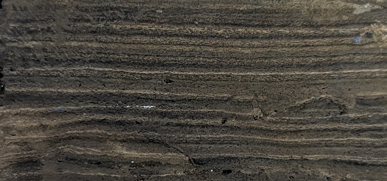
Lake LaSalle is the deepest inland natural lake in Minnesota, reaching a depth of 213 feet. A team of scientists, including USGS Research Geologist Jessica Rodysill, collected sediment cores from the lake that are allowing them to reconstruct more than 10,000 years of climate history. The sediments reveal when lake levels rose or fell in response to floods and droughts, information that can help researchers better predict future floods and droughts.
Working with the Minnesota Department of Natural Resources, the team is using the data to address a key management need: better understanding large precipitation events, like 100-year floods. By combining the data collected from Lake LaSalle with data from other Minnesota lakes, researchers are working to refine flood-frequency predictions and better estimate the likelihood of future 100-year floods in the state.
Jessica Rodysill, alongside project collaborator Dr. Byron Steinman from the University of Minnesota Duluth, were interviewed about this work by Northern News Now.