
Best Student Geologic Map Competition at GSA Connects is NOW accepting abstract submissions!
Abstracts must be submitted no later than August 6.
To receive information related to the EDMAP Program, click on the subscribe button below.
Table of recent EDMAP-funded projects, universities, and principal investigators.
As the educational component of the National Cooperative Geologic Mapping Program (NCGMP), EDMAP partners with colleges and universities to train the next generation of geologic mappers.
To receive information related to the EDMAP Program, click on the button below:
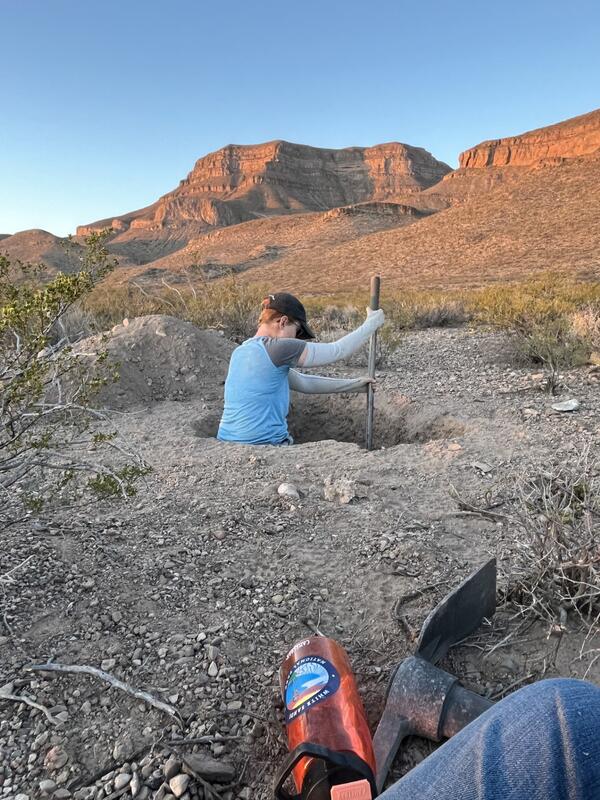
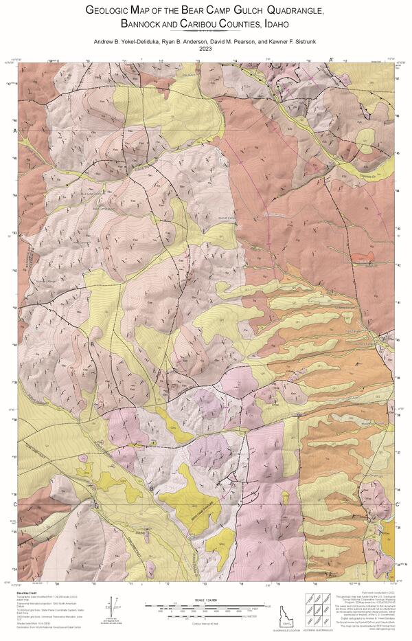
Table of recent EDMAP-funded projects, universities, and principal investigators, FY2020—FY2025
Use the sort and filter tools to browse the table below for details and contact information on recent EDMAP projects. Students can use this information to look for potential project advisors in this table, and reach out to them asking if they are applying for EDMAP and accepting new students!
Opportunity for funding
Faculty (including adjuncts) at accredited colleges and universities in the U.S. and its territories can apply for 1-2 years of EDMAP funding through an annual competitive grant proposal process:
- Up to \$45,000 per primary graduate student mapper per year (maximum \$90,000 per student)
- Up to \$25,000 per primary undergraduate student mapper per year (maximum \$50,000 per student)
Every Federal dollar requested must be matched 1:1 by the proposing institution. Detailed proposal and matching requirements are available in the EDMAP Notice of Funding Opportunity (NOFO), which is updated and reposted to grants.gov each fall.
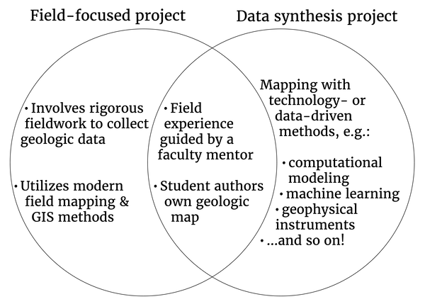
Each EDMAP proposal is categorized as either a "Field-Focused" of "Data Synthesis" project, but proposals may combine elements of both project types. Both types of EDMAP projects require a mentor-guided field experience and for each primary student mapper to produce their own first-author geologic map. This diagram shows a comparison between data-synthesis and field focused EDMAP projects.
Collaborations
Thinking of proposing an EDMAP project? Reach out to the local state geological survey where you plan to map! EDMAP encourages participants to collaborate with geoscientists at other institutions, state geological surveys, and federal bureaus (e.g., USGS, NPS, BLM), who may be mapping near the study area. EDMAP collaborations with scientists across different organizations often lead to stronger training across a wider set of geoscience skills, production of higher quality map deliverables, and future career success for students. Visit the Association of American State Geologists (AASG) website to find contact information for your local state geological survey, and check out the check out the National Geologic Map Database’s Mapping in Progress tool to find out if any USGS FEDMAP scientists are working nearby!
Best Student Geologic Map Competition at the Geological Society of America (GSA) Connects Annual Meeting
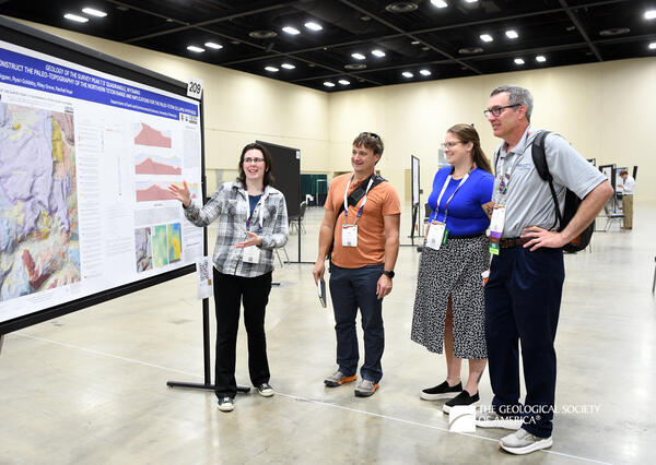
All student geologic mappers (EDMAP and non-EDMAP students alike) are encouraged to submit abstracts for presenting their maps at the Best Student Geologic Map Competition, which takes place during the Geological Society of America (GSA) Connects meeting each fall. Interested? Click here to learn more!
To participate, visit the GSA Connects webpage, follow the links and instructions to “Submit an Abstract” before the submission deadline; search the Topical Sessions for “Best Student Geologic Map Competition.”
Questions?
Students: look for potential EDMAP project advisors in this table of recent EDMAP-funded projects, universities, and principal investigators, and reach out to faculty asking if they are applying for EDMAP and accepting new students!
Faculty: email your questions directly to the EDMAP team at EDMAP@usgs.gov. The EDMAP team hosts webinars for applicants each fall, announced through the EDMAP GovDelivery email list—click the subscribe button below to sign up!
To request the schedule and links to “EDMAP office hours” meetings on Microsoft Teams during April and May 2026, contact EDMAP@usgs.gov.
Below are other science projects associated with this project.
Best Student Geologic Map Competition at the Geological Society of America (GSA) Connects Annual Meeting
As the educational component of the National Cooperative Geologic Mapping Program (NCGMP), EDMAP partners with colleges and universities to train the next generation of geologic mappers.
To receive information related to the EDMAP Program, click on the button below:
Table of recent EDMAP-funded projects, universities, and principal investigators, FY2020—FY2025
Use the sort and filter tools to browse the table below for details and contact information on recent EDMAP projects. Students can use this information to look for potential project advisors in this table, and reach out to them asking if they are applying for EDMAP and accepting new students!
Opportunity for funding
Faculty (including adjuncts) at accredited colleges and universities in the U.S. and its territories can apply for 1-2 years of EDMAP funding through an annual competitive grant proposal process:
- Up to \$45,000 per primary graduate student mapper per year (maximum \$90,000 per student)
- Up to \$25,000 per primary undergraduate student mapper per year (maximum \$50,000 per student)
Every Federal dollar requested must be matched 1:1 by the proposing institution. Detailed proposal and matching requirements are available in the EDMAP Notice of Funding Opportunity (NOFO), which is updated and reposted to grants.gov each fall.
Each EDMAP proposal is categorized as either a "Field-Focused" of "Data Synthesis" project, but proposals may combine elements of both project types. Both types of EDMAP projects require a mentor-guided field experience and for each primary student mapper to produce their own first-author geologic map. This diagram shows a comparison between data-synthesis and field focused EDMAP projects.
Collaborations
Thinking of proposing an EDMAP project? Reach out to the local state geological survey where you plan to map! EDMAP encourages participants to collaborate with geoscientists at other institutions, state geological surveys, and federal bureaus (e.g., USGS, NPS, BLM), who may be mapping near the study area. EDMAP collaborations with scientists across different organizations often lead to stronger training across a wider set of geoscience skills, production of higher quality map deliverables, and future career success for students. Visit the Association of American State Geologists (AASG) website to find contact information for your local state geological survey, and check out the check out the National Geologic Map Database’s Mapping in Progress tool to find out if any USGS FEDMAP scientists are working nearby!
Best Student Geologic Map Competition at the Geological Society of America (GSA) Connects Annual Meeting
All student geologic mappers (EDMAP and non-EDMAP students alike) are encouraged to submit abstracts for presenting their maps at the Best Student Geologic Map Competition, which takes place during the Geological Society of America (GSA) Connects meeting each fall. Interested? Click here to learn more!
To participate, visit the GSA Connects webpage, follow the links and instructions to “Submit an Abstract” before the submission deadline; search the Topical Sessions for “Best Student Geologic Map Competition.”
Questions?
Students: look for potential EDMAP project advisors in this table of recent EDMAP-funded projects, universities, and principal investigators, and reach out to faculty asking if they are applying for EDMAP and accepting new students!
Faculty: email your questions directly to the EDMAP team at EDMAP@usgs.gov. The EDMAP team hosts webinars for applicants each fall, announced through the EDMAP GovDelivery email list—click the subscribe button below to sign up!
To request the schedule and links to “EDMAP office hours” meetings on Microsoft Teams during April and May 2026, contact EDMAP@usgs.gov.
Below are other science projects associated with this project.