



USGS Energy and Wildlife Research Update (March–September 2026)
The USGS and collaborators are advancing research across a range of energy generation technologies and their effects on fish, wildlife and habitats. This research update highlights recent studies on oil and gas development, including the effectiveness of mitigation measures for migratory caribou in the Arctic and the demographic responses of mule deer to habitat quality, climate, and energy infrastructure in North America.
Researchers have produced spatial tools and science-based insights to guide resource managers in energy infrastructure planning, permitting, and habitat restoration. Additional topics addressed include data centers, hydropower operations and fish habitat connectivity and survival, and the assessment of solar energy facilities effects on wildlife, native plants and microclimate. Collectively, these findings provide actionable guidance to help accelerate project permitting, minimize conflicts between energy development and fish and wildlife conservation.
Oil and Gas Development and Big Game
Testing the efficacy of industrial mitigation measures for caribou in the Arctic
The USGS evaluated the effectiveness of common mitigation measures used in Arctic oil fields to reduce impacts on migratory caribou. Using movement data from adult female caribou and spatial analysis of infrastructure, researchers found that caribou are more likely to cross pipelines when they are elevated (at least 1.9 meters, or about 6 feet), supporting current recommendations. However, caribou were also more likely to cross roads and pipelines when these features are adjacent rather than separated, contradicting existing mitigation strategies. The research underscores the importance of scientific validation of mitigation measures and provides actionable insights for resource managers. These findings can inform infrastructure planning, permitting, and conservation efforts by highlighting which mitigation designs are most effective, helping to minimize conflicts between wildlife movement and energy development.
Citation: Johnson, H.E., and Severson, J.P., 2026, Testing the efficacy of industrial mitigation measures for caribou in the Arctic: Journal of Applied Ecology, v. 63, no. 7, e70510, 12 p., https://doi.org/10.1111/1365-2664.70510.
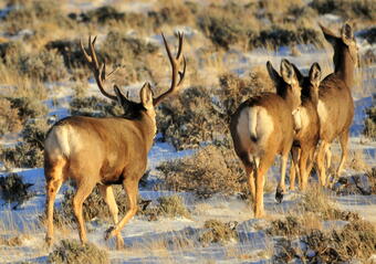
The interplay of habitat quality and temperature shape demographic patterns of mule deer in North America
This research investigates the demographic patterns of mule deer in western North America, focusing on how habitat quality and climate factors affect recruitment rates. Using extensive location data from female mule deer over 22 years in Wyoming, scientists found that hotter summers and colder winters significantly reduce fawn-to-doe ratios, while high-quality summer habitat boosts recruitment. The study also shows mule deer avoid areas with dense oil and gas development. These findings provide spatial tools to identify important habitat areas and inform development siting and mitigation strategies. By understanding the interplay between climate, habitat, and energy infrastructure, managers can make science-based decisions to support habitat restoration, plan energy projects, and minimize conflicts between wildlife conservation and energy operations.
Citation: Janousek, W.M., Johnston, A.N., Bullock, S.L. et al. The interplay of habitat quality and temperature shape demographic patterns of mule deer (Odocoileus hemionus) in North America. Commun Biol 9, 761 (2026). https://doi.org/10.1038/s42003-026-09687-8
Ungulate Migrations of the Western United States, Volume 6
Seasonal migration sustains ungulate populations by allowing animals to track seasonal forage, avoid deep snow, and reduce predation risk. Led by the USGS, the Corridor Mapping Team advances understanding of migratory ungulates across the western United States, including mule deer, white-tailed deer, elk, pronghorn, moose, and bison. The team produces peer-reviewed reports, detailed migration maps, and interactive online mapping tools that document migration routes, seasonal ranges, and land-use interactions. These products help land and wildlife managers reduce conflicts between wildlife and infrastructure, including energy development, and inform conservation planning. In March 2026, Volume 6 of the report series was released, bringing the total number of mapped migrations and seasonal ranges to 237. The team also released the Western Migration web viewer, which serves as a web-based tool for users to explore ungulate migrations across the Western U.S. and download mapping layers. The Corridor Mapping Team is led by the USGS and is a collaboration among 11 State agencies, as well as regional and Federal partners, and an expanding number of Tribal wildlife agencies. The team was initiated in response to the U.S. Department of the Interior Secretarial Order 3362, which was signed in 2018 and provided federal support to expand existing research efforts to study ungulate populations and conserve their migrations throughout the Western United States.
Citation: Kauffman, M., Lowrey, B., McKee, J.L., Beaupre, C., Beck, J., Beckmann, J., Bergen, S., Berger, J., Berkley, R., Borg, N., Carl, P., Cowardin, M., Dewey, S., Dugger, K.M., Ehrhart, A., Fort, J., Freeman, E., Freeman, I., Gelzer, E.R., German, D., Gray, J., Greenspan, E., Gregory, Z., Hagler, E., Hanson, M., Hinojoza-Rood, V.D., Hnilicka, P., Jaffe, N., Jakes, A.F., Johnson, A., Kolek, J.T., Lawson, A., Lockyer, Z., Lutz, D., McKee, C., McKeever, J., Merkle, J., Mumma, M.A., Newman, D., Peckham, E., Randall, J.E., Regan, T., Reinking, A.K., Ritson, R., Rudd, W.J., Russo, B.M., Sawyer, H., Schroeder, C., Scurlock, B., Short, J., Stansberry, B., Steiner, E., Steingisser, A., Stephenson, T., VanNatta, E., Wallace, C.F., Weinmeister, B., Whittaker, D., Woody, T., and Yancey, S., 2026, Ungulate migrations of the Western United States, volume 6 (ver. 1.1, August 2026): U.S. Geological Survey Scientific Investigations Report 2026–5123, 68 p., https://doi.org/10.3133/sir20265123.
Oil and Gas Development and Invasive Grasses
Effects of vegetation and soils surface disturbance and reclamation on invasive annual grasses: an annotated bibliography
This annotated bibliography compiles and analyzes 171 publications from 1996 to 2025, on how vegetation and soils disturbance and reclamation from oil and gas development affect invasive annual grasses, including cheatgrass, ventenata, and medusahead, across the western United States. Using a structured literature search and semi-automated content analysis, the research highlights frequent references to sagebrush ecosystems and key terms such as seeding, disturbance, soil moisture, and erosion. Summary figures and matrices provide insights into publication trends and term co-occurrences. This resource is a comprehensive overview of scientific findings relevant to soils and vegetation management, helping resource managers plan, permit, and develop strategies that address environmental effects related to oil and gas development. It supports informed choices for minimizing impacts on wildlife and ecosystems during energy operations.
Citation: Bailey, L.N., Whipple, S.E., Varner, D.M., Valler, J.B., and Stover, D.J., 2026, Effects of vegetation and soils surface disturbance and reclamation on invasive annual grasses: an annotated bibliography to inform environmental effects analyses related to oil and gas development: U.S. Geological Survey data release, https://doi.org/10.5066/P1K7CRTT.
Hydropower
Development of a two-stage lifecycle model to inform the trap-and-haul program for Coho Salmon in the Lewis River, Washington
Restoration of Coho Salmon in Washington’s Lewis River Basin relies on a trap-and-haul program to bypass dams that block migration. This study uses a two-stage lifecycle model, supported by more than a decade of data, to estimate salmon production and survival at key life stages, focusing on adult escapement and juvenile fish collection efficiency (FCE) at Swift Dam. Results show that FCE is the primary factor influencing productivity, with smolt-to-adult return rates averaging 4.5%. The model helps identify data gaps and opportunities for improvement, offering a framework for evaluating trap-and-haul performance. This research is important for aquatic resource managers because it provides science-based tools to inform planning and adaptive management, helping minimize hydropower impacts on salmon migration and supporting better decision-making for permitting and mitigation.
Citation: Plumb, J.M., and Perry, R.W., 2026, Development of a two-stage lifecycle model to inform the trap-and-haul program for Oncorhynchus kisutch (coho salmon) in the Lewis River, Washington: U.S. Geological Survey Open-File Report 2026–1004, 24 p., https://doi.org/10.3133/ofr20261004.
Response of juvenile Chinook Salmon to an experimental reservoir operation to facilitate downstream migration
High-head dams and reservoirs disrupt salmon migration, increasing risks of predation, disease, and mortality. This study evaluated a novel deep drawdown operation at the Lookout Point Project in Oregon, lowering reservoir levels from July to December 2024 to expedite downstream passage for juvenile Chinook Salmon. Larger fish had higher survival rates, especially during late drawdown, while early drawdown periods negatively impacted survival due to thermal changes. Acoustic telemetry and environmental monitoring informed a migration survival model. The research demonstrates that drawdown operations can improve fish passage but also alter rearing conditions. Further research could resolve remaining uncertainties regarding the overall effectiveness of drawdown operations with respect to the population dynamics of different juvenile life history strategies. Understanding these factors would help optimize future management actions aimed at Pacific salmon recovery above the Lookout Point Project study area.
Citation: Hance, D.J., Dirling, M.E., Couch, C.E., Hansen, A., Perry, R.W., and Kock, T., 2026, Response of juvenile Chinook Salmon to an experimental reservoir operation to facilitate downstream migration: North American Journal of Fisheries Management, v. 46, no. 4, p. 783-803, https://doi.org/10.1093/najfmt/vqag026.
Evaluating reservoir passage and survival of juvenile Chinook Salmon to support reintroduction upstream of Shasta Dam, California
This study tracked 656 acoustic-tagged juvenile Chinook Salmon released upstream of Shasta Reservoir to assess their downstream movement and survival. Most fish did not reach Shasta Dam. Survival rates were 26.8% to the downstream end of the McCloud River Arm and 11.9% to the dam. Arrival at the dam averaged 66.4 days, with departures mainly in daylight. The findings suggest that collection efforts should focus on the lower McCloud River and upper McCloud River Arm, not at the dam itself. These results provide resource managers with science-based guidance for improving collection of juvenile Chinook Salmon. The research supports informed decisions and adaptive management to enhance fish survival in dammed rivers.
Citation: Stockwell, C.L., Morse, J.M., Dirling, M.E., Couch, C.E., Michel, C.J., Notch, J.J., and Kock, T., 2026, Evaluating reservoir passage and survival of juvenile Chinook Salmon to support reintroduction upstream of Shasta Dam, California: Transactions of the American Fisheries Society, v. 155, no. 5, p. 471-483, https://doi.org/10.1093/tafafs/vnag016.
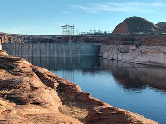
Future of the Colorado River: Reservoir operation to balance water supply and river ecosystems in the Grand Canyon
State and federal agencies are negotiating long-term water-supply agreements for the Colorado River Basin; however, current understanding is limited as to how reservoir operations affect river ecosystems and native fish communities. This research will develop a tool to assess ecosystem outcomes under various water use and reservoir management scenarios, with goals including restoring natural flow regimes and maintaining native fish populations in the Grand Canyon. The outcomes will provide actionable strategies to help managers weigh trade-offs between water supply and ecological protection and enable integration of ecosystem considerations into future water management policies to help minimize impacts on fish migration and river health during hydropower production and dam operation.
Final Report: Future of the Colorado River Phase 2: Integrated Operation of the Powell/Grand Canyon/Mead Segment for Water Supply, Hydropower, and River Ecosystems. https://cascprojects.org/#/project/4f8c6580e4b0546c0c397b4e/66f1e32dd34e0606a9dc869e
Data Centers
Colocating artificial intelligence data centers with energy infrastructure on federal public lands—A science synthesis and spatial analysis to inform decision making
Artificial intelligence (AI) is rapidly expanding, increasing demand for data centers and reliable energy. In response, federal agencies are directed to accelerate approval and development of energy and AI facilities, especially through colocation on public lands managed by the Bureau of Land Management (BLM). This report synthesizes scientific knowledge and spatial mapping of existing and potential data centers and energy infrastructure, reviewing energy and cooling needs under various environmental conditions. It outlines key planning factors: energy access, water resources, and permitting processes. The research is important for resource managers as it provides foundational information to inform decisions about siting and developing data centers and energy projects, aiming to minimize conflicts between wildlife conservation and energy operations.
Citation: Whipple, S.E., Kurth, K.A., Nikiel, C.A., Maguire, A.J., Alder, J.R., Reyes, J.J.T., Scott, J.A., and Carter, S.K., 2026, Colocating artificial intelligence data centers with energy infrastructure on Federal public lands—A science synthesis and spatial analysis to inform decision making: U.S. Geological Survey Scientific Investigations Report 2026–5035, 53 p., https://doi.org/10.3133/sir20265035.
Solar Energy
Desert kit foxes use solar energy facilities in southern California
This study examined the responses of desert kit foxes to three large-scale solar energy facilities in southern California. Foxes frequently used habitats within solar facilities, with substantial portions of their home ranges and daily activities occurring inside these areas, even during and after construction. The results suggest solar energy development can be compatible with kit fox conservation, and that actively managing solar facilities to enhance wildlife accessibility may provide additional benefits. This research is important for land managers making decisions about planning, permitting, and mitigation strategies to minimize impacts on wildlife while enabling renewable energy generation.
Citation: Poessel S.A., Hardouin, M., Grodsky, S.M., and Katzner, T.E., 2026, Desert kit foxes use solar energy facilities in southern California: Journal of Arid Environments, vol. 236, https://doi.org/10.1016/j.jaridenv.2026.105634.
Data: Telemetry data of desert kit foxes near solar facilities in southern California, 2022-2025
The effect of solar energy development on plant diversity across spatial scales
This study evaluated the effects of utility-scale solar facility construction on plant diversity in the Mojave Desert. One year after using modified, low-impact construction methods, local species richness and evenness were mostly unchanged, except for increased diversity in deep-soil creosote bush-white bursage communities. Beta diversity (species turnover among sites) was stable, while gamma diversity (total species richness across all sites comined) varied by soil type. The research indicates that low-impact construction can result in neutral or positive outcomes for plant diversity, providing valuable guidance for managers seeking to balance renewable energy development with conservation goals. These findings are important for planning, permitting, and mitigation strategies to minimize impacts on native plants.
Citation: Ohlert, T.J., Karban C. K., Munson, S.M., and Smith M.D., 2026, The effect of solar energy development on plant diversity across spatial scales: Environmental Research Communications, https://iopscience.iop.org/article/10.1088/2515-7620/ae9138/pdf
Ecovoltaic solar energy development creates novel microclimate, temperature, and soil moisture patterns under solar panels in a warm desert
This study examines the Gemini Solar Project in the Mojave Desert, where alternative installation methods were used to minimize ecosystem disturbance. Researchers compared microclimate and soil conditions across five locations, finding that solar panels altered solar radiation, soil temperature, and moisture patterns. Under-panel areas had lower solar radiation and evaporative demand, while west driplines showed higher soil moisture due to panel tracking and precipitation. The project’s design promoted microclimate heterogeneity, with environmental effects differing from more disruptive, fixed-panel facilities. This research provides critical information to balance renewable energy expansion and ecological function in warm deserts.
Citation: Pinos, J., Munson, S.M., Karban, C.C. et al. Ecovoltaic solar energy development creates novel microclimate, temperature, and soil moisture patterns under solar panels in a warm desert. Ecol Process 15, 33 (2026). https://doi.org/10.1186/s13717-026-00691-8
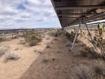
Decreased wind erosion at a solar energy facility with low-impact compared to conventional construction
This study compared wind erosion and dust emissions at two utility-scale solar facilities in the Mojave Desert, using different construction methods: conventional “blade and grade” versus lower-impact “overland travel” which results in less soil disturbance and retains existing vegetation between solar panel rows. Results showed that conventional methods caused much higher sediment flux than undisturbed areas, while low-impact methods reduced dust but were still above control levels. Elevated erosion was linked to low forb cover, unstable soil aggregates, and high compaction. The presence of non-native forbs posed a trade-off between removing invasives and maintaining soil protection. This research demonstrates that low-impact construction can minimize soil disturbance and fugitive dust (wind-blown sediment released from disturbed soils), offering practical guidance for making decisions on solar energy facility design and construction methods.
Citation: Karban, C.C., and Munson, S.M., 2026, Decreased wind erosion at a solar energy facility with low-impact compared to conventional construction: Land Degradation & Development, p. 1-9, https://doi.org/10.1002/ldr.70627
Data: Karban, C.C., Costanzo, S.A., and Munson, S.M., 2025, Dust flux and ecological flux predictor data following utility-scale solar energy development in the Mojave Desert, 2023-2025: U.S. Geological Survey data release, https://doi.org/10.5066/P1KDW774
Sustainability trade-offs at the nexus of solar energy, agriculture, and biodiversity
This study examines land-use conflicts from utility-scale solar development, focusing on trade-offs between energy generation, agriculture, and biodiversity in New York State. Using spatial optimization, it assessed three scenarios: minimizing costs, preserving farmland, and conserving biodiversity. Findings show that cost-focused siting targets pasture and hay fields, overlapping with wildlife habitats, while prioritizing agriculture risks deforestation. Biodiversity-conscious siting avoids sensitive areas and is economically feasible. This research provides a framework for landowners and other stakeholders to develop integrative, spatially informed strategies that balance climate goals with ecological and agricultural values.
Citation: Gallaher, A., Koch, T., Kalies, E.L., Woodbury, P.B., and Grodsky, S.M., 2026, Sustainability trade-offs at the nexus of solar energy, agriculture, and biodiversity: Geography and Sustainability, v. 7, no. 3, 100483, 13 p., https://doi.org/10.1016/j.geosus.2026.100483.
Avian point count data across a conservation-agriculture-energy nexus, New York State, 2023-2025
Researchers published a dataset containing comprehensive information on bird species, including their counts, spatial and temporal locations, and breeding behaviors, collected by five observers between May and July of 2023, 2024, and 2025. Observers also recorded the date and time of each observation, weather conditions, and additional variables affecting bird detection. Surveys were conducted across grassland and solar-developed habitats at sites in four regions of New York State, categorized into solar-developed sites, solar-adjacent open agricultural sites, isolated open agricultural sites, and public protected lands managed as grassland habitat. Each site is further described by land management regimes for each year of the surveys, and by covariates such as the focal land use patch area, age of solar facilities (where applicable), and land cover areas for eight National Landcover Database classes.
Citation: Boycott, T.J., Simamora, T.I., and Grodsky, S.M., 2026, Avian point count data across a conservation-agriculture-energy nexus, New York State, 2023 - 2025: U.S. Geological Survey data release, https://doi.org/10.5066/P14SCHBZ.
Marine Critical Mineral Resources
Abyssal plain mapping offshore the Territory of American Samoa
The USGS released an expedition report detailing the collection of samples and presenting preliminary findings from a recent box core sampling mission conducted in the Samoa Basin. The Samoa Basin is an abyssal plain offshore of the Territory of American Samoa within the U.S. Exclusive Economic Zone. Three data releases support this summary and provide information on the abundance and geochemical composition of ferromanganese minerals, including nodules, found on the seafloor of this region; the concentration of oxygen within the interstitial waters of sediments from this region; and the geochemistry of surficial sediments. Additional information provided in this report includes a summary of biological findings and brief mention of subsampling for planned additional analyses.
Citation: Gartman, A., Adamczyk, K.B., Addison, J.A., Bourque, J.R., Caissie, B.E., Caron, C.S., Demopoulos, A.W., Favela, J., Ianiri, H.L., Powers, D.C., Prouty, N.G., Rudebusch, J.A., and Shapiro, I.M., 2026, Cruise summary—Samoa Basin abyssal mapping: U.S. Geological Survey Data Report 1226, 24 p., https://doi.org/10.3133/dr1226.
Habitat Restoration Following Energy Development and Mineral Extraction
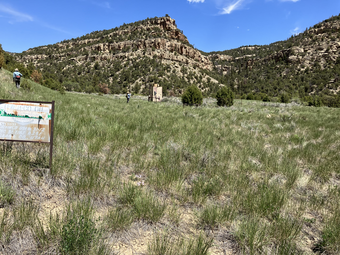
Alternative approaches to dryland reclamation enhance vegetation cover and soil stability at a former uranium mine
This study evaluated alternative dryland reclamation techniques at a former uranium mine in northern Arizona, comparing traditional soil stabilization to methods including native-only seed mixes, connectivity modifiers (ConMods), and biocrust inoculation. Results showed that ConMods and native seed mixes improved native plant cover and soil stability, while biocrust inoculation fostered late-successional biocrust development, especially when combined with ConMods. These approaches were more effective than conventional practices at restoring vegetation and stabilizing soils over five years. This research is important for land managers as it provides evidence-based strategies for enhancing ecosystem recovery following mineral extraction. Such findings support better decision-making for mine reclamation in the desert southwest.
Citation: Eckhoff, K.D., Mann, R.K., Munson, S.M., Walton-Day, K., Hinck, J.E. and Duniway, M.C. (2026), Alternative approaches to dryland reclamation enhance vegetation cover and soil stability at a former uranium mine: Restoration Ecology, e70420. https://doi.org/10.1111/rec.70420
Associated data: Eckhoff, K.D., Duniway, M.C., and Mann, R.K., 2026, Vegetation composition, soil characteristics, horizontal mass flux, and weather data (2018-2024) from a dryland reclamation experiment at a former uranium mine in northern Arizona, USA: U.S. Geological Survey data release, https://doi.org/10.5066/P13BDPJE
Land Treatment Exploration Tool 3.1
The Land Treatment Exploration Tool is a decision-support tool resource managers can use before and during the planning phase of energy projects on public rangelands to improve restoration and rehabilitation success. It is useful when selecting sites, designing treatments, completing environmental analyses, and developing reclamation strategies based on historical data. A new version of the Land Treatment Exploration Tool (v3.1) includes enhancements such as customizable line charts and boxplot charts of the AIM Terrestrial Monitoring data. It also incorporates iNaturalist species occurrence data and updated data sources. The tool assembles information about a site, including past treatments from the Land Treatment Digital Library. Using statistical similarity indices, users can find past treatments that most closely match the planned treatment area based on climate and topography indices. Examining and comparing previous treatments with the planned approach not only helps determine the most effective course of action, but also provides a clear rationale for the chosen methods.
News release: Land Treatment Exploration Tool 3.1 Launch | U.S. Geological Survey
These projects support Executive Orders 14154 “Unleashing American Energy” and 14285 “Unleashing America’s Offshore Critical Minerals and Resources” by providing new information that can be used to accelerate permitting of energy and critical mineral projects vital to the Nation’s security, economic resilience, and energy independence.
The USGS and collaborators are advancing research across a range of energy generation technologies and their effects on fish, wildlife and habitats. This research update highlights recent studies on oil and gas development, including the effectiveness of mitigation measures for migratory caribou in the Arctic and the demographic responses of mule deer to habitat quality, climate, and energy infrastructure in North America.
Researchers have produced spatial tools and science-based insights to guide resource managers in energy infrastructure planning, permitting, and habitat restoration. Additional topics addressed include data centers, hydropower operations and fish habitat connectivity and survival, and the assessment of solar energy facilities effects on wildlife, native plants and microclimate. Collectively, these findings provide actionable guidance to help accelerate project permitting, minimize conflicts between energy development and fish and wildlife conservation.
Oil and Gas Development and Big Game
Testing the efficacy of industrial mitigation measures for caribou in the Arctic
The USGS evaluated the effectiveness of common mitigation measures used in Arctic oil fields to reduce impacts on migratory caribou. Using movement data from adult female caribou and spatial analysis of infrastructure, researchers found that caribou are more likely to cross pipelines when they are elevated (at least 1.9 meters, or about 6 feet), supporting current recommendations. However, caribou were also more likely to cross roads and pipelines when these features are adjacent rather than separated, contradicting existing mitigation strategies. The research underscores the importance of scientific validation of mitigation measures and provides actionable insights for resource managers. These findings can inform infrastructure planning, permitting, and conservation efforts by highlighting which mitigation designs are most effective, helping to minimize conflicts between wildlife movement and energy development.
Citation: Johnson, H.E., and Severson, J.P., 2026, Testing the efficacy of industrial mitigation measures for caribou in the Arctic: Journal of Applied Ecology, v. 63, no. 7, e70510, 12 p., https://doi.org/10.1111/1365-2664.70510.
The interplay of habitat quality and temperature shape demographic patterns of mule deer in North America
This research investigates the demographic patterns of mule deer in western North America, focusing on how habitat quality and climate factors affect recruitment rates. Using extensive location data from female mule deer over 22 years in Wyoming, scientists found that hotter summers and colder winters significantly reduce fawn-to-doe ratios, while high-quality summer habitat boosts recruitment. The study also shows mule deer avoid areas with dense oil and gas development. These findings provide spatial tools to identify important habitat areas and inform development siting and mitigation strategies. By understanding the interplay between climate, habitat, and energy infrastructure, managers can make science-based decisions to support habitat restoration, plan energy projects, and minimize conflicts between wildlife conservation and energy operations.
Citation: Janousek, W.M., Johnston, A.N., Bullock, S.L. et al. The interplay of habitat quality and temperature shape demographic patterns of mule deer (Odocoileus hemionus) in North America. Commun Biol 9, 761 (2026). https://doi.org/10.1038/s42003-026-09687-8
Ungulate Migrations of the Western United States, Volume 6
Seasonal migration sustains ungulate populations by allowing animals to track seasonal forage, avoid deep snow, and reduce predation risk. Led by the USGS, the Corridor Mapping Team advances understanding of migratory ungulates across the western United States, including mule deer, white-tailed deer, elk, pronghorn, moose, and bison. The team produces peer-reviewed reports, detailed migration maps, and interactive online mapping tools that document migration routes, seasonal ranges, and land-use interactions. These products help land and wildlife managers reduce conflicts between wildlife and infrastructure, including energy development, and inform conservation planning. In March 2026, Volume 6 of the report series was released, bringing the total number of mapped migrations and seasonal ranges to 237. The team also released the Western Migration web viewer, which serves as a web-based tool for users to explore ungulate migrations across the Western U.S. and download mapping layers. The Corridor Mapping Team is led by the USGS and is a collaboration among 11 State agencies, as well as regional and Federal partners, and an expanding number of Tribal wildlife agencies. The team was initiated in response to the U.S. Department of the Interior Secretarial Order 3362, which was signed in 2018 and provided federal support to expand existing research efforts to study ungulate populations and conserve their migrations throughout the Western United States.
Citation: Kauffman, M., Lowrey, B., McKee, J.L., Beaupre, C., Beck, J., Beckmann, J., Bergen, S., Berger, J., Berkley, R., Borg, N., Carl, P., Cowardin, M., Dewey, S., Dugger, K.M., Ehrhart, A., Fort, J., Freeman, E., Freeman, I., Gelzer, E.R., German, D., Gray, J., Greenspan, E., Gregory, Z., Hagler, E., Hanson, M., Hinojoza-Rood, V.D., Hnilicka, P., Jaffe, N., Jakes, A.F., Johnson, A., Kolek, J.T., Lawson, A., Lockyer, Z., Lutz, D., McKee, C., McKeever, J., Merkle, J., Mumma, M.A., Newman, D., Peckham, E., Randall, J.E., Regan, T., Reinking, A.K., Ritson, R., Rudd, W.J., Russo, B.M., Sawyer, H., Schroeder, C., Scurlock, B., Short, J., Stansberry, B., Steiner, E., Steingisser, A., Stephenson, T., VanNatta, E., Wallace, C.F., Weinmeister, B., Whittaker, D., Woody, T., and Yancey, S., 2026, Ungulate migrations of the Western United States, volume 6 (ver. 1.1, August 2026): U.S. Geological Survey Scientific Investigations Report 2026–5123, 68 p., https://doi.org/10.3133/sir20265123.
Oil and Gas Development and Invasive Grasses
Effects of vegetation and soils surface disturbance and reclamation on invasive annual grasses: an annotated bibliography
This annotated bibliography compiles and analyzes 171 publications from 1996 to 2025, on how vegetation and soils disturbance and reclamation from oil and gas development affect invasive annual grasses, including cheatgrass, ventenata, and medusahead, across the western United States. Using a structured literature search and semi-automated content analysis, the research highlights frequent references to sagebrush ecosystems and key terms such as seeding, disturbance, soil moisture, and erosion. Summary figures and matrices provide insights into publication trends and term co-occurrences. This resource is a comprehensive overview of scientific findings relevant to soils and vegetation management, helping resource managers plan, permit, and develop strategies that address environmental effects related to oil and gas development. It supports informed choices for minimizing impacts on wildlife and ecosystems during energy operations.
Citation: Bailey, L.N., Whipple, S.E., Varner, D.M., Valler, J.B., and Stover, D.J., 2026, Effects of vegetation and soils surface disturbance and reclamation on invasive annual grasses: an annotated bibliography to inform environmental effects analyses related to oil and gas development: U.S. Geological Survey data release, https://doi.org/10.5066/P1K7CRTT.
Hydropower
Development of a two-stage lifecycle model to inform the trap-and-haul program for Coho Salmon in the Lewis River, Washington
Restoration of Coho Salmon in Washington’s Lewis River Basin relies on a trap-and-haul program to bypass dams that block migration. This study uses a two-stage lifecycle model, supported by more than a decade of data, to estimate salmon production and survival at key life stages, focusing on adult escapement and juvenile fish collection efficiency (FCE) at Swift Dam. Results show that FCE is the primary factor influencing productivity, with smolt-to-adult return rates averaging 4.5%. The model helps identify data gaps and opportunities for improvement, offering a framework for evaluating trap-and-haul performance. This research is important for aquatic resource managers because it provides science-based tools to inform planning and adaptive management, helping minimize hydropower impacts on salmon migration and supporting better decision-making for permitting and mitigation.
Citation: Plumb, J.M., and Perry, R.W., 2026, Development of a two-stage lifecycle model to inform the trap-and-haul program for Oncorhynchus kisutch (coho salmon) in the Lewis River, Washington: U.S. Geological Survey Open-File Report 2026–1004, 24 p., https://doi.org/10.3133/ofr20261004.
Response of juvenile Chinook Salmon to an experimental reservoir operation to facilitate downstream migration
High-head dams and reservoirs disrupt salmon migration, increasing risks of predation, disease, and mortality. This study evaluated a novel deep drawdown operation at the Lookout Point Project in Oregon, lowering reservoir levels from July to December 2024 to expedite downstream passage for juvenile Chinook Salmon. Larger fish had higher survival rates, especially during late drawdown, while early drawdown periods negatively impacted survival due to thermal changes. Acoustic telemetry and environmental monitoring informed a migration survival model. The research demonstrates that drawdown operations can improve fish passage but also alter rearing conditions. Further research could resolve remaining uncertainties regarding the overall effectiveness of drawdown operations with respect to the population dynamics of different juvenile life history strategies. Understanding these factors would help optimize future management actions aimed at Pacific salmon recovery above the Lookout Point Project study area.
Citation: Hance, D.J., Dirling, M.E., Couch, C.E., Hansen, A., Perry, R.W., and Kock, T., 2026, Response of juvenile Chinook Salmon to an experimental reservoir operation to facilitate downstream migration: North American Journal of Fisheries Management, v. 46, no. 4, p. 783-803, https://doi.org/10.1093/najfmt/vqag026.
Evaluating reservoir passage and survival of juvenile Chinook Salmon to support reintroduction upstream of Shasta Dam, California
This study tracked 656 acoustic-tagged juvenile Chinook Salmon released upstream of Shasta Reservoir to assess their downstream movement and survival. Most fish did not reach Shasta Dam. Survival rates were 26.8% to the downstream end of the McCloud River Arm and 11.9% to the dam. Arrival at the dam averaged 66.4 days, with departures mainly in daylight. The findings suggest that collection efforts should focus on the lower McCloud River and upper McCloud River Arm, not at the dam itself. These results provide resource managers with science-based guidance for improving collection of juvenile Chinook Salmon. The research supports informed decisions and adaptive management to enhance fish survival in dammed rivers.
Citation: Stockwell, C.L., Morse, J.M., Dirling, M.E., Couch, C.E., Michel, C.J., Notch, J.J., and Kock, T., 2026, Evaluating reservoir passage and survival of juvenile Chinook Salmon to support reintroduction upstream of Shasta Dam, California: Transactions of the American Fisheries Society, v. 155, no. 5, p. 471-483, https://doi.org/10.1093/tafafs/vnag016.
Future of the Colorado River: Reservoir operation to balance water supply and river ecosystems in the Grand Canyon
State and federal agencies are negotiating long-term water-supply agreements for the Colorado River Basin; however, current understanding is limited as to how reservoir operations affect river ecosystems and native fish communities. This research will develop a tool to assess ecosystem outcomes under various water use and reservoir management scenarios, with goals including restoring natural flow regimes and maintaining native fish populations in the Grand Canyon. The outcomes will provide actionable strategies to help managers weigh trade-offs between water supply and ecological protection and enable integration of ecosystem considerations into future water management policies to help minimize impacts on fish migration and river health during hydropower production and dam operation.
Final Report: Future of the Colorado River Phase 2: Integrated Operation of the Powell/Grand Canyon/Mead Segment for Water Supply, Hydropower, and River Ecosystems. https://cascprojects.org/#/project/4f8c6580e4b0546c0c397b4e/66f1e32dd34e0606a9dc869e
Data Centers
Colocating artificial intelligence data centers with energy infrastructure on federal public lands—A science synthesis and spatial analysis to inform decision making
Artificial intelligence (AI) is rapidly expanding, increasing demand for data centers and reliable energy. In response, federal agencies are directed to accelerate approval and development of energy and AI facilities, especially through colocation on public lands managed by the Bureau of Land Management (BLM). This report synthesizes scientific knowledge and spatial mapping of existing and potential data centers and energy infrastructure, reviewing energy and cooling needs under various environmental conditions. It outlines key planning factors: energy access, water resources, and permitting processes. The research is important for resource managers as it provides foundational information to inform decisions about siting and developing data centers and energy projects, aiming to minimize conflicts between wildlife conservation and energy operations.
Citation: Whipple, S.E., Kurth, K.A., Nikiel, C.A., Maguire, A.J., Alder, J.R., Reyes, J.J.T., Scott, J.A., and Carter, S.K., 2026, Colocating artificial intelligence data centers with energy infrastructure on Federal public lands—A science synthesis and spatial analysis to inform decision making: U.S. Geological Survey Scientific Investigations Report 2026–5035, 53 p., https://doi.org/10.3133/sir20265035.
Solar Energy
Desert kit foxes use solar energy facilities in southern California
This study examined the responses of desert kit foxes to three large-scale solar energy facilities in southern California. Foxes frequently used habitats within solar facilities, with substantial portions of their home ranges and daily activities occurring inside these areas, even during and after construction. The results suggest solar energy development can be compatible with kit fox conservation, and that actively managing solar facilities to enhance wildlife accessibility may provide additional benefits. This research is important for land managers making decisions about planning, permitting, and mitigation strategies to minimize impacts on wildlife while enabling renewable energy generation.
Citation: Poessel S.A., Hardouin, M., Grodsky, S.M., and Katzner, T.E., 2026, Desert kit foxes use solar energy facilities in southern California: Journal of Arid Environments, vol. 236, https://doi.org/10.1016/j.jaridenv.2026.105634.
Data: Telemetry data of desert kit foxes near solar facilities in southern California, 2022-2025
The effect of solar energy development on plant diversity across spatial scales
This study evaluated the effects of utility-scale solar facility construction on plant diversity in the Mojave Desert. One year after using modified, low-impact construction methods, local species richness and evenness were mostly unchanged, except for increased diversity in deep-soil creosote bush-white bursage communities. Beta diversity (species turnover among sites) was stable, while gamma diversity (total species richness across all sites comined) varied by soil type. The research indicates that low-impact construction can result in neutral or positive outcomes for plant diversity, providing valuable guidance for managers seeking to balance renewable energy development with conservation goals. These findings are important for planning, permitting, and mitigation strategies to minimize impacts on native plants.
Citation: Ohlert, T.J., Karban C. K., Munson, S.M., and Smith M.D., 2026, The effect of solar energy development on plant diversity across spatial scales: Environmental Research Communications, https://iopscience.iop.org/article/10.1088/2515-7620/ae9138/pdf
Ecovoltaic solar energy development creates novel microclimate, temperature, and soil moisture patterns under solar panels in a warm desert
This study examines the Gemini Solar Project in the Mojave Desert, where alternative installation methods were used to minimize ecosystem disturbance. Researchers compared microclimate and soil conditions across five locations, finding that solar panels altered solar radiation, soil temperature, and moisture patterns. Under-panel areas had lower solar radiation and evaporative demand, while west driplines showed higher soil moisture due to panel tracking and precipitation. The project’s design promoted microclimate heterogeneity, with environmental effects differing from more disruptive, fixed-panel facilities. This research provides critical information to balance renewable energy expansion and ecological function in warm deserts.
Citation: Pinos, J., Munson, S.M., Karban, C.C. et al. Ecovoltaic solar energy development creates novel microclimate, temperature, and soil moisture patterns under solar panels in a warm desert. Ecol Process 15, 33 (2026). https://doi.org/10.1186/s13717-026-00691-8
Decreased wind erosion at a solar energy facility with low-impact compared to conventional construction
This study compared wind erosion and dust emissions at two utility-scale solar facilities in the Mojave Desert, using different construction methods: conventional “blade and grade” versus lower-impact “overland travel” which results in less soil disturbance and retains existing vegetation between solar panel rows. Results showed that conventional methods caused much higher sediment flux than undisturbed areas, while low-impact methods reduced dust but were still above control levels. Elevated erosion was linked to low forb cover, unstable soil aggregates, and high compaction. The presence of non-native forbs posed a trade-off between removing invasives and maintaining soil protection. This research demonstrates that low-impact construction can minimize soil disturbance and fugitive dust (wind-blown sediment released from disturbed soils), offering practical guidance for making decisions on solar energy facility design and construction methods.
Citation: Karban, C.C., and Munson, S.M., 2026, Decreased wind erosion at a solar energy facility with low-impact compared to conventional construction: Land Degradation & Development, p. 1-9, https://doi.org/10.1002/ldr.70627
Data: Karban, C.C., Costanzo, S.A., and Munson, S.M., 2025, Dust flux and ecological flux predictor data following utility-scale solar energy development in the Mojave Desert, 2023-2025: U.S. Geological Survey data release, https://doi.org/10.5066/P1KDW774
Sustainability trade-offs at the nexus of solar energy, agriculture, and biodiversity
This study examines land-use conflicts from utility-scale solar development, focusing on trade-offs between energy generation, agriculture, and biodiversity in New York State. Using spatial optimization, it assessed three scenarios: minimizing costs, preserving farmland, and conserving biodiversity. Findings show that cost-focused siting targets pasture and hay fields, overlapping with wildlife habitats, while prioritizing agriculture risks deforestation. Biodiversity-conscious siting avoids sensitive areas and is economically feasible. This research provides a framework for landowners and other stakeholders to develop integrative, spatially informed strategies that balance climate goals with ecological and agricultural values.
Citation: Gallaher, A., Koch, T., Kalies, E.L., Woodbury, P.B., and Grodsky, S.M., 2026, Sustainability trade-offs at the nexus of solar energy, agriculture, and biodiversity: Geography and Sustainability, v. 7, no. 3, 100483, 13 p., https://doi.org/10.1016/j.geosus.2026.100483.
Avian point count data across a conservation-agriculture-energy nexus, New York State, 2023-2025
Researchers published a dataset containing comprehensive information on bird species, including their counts, spatial and temporal locations, and breeding behaviors, collected by five observers between May and July of 2023, 2024, and 2025. Observers also recorded the date and time of each observation, weather conditions, and additional variables affecting bird detection. Surveys were conducted across grassland and solar-developed habitats at sites in four regions of New York State, categorized into solar-developed sites, solar-adjacent open agricultural sites, isolated open agricultural sites, and public protected lands managed as grassland habitat. Each site is further described by land management regimes for each year of the surveys, and by covariates such as the focal land use patch area, age of solar facilities (where applicable), and land cover areas for eight National Landcover Database classes.
Citation: Boycott, T.J., Simamora, T.I., and Grodsky, S.M., 2026, Avian point count data across a conservation-agriculture-energy nexus, New York State, 2023 - 2025: U.S. Geological Survey data release, https://doi.org/10.5066/P14SCHBZ.
Marine Critical Mineral Resources
Abyssal plain mapping offshore the Territory of American Samoa
The USGS released an expedition report detailing the collection of samples and presenting preliminary findings from a recent box core sampling mission conducted in the Samoa Basin. The Samoa Basin is an abyssal plain offshore of the Territory of American Samoa within the U.S. Exclusive Economic Zone. Three data releases support this summary and provide information on the abundance and geochemical composition of ferromanganese minerals, including nodules, found on the seafloor of this region; the concentration of oxygen within the interstitial waters of sediments from this region; and the geochemistry of surficial sediments. Additional information provided in this report includes a summary of biological findings and brief mention of subsampling for planned additional analyses.
Citation: Gartman, A., Adamczyk, K.B., Addison, J.A., Bourque, J.R., Caissie, B.E., Caron, C.S., Demopoulos, A.W., Favela, J., Ianiri, H.L., Powers, D.C., Prouty, N.G., Rudebusch, J.A., and Shapiro, I.M., 2026, Cruise summary—Samoa Basin abyssal mapping: U.S. Geological Survey Data Report 1226, 24 p., https://doi.org/10.3133/dr1226.
Habitat Restoration Following Energy Development and Mineral Extraction
Alternative approaches to dryland reclamation enhance vegetation cover and soil stability at a former uranium mine
This study evaluated alternative dryland reclamation techniques at a former uranium mine in northern Arizona, comparing traditional soil stabilization to methods including native-only seed mixes, connectivity modifiers (ConMods), and biocrust inoculation. Results showed that ConMods and native seed mixes improved native plant cover and soil stability, while biocrust inoculation fostered late-successional biocrust development, especially when combined with ConMods. These approaches were more effective than conventional practices at restoring vegetation and stabilizing soils over five years. This research is important for land managers as it provides evidence-based strategies for enhancing ecosystem recovery following mineral extraction. Such findings support better decision-making for mine reclamation in the desert southwest.
Citation: Eckhoff, K.D., Mann, R.K., Munson, S.M., Walton-Day, K., Hinck, J.E. and Duniway, M.C. (2026), Alternative approaches to dryland reclamation enhance vegetation cover and soil stability at a former uranium mine: Restoration Ecology, e70420. https://doi.org/10.1111/rec.70420
Associated data: Eckhoff, K.D., Duniway, M.C., and Mann, R.K., 2026, Vegetation composition, soil characteristics, horizontal mass flux, and weather data (2018-2024) from a dryland reclamation experiment at a former uranium mine in northern Arizona, USA: U.S. Geological Survey data release, https://doi.org/10.5066/P13BDPJE
Land Treatment Exploration Tool 3.1
The Land Treatment Exploration Tool is a decision-support tool resource managers can use before and during the planning phase of energy projects on public rangelands to improve restoration and rehabilitation success. It is useful when selecting sites, designing treatments, completing environmental analyses, and developing reclamation strategies based on historical data. A new version of the Land Treatment Exploration Tool (v3.1) includes enhancements such as customizable line charts and boxplot charts of the AIM Terrestrial Monitoring data. It also incorporates iNaturalist species occurrence data and updated data sources. The tool assembles information about a site, including past treatments from the Land Treatment Digital Library. Using statistical similarity indices, users can find past treatments that most closely match the planned treatment area based on climate and topography indices. Examining and comparing previous treatments with the planned approach not only helps determine the most effective course of action, but also provides a clear rationale for the chosen methods.
News release: Land Treatment Exploration Tool 3.1 Launch | U.S. Geological Survey
These projects support Executive Orders 14154 “Unleashing American Energy” and 14285 “Unleashing America’s Offshore Critical Minerals and Resources” by providing new information that can be used to accelerate permitting of energy and critical mineral projects vital to the Nation’s security, economic resilience, and energy independence.