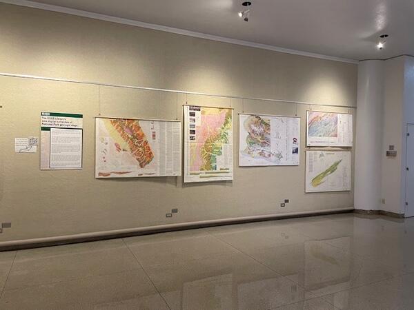
New digital collection of National Park geologic maps featured in Library’s catalog
The USGS Library is showcasing our physical collections of National Park geologic maps online.
With a collection of over 1.6 million physical items, there are amazing scientific works in our holdings. A new collection of USGS geologic maps of National Parks showcases these physical items curated into collections of interest for the general public.
This new collection consists of geologic maps USGS produced between 1964 and 2019 in cooperation with the National Park Service (NPS). As the principal science agency in the Department of the Interior (DOI), USGS has a special role in meeting the scientific needs of other DOI bureaus such as the National Park Service. The USGS provides objective scientific information and interpretation to DOI bureaus that can inform resource management policies.
USGS scientists are experts on the geology of national parks and have generated detailed geologic maps of these areas with important to both park managers and park visitors.1 While maps in this digital collection are fairly recent, the U.S. Geological Survey has been contributing to research and monitoring efforts in the parks since before each bureau officially existed. The U.S. Geological and Geographical Survey of the Territories, precursor to the USGS, explored parts of Yellowstone National Park in 1876, predating both the USGS (established in 1879) and the NPS (established in 1916).2
Twenty-two national parks are represented in this digital collection, comprising the extent of the Library’s physical collection on this topic with Yellowstone National Park having the largest showing.3 The Yellowstone National Park Act, signed into law on March 1, 1872, established the world's first true national park. The Act "dedicated and set apart as a public park or pleasuring-ground for the benefit and enjoyment of the people." It placed the park under the control of the Secretary of the Interior and gave the Secretary responsibility for preserving all timber, mineral deposits, geologic wonders, and other resources within the park.
With 325.5 million recreation visits to NPS sites in 2023 and 28% of those visits to our national parks,4 there is a lot of interest in these magnificent natural areas.
View the new digital collection at USGS Geologic Maps of U.S. National Parks - United States Geological Survey Library
More digital collections will be added in the future, so check back often.
1 USGS Geologic Division Strategic Plan, accessed January 31, 2025.
2 Celebrating a Century of Partnerships in Parks: USGS, NPS, and 100 Years of Science. | U.S. Geological Survey, accessed February 3, 2025.
3 This collection does not include maps covering other geologic map types, such as surficial geologic maps and bedrock geologic maps, or geologic maps of other NPS park unit types, such as monuments, memorials, and parkways.


