
The USGS Library Celebrates the 50th Anniversary of the National Center
To celebrate the 50th anniversary of the USGS’s National Center, the USGS Library is showcasing its collection of materials documenting the planning, development, and completion of this iconic building.
To celebrate the 50th anniversary of the USGS’s National Center, the USGS Library is showcasing its collection of materials documenting the planning, development, and completion of this iconic building.

The events
On display in the National Center Art Hallway during December and January were original photographs, blueprints, documents, and new photographs, including a group photograph on the roof of the National Center taken in October 2024 when more than 150 USGS employees, retirees, and emeriti stood together for an airborne Uncrewed Aircraft System (UAS – or, “drone”) “selfie” that recreated original aerial photographs taken in the early 1970s.


The Library hosted an exhibit-opening panel discussion and reception on Tuesday, December 3, in the Dallas Peck Auditorium. Director David Applegate provided opening remarks about the National Center’s storied history, its current role as the center of the USGS, and future opportunities for science and collaboration. Panelists Susan Russell-Robinson (emeritus and former associate program coordinator, Coastal and Marine Geology Program), Harvey Belkin (emeritus research geologist, Geology, Energy, and Minerals Science Center), Jim Devine (former senior advisor for science applications), and Jane Hammarstrom (research geologist) shared stories about the building’s early years, including:

- Commuting on the employee shuttle bus between downtown D.C. and Reston, which included snacks and beverages on Friday afternoons.
- Navigating the new building, with its labyrinthine hallways and colorful floor plans. Floors were initially identified by distinctive carpet and wall colors. Navigating the building often involved using landmarks like an American flag or even a “Snoopy” poster used as a waypoint. This system led to episodes of hijinks, such as the surreptitious wall repainting using the color of a different floor, and the moving of navigational landmarks to confusing yet comedic effect.
- Enjoying a more open environment where exterior doors were left open and staff were not required to show identification.
- The challenge of packing and unpacking vast numbers of geologic samples and sometimes finding that on-the-fly customization was needed when storage systems didn’t work as intended.
- The plan to have a helipad on the roof for Secretarial visits. (Once it was determined that fume hood exhaust from the building’s labs posed a potential explosion hazard, the plan was scrapped.)
Sandy Brosnahan, the head of the Woods Hole Coastal and Marine Science Center’s UAS program, organized the UAS overflight with logistical support from Jessica DeWitt from the Florence Bascom Geoscience Center. Facilities support for the rooftop activities was provided by Alan Ragsdale and Erica Lowe.


Building history highlights
As the National Center in Reston marks this milestone, it's an excellent time to reflect on its history. The journey to the National Center began long before its groundbreaking in 1971. In the years following World War II, the USGS had expanded significantly, operating out of more than 30 different buildings across Washington, D.C., and its surrounding areas, from Silver Spring to Arlington to McLean. With the need for a centralized location to support its growing mission, plans were set in motion to relocate the USGS to a single site.
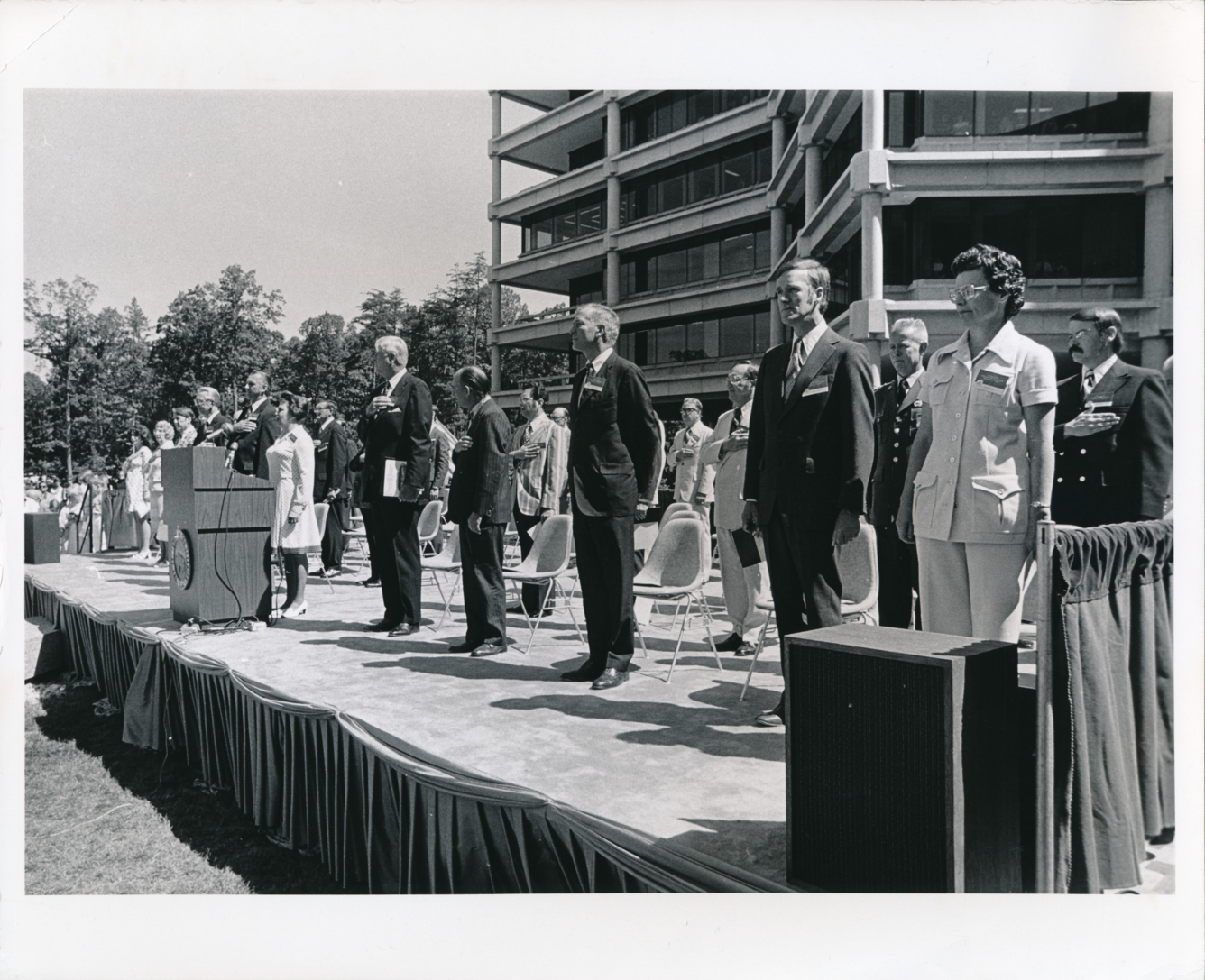
After considering multiple location options, the decision was made to build in Reston, which was then a rural area far from the bustling heart of D.C. In 1970, the Bureau of the Budget approved the project to move forward and in 1971, the George H. Hyman Construction Company of Washington was awarded the \$44 million contract to construct the USGS National Center. At the groundbreaking on July 31, 1971, Secretary of the Interior Rogers C.B. Morton turned the ceremonial first shovelful of earth.
The challenges of moving to a less-developed location were numerous. Traffic studies were conducted to determine how to manage the daily influx of 2,500 employees into Reston, which at the time had only one bridge and narrow roads. Despite these hurdles, the site offered opportunities that could not be realized in the congested downtown D.C. area.
The building’s unique design, which evokes a compass rose, has become synonymous with the bureau’s mission of scientific exploration and discovery. The first occupants of the National Center included a large number of staff and machinery to conduct mapping, printing and the reproduction of USGS products. The building has since housed numerous labs, offices, and support functions, serving as a hub for geological, biological, and environmental research that serves the U.S. and the world.