View of downtown Milwaukee, Wisconsin at Pier Wisconsin Cruise Dock in winter
View of downtown Milwaukee, Wisconsin at Pier Wisconsin Cruise Dock in winterView of downtown Milwaukee, Wisconsin from Pier Wisconsin Cruise Dock in winter.

Official websites use .gov
A .gov website belongs to an official government organization in the United States.
Secure .gov websites use HTTPS
A lock () or https:// means you’ve safely connected to the .gov website. Share sensitive information only on official, secure websites.
Images

View of downtown Milwaukee, Wisconsin from Pier Wisconsin Cruise Dock in winter.
View of downtown Milwaukee, Wisconsin from Pier Wisconsin Cruise Dock in winter.

Invasion by annual brome grasses (cheatgrass and Japanese brome) on a trail across native prairie into National Park Service units in the Northern Great Plains.
Invasion by annual brome grasses (cheatgrass and Japanese brome) on a trail across native prairie into National Park Service units in the Northern Great Plains.

A snow-covered Streamgage 04085074 with a green USGS sign in front of a red barn on an overcast snowy day at Dutchman Creek at Cyrus Street near Ashwaubenon, Wisconsin.
A snow-covered Streamgage 04085074 with a green USGS sign in front of a red barn on an overcast snowy day at Dutchman Creek at Cyrus Street near Ashwaubenon, Wisconsin.

Hydrologic Technician Scott Adolphson takes a discharge measurement of the ice-covered Chippewa River at streamgage 05305000 near Watson, Minnesota surrounded by snow-covered trees.
Hydrologic Technician Scott Adolphson takes a discharge measurement of the ice-covered Chippewa River at streamgage 05305000 near Watson, Minnesota surrounded by snow-covered trees.
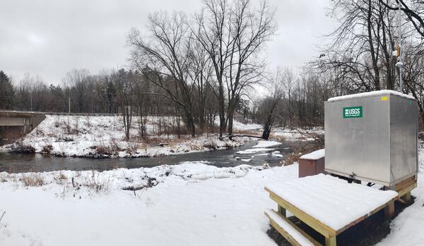
USGS streamgage 04072150 at Duck Creek near Howard, Wisconsin covered in layer of snow overcast December day.
View this streamgage's data here: https://waterdata.usgs.gov/monitoring-location/04072150/
USGS streamgage 04072150 at Duck Creek near Howard, Wisconsin covered in layer of snow overcast December day.
View this streamgage's data here: https://waterdata.usgs.gov/monitoring-location/04072150/

A snowy entrance to the USGS Mounds View (Twin Cities), Minnesota office in December.
A snowy entrance to the USGS Mounds View (Twin Cities), Minnesota office in December.

Upstream Infall gaging station near the Air Guard 128th Air Refueling Wing base in Milwaukee, Wisconsin.
Upstream Infall gaging station near the Air Guard 128th Air Refueling Wing base in Milwaukee, Wisconsin.

Streamgage 05291000, Whetstone River near Big Stone City, South Dakota. A green gage house on an elevated platform with a walkway over a shallow bank surrounded by snow-covered foliage during early morning in December.
Streamgage 05291000, Whetstone River near Big Stone City, South Dakota. A green gage house on an elevated platform with a walkway over a shallow bank surrounded by snow-covered foliage during early morning in December.

Streamgage 05049700 Lake Traverse at Reservation Dam near Wheaton, Minnesota in winter, surrounded by windswept snow, with a pink-hued snow-covered lake and open water in the background.
Streamgage 05049700 Lake Traverse at Reservation Dam near Wheaton, Minnesota in winter, surrounded by windswept snow, with a pink-hued snow-covered lake and open water in the background.

An orange acoustic Doppler current profiler (ADCP) floats in the middle of the Flambeau River near Bruce, Wisconsin near USGS streamgage 05360500 on an overcast winter day.
An orange acoustic Doppler current profiler (ADCP) floats in the middle of the Flambeau River near Bruce, Wisconsin near USGS streamgage 05360500 on an overcast winter day.

A wintery landscape of snow-covered grass and trees on a late morning in November in Kewaunee County in northeast Wisconsin.
A wintery landscape of snow-covered grass and trees on a late morning in November in Kewaunee County in northeast Wisconsin.

Kewaunee Wisconsin well water advisory forecast study door hanger left after sample collection.
Kewaunee Wisconsin well water advisory forecast study door hanger left after sample collection.

Laboratory for Infectious Disease and the Environment team member Joel Stokdyk collects residential private well water sample for the well water advisory forecast study in Kewaunee County, Wisconsin.
Laboratory for Infectious Disease and the Environment team member Joel Stokdyk collects residential private well water sample for the well water advisory forecast study in Kewaunee County, Wisconsin.

Joel Stokdyk (USGS) and Rachel Cook (USDA) from the USGS Laboratory for Infectious Disease and the Environment (LIDE) standing in front of field vehicle en route to collecting private well water samples on a chilly November day in Kewaunee County, Wisconsin.
Joel Stokdyk (USGS) and Rachel Cook (USDA) from the USGS Laboratory for Infectious Disease and the Environment (LIDE) standing in front of field vehicle en route to collecting private well water samples on a chilly November day in Kewaunee County, Wisconsin.

Team members from the USGS Laboratory for Infectious Disease and the Environment (LIDE) collecting private well water samples on a chilly November day in Kewaunee County, Wisconsin. Pictured from left to right Joel Stokdyk (USGS), Rachel Cook (USDA), Aaron Firnstahl (USGS).
Team members from the USGS Laboratory for Infectious Disease and the Environment (LIDE) collecting private well water samples on a chilly November day in Kewaunee County, Wisconsin. Pictured from left to right Joel Stokdyk (USGS), Rachel Cook (USDA), Aaron Firnstahl (USGS).

Streamgage 05429369 Swan Creek at Lalor Road near Fitchburg, Wisconsin with snow covered brushy vegetation on the shore of stream on overcast day.
Streamgage 05429369 Swan Creek at Lalor Road near Fitchburg, Wisconsin with snow covered brushy vegetation on the shore of stream on overcast day.

USGS, ANA and Geological Survey of Brazil (SGB-CPRM) staff standing in front of an ANA/SBG-CPRM research vessel in the Amazon River basin in Manacapuru, Brazil to measure measure streamflow and sample suspended sediment.
SGB-CPRM (Geological Survey of Brazil)
ANA (Agencia Nacional De Aguas E Saneamento Basico)

Yellow sediment sampler suspended off side of boat in Manacapuru, Amazon River Basin, Brazil, during a field trip with USGS and National Agency for Water and Basic Sanitation (ANA) scientists (Brazil) and Geological Survey of Brazil (SGB-CPRM).
ANA (Agencia Nacional De Aguas E Saneamento Basico)
SGB-CPRM (Geological Survey of Brazil)

USGS, ANA and SBG-CPRM staff reviewing streamflow measurements on board an ANA/SBG-CPRM research vessel in the Amazon River basin in Manacapuru, Brazil. USGS staff in middle wearing orange shirt and yellow PFD, ANA and SGB-CPRM staff in navy blue attire discuss measurements and look over data.
SGB-CPRM (Geological Survey of Brazil)

USGS meeting with National Agency for Water and Basic Sanitation (ANA) scientists in Brazil.
Top (L – R) ANA Scientists Vitor Saback, Brian McCallum, Mauricio Abijaodi
Bottom (L-R) USGS Hydrologists Travis Knight, Joel Groten, Filipe Sampaio
ANA (Agencia Nacional De Aguas E Saneamento Basico)
USGS meeting with National Agency for Water and Basic Sanitation (ANA) scientists in Brazil.
Top (L – R) ANA Scientists Vitor Saback, Brian McCallum, Mauricio Abijaodi
Bottom (L-R) USGS Hydrologists Travis Knight, Joel Groten, Filipe Sampaio
ANA (Agencia Nacional De Aguas E Saneamento Basico)

USGS meeting with National Agency for Water and Basic Sanitation (ANA) scientists in Brazil, standing in front of three flags (L-R) American flag, Brazilian Flag, ANA logo flag.
(L-R) Mauricio Abijaodi, Brian McCallum, Filipe Sampaio, Joel Groten, Travis Knight, and Vitor Saback.
ANA (Agencia Nacional De Aguas E Saneamento Basico)