
When surface water runs low, groundwater supplements water supply
Both surface water and groundwater provide critical water supplies across the United States. In surface-water limited regions, users turn to groundwater to meet water demand. But water above and below the ground can be closely connected. Is groundwater the answer to limited surface water supplies?
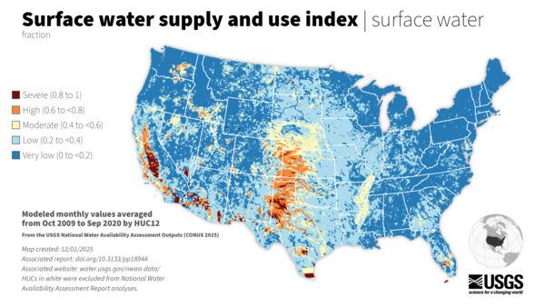
Across the lower 48 states, there is generally enough water supplied from rivers, lakes and reservoirs to meet our needs. Regions with low surface-water supply, however, show greater potential for water limitation. The 2025 USGS National Water Availability Assessment found between 2010-2020 that significant portions of the Southern High Plains, Central High Plains, Texas, Mississippi Embayment, and Southwest Desert regions were at risk for local water limitation. In these regions, the gap between surface water supply and demand is small, requiring water managers to look to other water sources.
Tapping into groundwater
In regions with low water supply from rivers, lakes, and reservoirs, groundwater can be used to meet local water needs. For example, more groundwater is used compared to surface water for crop irrigation in the California-Nevada hydrologic region and for public supply in the Southwest Desert hydrologic region (https://doi.org/10.3133/pp1894D).
In most areas of the U.S., however, surface water and groundwater are interconnected, and the withdrawal of one resource can affect the other. Across the lower 48 United States, regions with low precipitation and little surface-water storage overlap with declining groundwater levels. During 2010–20, the Southern High Plains, Central High Plains, and Texas hydrologic regions were characterized by low overall precipitation and low surface-water storage in soil moisture, lakes, and snow. In the same time period, these regions also had underlying aquifers with median groundwater levels considerably lower than normal (https://doi.org/10.3133/pp1894B). These findings show that it is common for low supplies of surface water and groundwater to occur in the same places. To understand water availability and effectively manage water resources in these regions, we need to understand the connectivity of surface water and groundwater.
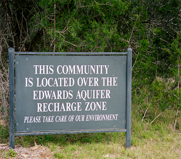
A closer look at Texas: The Edwards Aquifer
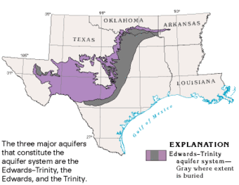
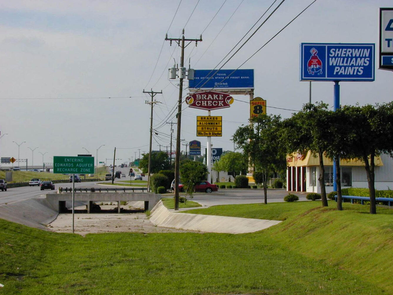
In the Edwards aquifer area of Texas, USGS science is providing information about surface water and groundwater connectivity, water quality, and resource vulnerability to support water availability decisions. The Edwards aquifer, located in Central Texas, provides drinking water for over two million people as well as water for agriculture, ranching, and industry (https://doi.org/10.1130/MEM215). The aquifer also discharges water to the surface through springs that maintain endangered species habitat, offer numerous recreational opportunities, and provide surface water for downstream uses (Edwards Aquifer Authority, 2017). The aquifer continues to support the increasing demand for a rapidly urbanizing region that includes the city of San Antonio, for which it is a designated sole-source aquifer (U.S. Environmental Protection Agency, 2026).
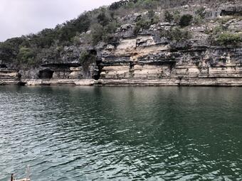
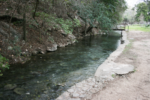
The Edwards aquifer is a well-known karst aquifer and is characterized by extensive surface water and groundwater interaction. It is recharged primarily through leaky streambeds that sit on top of porous geology and surface-water runoff and precipitation recharge the aquifer through focused geologic structures like fractures, faults, and sinkholes. Water also moves in the opposite direction, rising to the surface through aquifer-fed springs. Lakes that persist in this region, like Spring Lake in San Marcos, Texas, are supplied by groundwater. Because surface-water and groundwater resources are tightly connected in the Edwards aquifer area, when surface water supply is low, groundwater supply is also low and vice versa. These deficits can present challenges for the management of water in the region.
"Water managers from the city of San Antonio and the city’s primary water utility, the San Antonio Water System need information to make informed decisions about water availability"
- Stephen Opsahl, Oklahoma-Texas Water Science Center
To meet this need in Texas, an ongoing program funded by the San Antonio Water System, in cooperation with the Oklahoma-Texas Water Science Center, is conducting monitoring, mapping and modeling. The goal of the Edwards Aquifer Urban Hydrology Monitoring Network is to understand water quantity and water quality in this water-limited region.
“Challenges facing the Edwards Aquifer include the threat of extracting groundwater faster than it can be replenished, increasing water demand from a growing population, recurring droughts, and water-quality concerns from urbanization” said Dr. MaryLynn Musgrove of the Oklahoma-Texas Water Science Center. High-quality data and information can support the understanding of surface water and groundwater as a closely linked, combined resource and help prepare Texas to meet the water demands of the future.
The Edwards Aquifer area is one example of a region where surface water and groundwater connectivity affect water supply. USGS science supports management decision-making in Texas, and other water-limited regions, while also providing nationally-consistent and wall-to-wall water supply and use data for wider assessment of the Nation’s water resources. USGS water availability studies combine regional science to support management with national-scale science to broadly assess water resource challenges. Together, these efforts strengthen our understanding of integrated water systems and provide the science needed to protect water resources and the communities that depend on them.
Related
Related science

Edwards Aquifer Studies in Texas

Karst Aquifers: Edwards-Trinity Plateau Aquifer

Edwards Aquifer Recharge Zone Surface-water and Groundwater Interaction

Hydrogeology of the Edwards and Trinity Aquifers within Hays County

Hydrogeologic and Geochemical Investigation of the Trinity and Northern Segment Edwards Aquifers
Related
Related science
Edwards Aquifer Studies in Texas
Karst Aquifers: Edwards-Trinity Plateau Aquifer
Edwards Aquifer Recharge Zone Surface-water and Groundwater Interaction
Hydrogeology of the Edwards and Trinity Aquifers within Hays County