
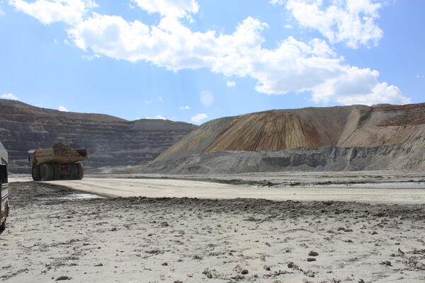
View from the floor of the Continental Mine (Continental Pit) facing an in-pit material dump to the west, Butte, Montana.
Autumn L Helfrich
Autumn Helfrich is a Geologist with the Geology, Minerals, Energy, and Geophysics Science Center in our Moffett Field, CA office. Autumn works primarily with the Landslide Hazards Program.
Science and Products
Mine Waste, Butte Deposit, Montana
View from the floor of the Continental Mine (Continental Pit) facing an in-pit material dump to the west, Butte, Montana.
Mine Tailings Near Butte, MT
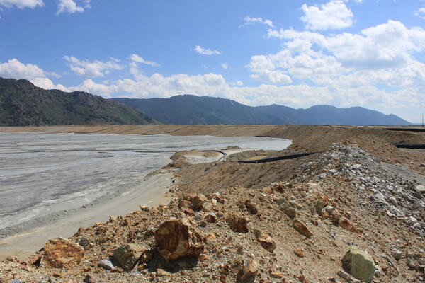
Edge of the Yankee Doodle Tailings Pond in Butte, Montana, where the tailings slurry is piped into the pond.
Edge of the Yankee Doodle Tailings Pond in Butte, Montana, where the tailings slurry is piped into the pond.
Science and Products
Mine Waste, Butte Deposit, Montana
View from the floor of the Continental Mine (Continental Pit) facing an in-pit material dump to the west, Butte, Montana.
View from the floor of the Continental Mine (Continental Pit) facing an in-pit material dump to the west, Butte, Montana.
Mine Tailings Near Butte, MT
Edge of the Yankee Doodle Tailings Pond in Butte, Montana, where the tailings slurry is piped into the pond.
Edge of the Yankee Doodle Tailings Pond in Butte, Montana, where the tailings slurry is piped into the pond.