



The Next Generation Water Observing Program (NGWOS) supports the advancement of water resources observations in order to assess water availability, management, and prediction across the US’s major hydrologic regions.
Nicholas Giro
Nick Giro is a Hydrologic Technician at the Baltimore, MD office of the MD-DE-DC Water Science Center. Nick has worked for the U.S. Geological Survey since 2019.
Nick primarily works on the Surface Water team for the operation, maintenance, and construction of stream gages as part of the national network of water data for the nation to provide flood science data for flood forecasting, modeling, road closures, and monitoring for public awareness and safety. He is currently the primary GNSS surveyor for the Baltimore office, with his work also including the surveying and computation of flood indirects (Slope-Area, Slope-Conveyance, Contracted Openings, Culvert Flow), analysis/approval of stage-discharge, precipitation, and index-velocity data, for the use of non-contact methods (such as sUAS and image velocimetry) for data collection.
Science and Products
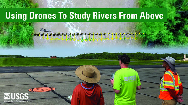
Using Drones To Study Rivers From Above
The Next Generation Water Observing Program (NGWOS) supports the advancement of water resources observations in order to assess water availability, management, and prediction across the US’s major hydrologic regions.

HIVIS-ability at Serene Lake (AD)
What is HIVIS?
HIVIS stands for Hydrologic Imagery Visualization and Information System.
HIVIS is a network of cameras across the United States that serve as remote “eyes on the ground,” providing the USGS and its cooperators with the ability to monitor conditions in near real-time at sites where a camera is installed.
What is HIVIS?
HIVIS stands for Hydrologic Imagery Visualization and Information System.
HIVIS is a network of cameras across the United States that serve as remote “eyes on the ground,” providing the USGS and its cooperators with the ability to monitor conditions in near real-time at sites where a camera is installed.

HIVIS-ability at Serene Lake
What is HIVIS?
HIVIS stands for Hydrologic Imagery Visualization and Information System.
HIVIS is a network of cameras across the United States that serve as remote “eyes on the ground,” providing the USGS and its cooperators with the ability to monitor conditions in near real-time at sites where a camera is installed.
What is HIVIS?
HIVIS stands for Hydrologic Imagery Visualization and Information System.
HIVIS is a network of cameras across the United States that serve as remote “eyes on the ground,” providing the USGS and its cooperators with the ability to monitor conditions in near real-time at sites where a camera is installed.

Monitoring Water Quality on the Anacostia River
Join Ashley and Nick at Bladensburg Waterfront Park along the Anacostia River. The gage in this park is “supercharged” to monitor the “BIG 5” water-quality parameters: dissolved-oxygen concentration, pH, specific conductance, water temperature, and turbidity.
Join Ashley and Nick at Bladensburg Waterfront Park along the Anacostia River. The gage in this park is “supercharged” to monitor the “BIG 5” water-quality parameters: dissolved-oxygen concentration, pH, specific conductance, water temperature, and turbidity.

Monitoring Water Quality on the Anacostia River (AD)
Monitoring Water Quality on the Anacostia River (AD)Join Ashley and Nick at Bladensburg Waterfront Park along the Anacostia River. The gage in this park is “supercharged” to monitor the “BIG 5” water-quality parameters: dissolved-oxygen concentration, pH, specific conductance, water temperature, and turbidity.
Monitoring Water Quality on the Anacostia River (AD)
Monitoring Water Quality on the Anacostia River (AD)Join Ashley and Nick at Bladensburg Waterfront Park along the Anacostia River. The gage in this park is “supercharged” to monitor the “BIG 5” water-quality parameters: dissolved-oxygen concentration, pH, specific conductance, water temperature, and turbidity.
Science and Products
Using Drones To Study Rivers From Above
The Next Generation Water Observing Program (NGWOS) supports the advancement of water resources observations in order to assess water availability, management, and prediction across the US’s major hydrologic regions.
The Next Generation Water Observing Program (NGWOS) supports the advancement of water resources observations in order to assess water availability, management, and prediction across the US’s major hydrologic regions.
HIVIS-ability at Serene Lake (AD)
What is HIVIS?
HIVIS stands for Hydrologic Imagery Visualization and Information System.
HIVIS is a network of cameras across the United States that serve as remote “eyes on the ground,” providing the USGS and its cooperators with the ability to monitor conditions in near real-time at sites where a camera is installed.
What is HIVIS?
HIVIS stands for Hydrologic Imagery Visualization and Information System.
HIVIS is a network of cameras across the United States that serve as remote “eyes on the ground,” providing the USGS and its cooperators with the ability to monitor conditions in near real-time at sites where a camera is installed.
HIVIS-ability at Serene Lake
What is HIVIS?
HIVIS stands for Hydrologic Imagery Visualization and Information System.
HIVIS is a network of cameras across the United States that serve as remote “eyes on the ground,” providing the USGS and its cooperators with the ability to monitor conditions in near real-time at sites where a camera is installed.
What is HIVIS?
HIVIS stands for Hydrologic Imagery Visualization and Information System.
HIVIS is a network of cameras across the United States that serve as remote “eyes on the ground,” providing the USGS and its cooperators with the ability to monitor conditions in near real-time at sites where a camera is installed.
Monitoring Water Quality on the Anacostia River
Join Ashley and Nick at Bladensburg Waterfront Park along the Anacostia River. The gage in this park is “supercharged” to monitor the “BIG 5” water-quality parameters: dissolved-oxygen concentration, pH, specific conductance, water temperature, and turbidity.
Join Ashley and Nick at Bladensburg Waterfront Park along the Anacostia River. The gage in this park is “supercharged” to monitor the “BIG 5” water-quality parameters: dissolved-oxygen concentration, pH, specific conductance, water temperature, and turbidity.
Monitoring Water Quality on the Anacostia River (AD)
Monitoring Water Quality on the Anacostia River (AD)Join Ashley and Nick at Bladensburg Waterfront Park along the Anacostia River. The gage in this park is “supercharged” to monitor the “BIG 5” water-quality parameters: dissolved-oxygen concentration, pH, specific conductance, water temperature, and turbidity.
Monitoring Water Quality on the Anacostia River (AD)
Monitoring Water Quality on the Anacostia River (AD)Join Ashley and Nick at Bladensburg Waterfront Park along the Anacostia River. The gage in this park is “supercharged” to monitor the “BIG 5” water-quality parameters: dissolved-oxygen concentration, pH, specific conductance, water temperature, and turbidity.