
USGS EcoNews - Vol. 6 | Issue 1
Invasives and Disease
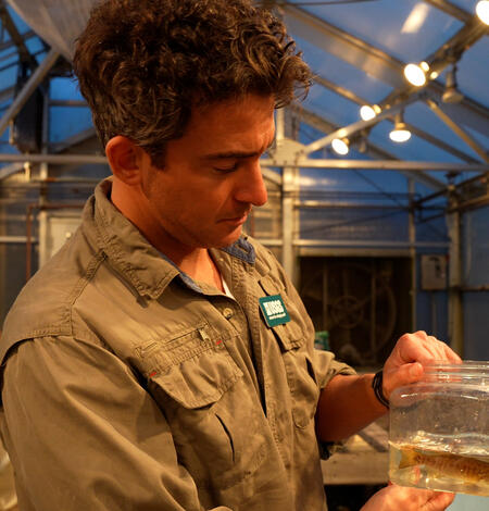
USGS Avian Influenza Research

Helene and Milton potentially spread invasive species to new locations in Florida and Georgia
As communities continue to recover from widespread destruction caused by recent hurricanes Helene and Milton, floodwaters from these storms may have accelerated the spread of invasive wildlife and plant species into new areas.

New study finds deer hunting can help keep chronic wasting disease in check
The study finds that hunting can be an effective form of disease control when enacted consistently at high levels over many years.
SBSC science supports invasive species management
Invasive species can harm ecosystems, increase wildfires, damage forests, and outcompete native species. The US Geological Survey's Southwest Biological Science Center conducts research that provides our federal and state partners, cooperators and land managers with the tools, data and strategies to enhance biosecurity management.Scroll through the information below to read about different SBSC...
Land and Water
Discovering Connections Across America's Lands and Waters
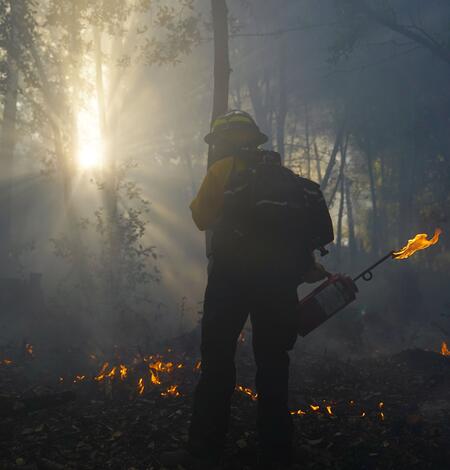
USGS Fire Science Support for DOI Lands
The USGS Fire Science Support for DOI Lands project is a U.S. Geological Survey (USGS) effort to address key aspects of recent legislation concerning wildland fire on Department of the Interior (DOI) lands. The project was initiated in 2023, and work will continue through 2025. The project is comprised of four separate but interrelated tasks and is guided by the input of DOI bureau representatives...
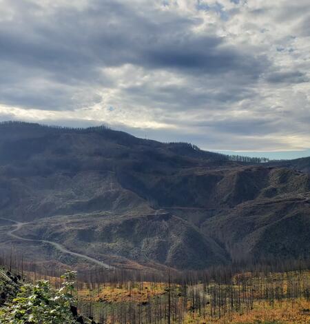
Wildfires Increase Mercury Concentrations in Headwater Streams
The U.S. Geological Survey is researching the effect of wildfires on the release of stored mercury from forest watersheds and subsequent transport, methylmercury formation, and bioaccumulation post-fire. Wildfires not only alter the re-release of mercury into the environment but also affect its reactivity and availability to the food web, complicating predictions of mercury exposure risks to...

Securing the Nation’s Need for Native Seed
A new progress report showcases how partnership and federal investment have advanced the National Seed Strategy, a pragmatic tool for restoring healthy ecosystems.
Wildlife
Ungulate Migrations of the Western United States, Volume 5

Rising Temperatures and Habitat Preferences Shape Grassland Bird Nesting Success
A new Midwest CASC-supported study reveals that many grassland birds have strict habitat preferences, leaving them more susceptible to rising temperatures.

Foundational science in flight—USGS bird programs support conservation, culture, and a thriving U.S. economy
Birds are vital to our economy, ecosystems, and cultural heritage. Investing in bird conservation benefits communities, businesses, and working lands while reinforcing our nation’s legacy of stewardship and biodiversity. By valuing birds, we ensure a richer, healthier, and more vibrant future for all Americans. The USGS leads two national bird monitoring programs Thriving bird...

Nearshore Fish Surveys in the Beaufort Sea
Nearshore systems provide habitat to a unique community of marine and diadromous (lives in both fresh and saltwater) fish and support high fish abundance.
Innovation and Technology
An Updated Vulnerability Index (CCVI 4.0) for Species Adaptation Planning

Development of Environmental DNA (eDNA) Detection Tools to Track the Obligate Coral Predator Coralliophila galea to Support Coral Outplant Site Selection
With the support of the Mote Marine Laboratory and Aquarium, USGS researchers will develop and optimize a CRISPR biosensor to detect C. galea eDNA in the field. The development of this tool could assist coral restoration managers and stakeholders to more effectively inform decisions on coral outplant site selection, based on coral predator presence.

Combining Artificial Intelligence and Native Hawaiian Traditions to Better Understand Native Birds
Researchers supported by Pacific Islands CASC use artificial intelligence and Native Hawaiian “oli” (chants) to develop management tools for endangered native bird conservation.

Introducing the Earth in Flux Chart Gallery
A shared initiative between the USGS Water Resources Mission Area and Ecosystems Mission Area to communicate key findings of USGS land change science in innovative ways, and to encourage creativity, exploration, and community in data visualization across USGS mission areas.