Map showing temporary seismic nodes across Kīlauea ERZ
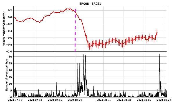
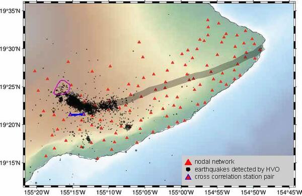
Map showing temporary seismic nodes across Kīlauea ERZMap showing temporary seismic nodes across Kīlauea ERZ (red triangles). Earthquakes located in the ERZ between July 1, 2024, and September 22, 2024, are shown as black dots. Kaluapele (Kīlauea’s summit caldera) is outlined in magenta. The blue line drawn between two nodes indicates the area where the velocity changes in were calculated.