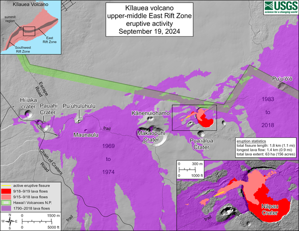
September 19, 2024 —Kīlauea middle East Rift Zone eruption overflight
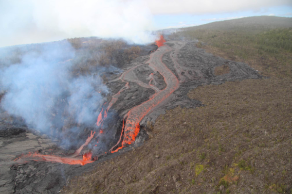
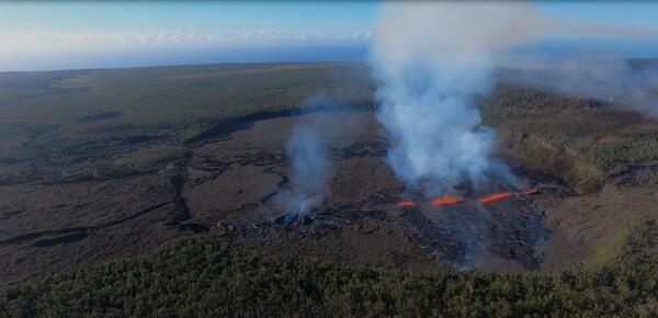
September 19, 2024 —Kīlauea middle East Rift Zone eruption overflightDuring the USGS Hawaiian Volcano Observatory reconnaissance overflight the morning of September 19, geologists observed the fissure west of Nāpau Crater generating a lava flow that travels northeast before cascading into the crater on the remote middle East Rift Zone of Kīlauea. This aerial view is looking in a south direction, from north of the eruption site.