An official website of the United States government
Here's how you know
Official websites use .gov
A .gov website belongs to an official government organization in the United States.
Secure .gov websites use HTTPS
A lock () or https:// means you’ve safely connected to the .gov website. Share sensitive information only on official, secure websites.
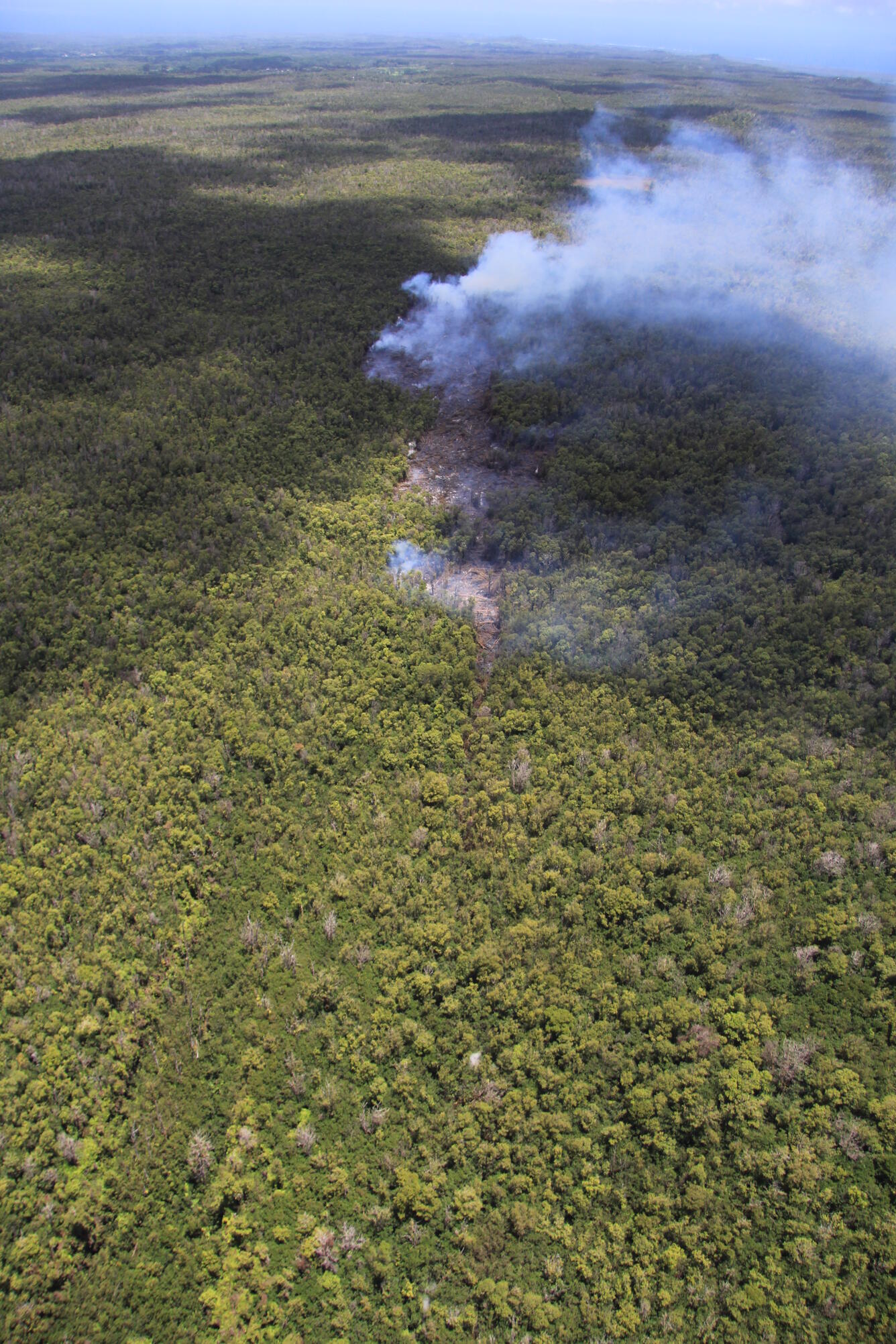
The leading edge of the June 27th lava flow plunged into a deep crack on Kīlauea's East Rift Zone last week, and lava within the crack remained hidden for several days. Over the past day, lava returned to the surface at a point slightly farther along the crack, creating a small island of lava surrounded by thick forest. The farthest tip of the flow today was 11.4 km (7.1 miles) northeast of the vent on Pu‘u ‘Ō‘ō, and 3.1 km (1.9 miles) from the eastern boundary of the Wao Kele o Puna forest reserve.
A view of the small pad of lava that has emerged from the crack over the past day. The lava pad was about 800 m (0.5 miles) long, and was about 1.3 km (0.8 miles) east of the point where lava plunged into the crack.
Another view of the isolated pad of lava that has emerged from the crack. This view is towards the east, along the East Rift Zone. The spot at which lava flowed into the crack is to the west, out of view beyond the bottom of the photograph.
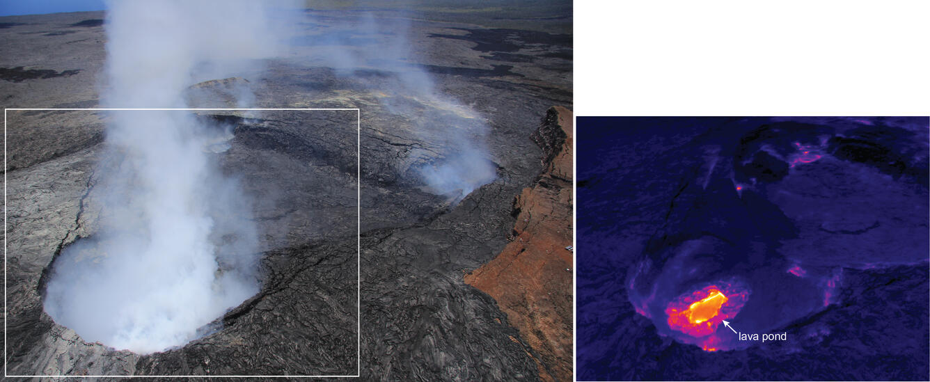
Pu‘u ‘Ō‘ō crater remains partly obscured by thick fume. In particular, the northeastern portion of the crater (bottom left part of image) has recently been entirely obscured to the naked eye, but the thermal camera provides a clear view through the fume, revealing a small lava pond.