An official website of the United States government
Here's how you know
Official websites use .gov
A .gov website belongs to an official government organization in the United States.
Secure .gov websites use HTTPS
A lock () or https:// means you’ve safely connected to the .gov website. Share sensitive information only on official, secure websites.
As of about 8 a.m. HST this morning (Dec. 23), HVO field crews noted that the Kīlauea summit lava lake surface is now 464 m (1522 ft) below the crater rim observation site, indicating that the lake has filled 156 m (515 ft) of the bottom of Halema‘uma‘u crater. This compares to a measurement just before 5 am HST on Dec 22, when the lake surface was 487 m (1598 ft) below the crater rim observation site, indicating that the lake rose 23 m (75 ft) in just over 24 hours. The current depth is more than triple the depth of the water lake that was in the crater until the evening of Dec. 20 when it was vaporized. Fountaining continues at two locations, more vigorously at eastern vent, and both vents continue to feed the growing lava lake. USGS photo by H. Dietterich.
Scientists continue to monitor the ongoing eruption in Kīlauea Volcano's summit caldera, Island of Hawai‘i. This photo, from the south rim of Halema‘uma‘u crater and looking north, shows the volcanic gas plume heading west. USGS photo by M. Patrick.
A helicopter overflight yesterday (Dec. 22, 2020) at approximately ~11:30 AM HST allowed for aerial visual and thermal imagery to be collected, which was used to map the area of Kīlauea's growing summit lava lake in Halema‘uma‘u crater. As of yesterday afternoon, the lake is over 690 m (yd) E-W axis and 410 m (yd) in N-S axis. The lake area is more than 22 hectares (54 acres). USGS photo by M. Patrick.
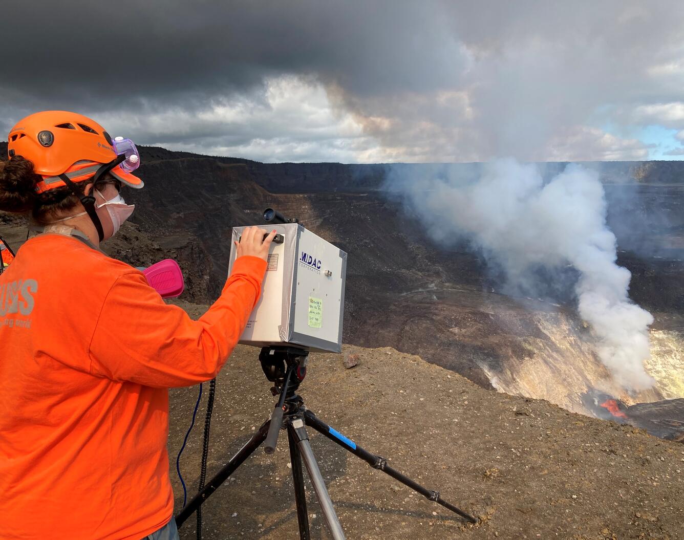
On the rim of Halema‘uma‘u crater, Hawaiian Volcano Observatory scientists measure gas concentrations from the ongoing Kīlauea Volcano summit eruption using a FTIR spectrometer. The sulfur-dioxide (SO2) rich eruption plume also contains water vapor, carbon dioxide, and halogen gases such as HCl and HF. Light-weight pieces of volcanic glass, such as Pele's hair and tears, are also carried downwind in the plume. USGS photo by T. Elias on December 23.
Plot showing rise of Kīlauea's summit lava lake since the eruption in Halema‘uma‘u began on December 20 at 9:30 p.m. Since then, laser rangefinder measurements of lava lake surface are made 2–3 times per day. Photos compare the lava lake on the morning of Dec. 21, when it was about 289 ft (87 m) deep, to the evening of Dec. 23 when it was about 511 ft (155 m) deep. For comparison, the water lake that was present in Halema‘uma‘u until the evening of December 20 was 167 ft (51 m) at its deepest, prior to vaporizing. USGS plot by H. Dietterich.
Hawaiian Volcano Observatory (HVO) technicians visited several monitoring stations downwind of the Kīlauea Volcano’s summit eruption within Halema‘um‘u crater, to clean small particle of volcanic glass (tephra) off of solar panels and other equipment today. HVO geologists deployed buckets downwind of the eruption site to collect samples of the tephra for geochemical and physical volcanology analysis. USGS photo by K. Kamibayshi.
A close-up view of several pieces of tephra collected by Hawaiian Volcano Observatory geologists for analysis. The tephra, produced by the fissures erupting within Halema‘um‘u crater, is transported and deposited downwind of the eruptive vents. USGS photo by C. Parcheta.